
| Memorials | : | 0 |
| Location | : | Bingum, Landkreis Leer, Germany |
| Coordinate | : | 53.2223830, 7.4134750 |
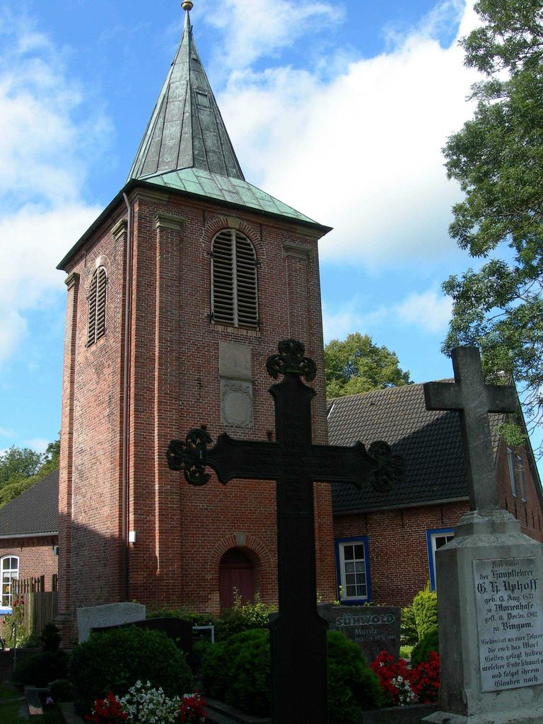
| Description | : | The cemetery in the small village of Bingum is managed by the Lutheran church of Leer-Bingum. It's located right next to the St. Matthew Church (St. Matthäikirche). Please note that the graves in Germany are not perpetual. After a certain period of repose (20-30 years) the graves are being leveled and re-used. There is no toxic embalming being done in Germany, so the coffin and the corpse have decomposed naturally. If the family of the deceased decides to purchase another period the duration can be extended by another 30 years. War Graves are considered memorials and are kept up by the... Read More |
frequently asked questions (FAQ):
-
Where is Friedhof Bingum?
Friedhof Bingum is located at An der Matthäikirche 8 Bingum, Landkreis Leer ,Lower Saxony (Niedersachsen) , 26789Germany.
-
Friedhof Bingum cemetery's updated grave count on graveviews.com?
0 memorials
-
Where are the coordinates of the Friedhof Bingum?
Latitude: 53.2223830
Longitude: 7.4134750
Nearby Cemetories:
1. Alter Friedhof Leer
Leer, Landkreis Leer, Germany
Coordinate: 53.2290680, 7.4404290
2. Jüdischer Friedhof Leer
Leer, Landkreis Leer, Germany
Coordinate: 53.2178990, 7.4445990
3. Friedhof Esklum
Westoverledingen, Landkreis Leer, Germany
Coordinate: 53.2109310, 7.4415540
4. Friedhof Lutherkirche Leer
Leer, Landkreis Leer, Germany
Coordinate: 53.2272890, 7.4474250
5. Friedhof Kirchborgum
Weener, Landkreis Leer, Germany
Coordinate: 53.2002893, 7.4044874
6. Friedhof Driever
Westoverledingen, Landkreis Leer, Germany
Coordinate: 53.1944670, 7.4189670
7. Friedhof Leer-Heisfelder Strasse
Leer, Landkreis Leer, Germany
Coordinate: 53.2360000, 7.4554250
8. Friedhof Holtgaste
Holtgaste, Landkreis Leer, Germany
Coordinate: 53.2315610, 7.3634260
9. Friedhof Leer-Augustenstrasse
Leer, Landkreis Leer, Germany
Coordinate: 53.2382530, 7.4596520
10. Friedhof Nüttermoor
Leer, Landkreis Leer, Germany
Coordinate: 53.2595940, 7.4342950
11. Friedhof Poghausen
Landkreis Leer, Germany
Coordinate: 53.2469400, 7.4711100
12. Neuer Friedhof Loga
Loga, Landkreis Leer, Germany
Coordinate: 53.2385150, 7.4863520
13. Friedhof Jemgum
Jemgum, Landkreis Leer, Germany
Coordinate: 53.2654730, 7.3818820
14. Jüdischer Friedhof Jemgum
Jemgum, Landkreis Leer, Germany
Coordinate: 53.2608620, 7.3671270
15. Alter Friedhof Loga
Loga, Landkreis Leer, Germany
Coordinate: 53.2323490, 7.4934880
16. Friedhof Grotegaste
Westoverledingen, Landkreis Leer, Germany
Coordinate: 53.1731640, 7.3988520
17. Friedhof Böhmerwold
Jemgum, Landkreis Leer, Germany
Coordinate: 53.2334640, 7.3302280
18. Friedhof Sankt Georgiwold
Weener, Landkreis Leer, Germany
Coordinate: 53.2151970, 7.3208000
19. Kirchfriedhof Ihrhove
Westoverledingen, Landkreis Leer, Germany
Coordinate: 53.1678020, 7.4543660
20. Friedhof Weenermoor
Weener, Landkreis Leer, Germany
Coordinate: 53.1951651, 7.3228192
21. Friedhof Breinermoor
Landkreis Leer, Germany
Coordinate: 53.1897580, 7.5018780
22. Friedhof Ihrhove
Westoverledingen, Landkreis Leer, Germany
Coordinate: 53.1619890, 7.4590140
23. Alter Friedhof Weener
Weener, Landkreis Leer, Germany
Coordinate: 53.1655418, 7.3565815
24. Friedhof Midlum
Jemgum, Landkreis Leer, Germany
Coordinate: 53.2848680, 7.3725560