
| Memorials | : | 0 |
| Location | : | Dietlingen, Enzkreis, Germany |
| Coordinate | : | 48.8952600, 8.6051400 |
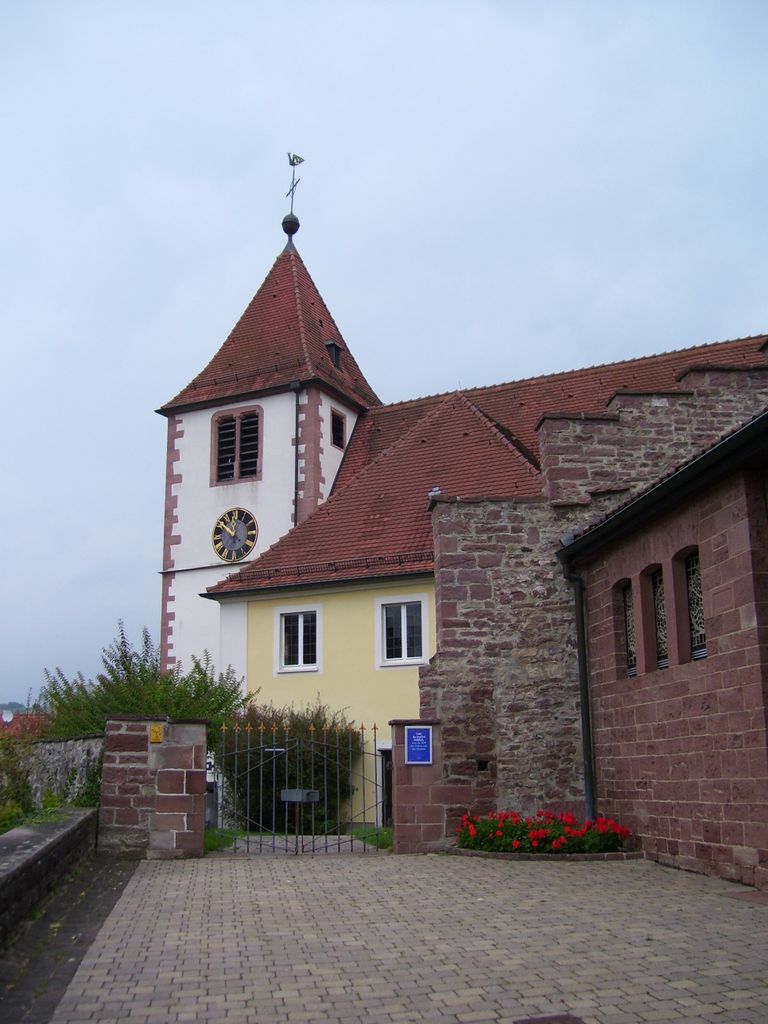
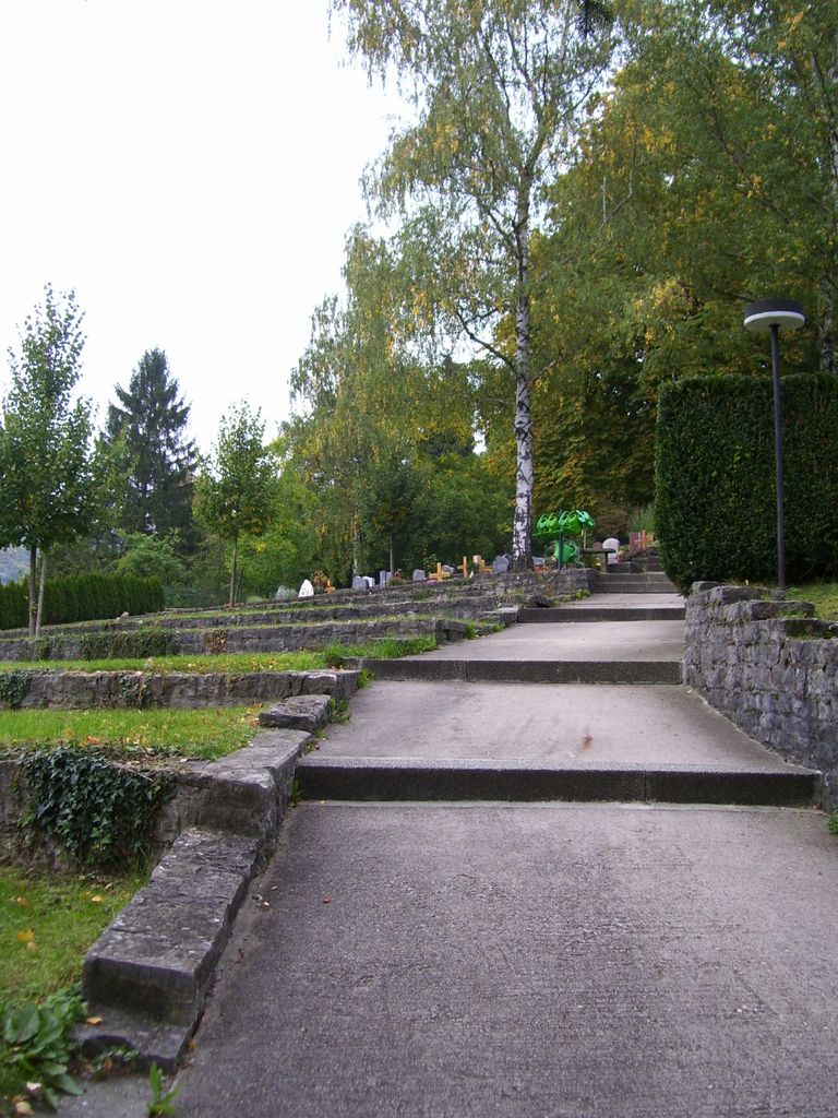
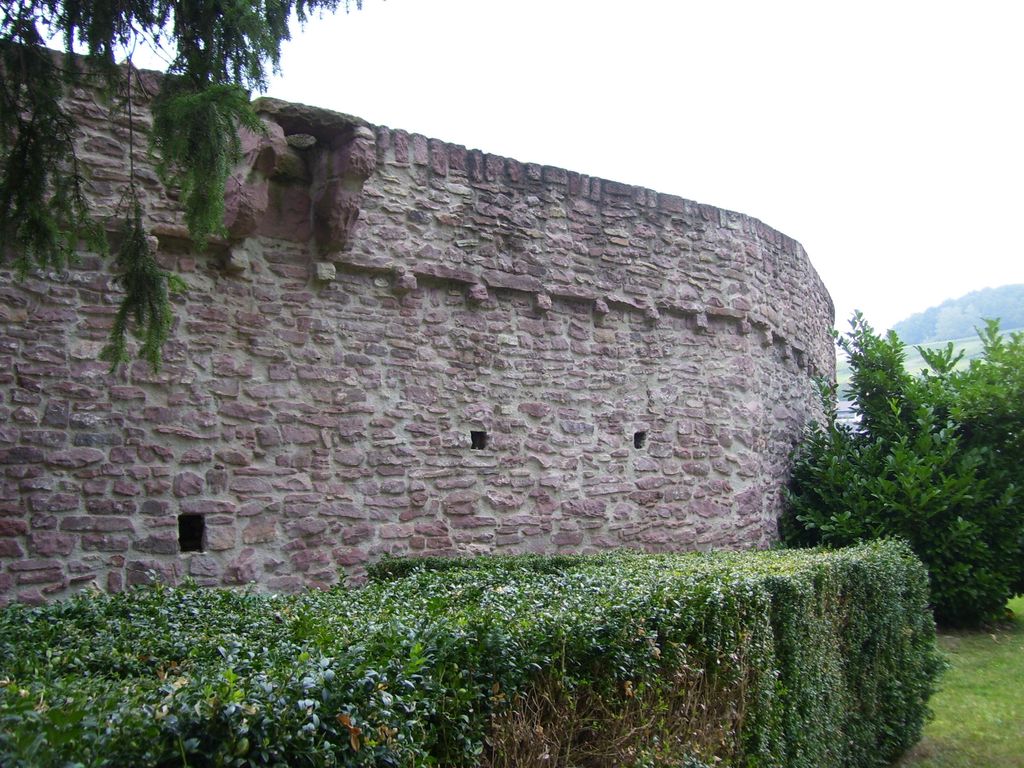
| Description | : | Andreaskirchefriedhof is located in Keltern Dietlingen, southwest of the town of Ispringen. The base (and perhaps the full tower) of St. Andrew’s Church was built as early as 300 or 400 a.d. as a Catholic Church. The remainder of the main church was built in 1410. The wall around the church and a moat were built at the same time. Part of the church was used for families to store necessities during times of attack. After Martin Luther, the church broke up with the Catholics building a church at another location in town. In 1785 the nave was pushed out to the... Read More |
frequently asked questions (FAQ):
-
Where is Friedhof Dietlingen?
Friedhof Dietlingen is located at Östliche Friedrichstraße 1/1 Dietlingen, Enzkreis ,Baden-Württemberg , 75210Germany.
-
Friedhof Dietlingen cemetery's updated grave count on graveviews.com?
0 memorials
-
Where are the coordinates of the Friedhof Dietlingen?
Latitude: 48.8952600
Longitude: 8.6051400
Nearby Cemetories:
1. Friedhof Ellmendingen
Ellmendingen, Enzkreis, Germany
Coordinate: 48.9061000, 8.5722000
2. Friedhof Gräfenhausen
Gräfenhausen, Enzkreis, Germany
Coordinate: 48.8707150, 8.5796140
3. Friedhof Brötzingen
Brötzingen, Stadtkreis Pforzheim, Germany
Coordinate: 48.8917000, 8.6540000
4. Waldfriedhof Birkenfeld
Birkenfeld, Enzkreis, Germany
Coordinate: 48.8648507, 8.6341041
5. Friedhof Nöttingen
Nöttingen, Enzkreis, Germany
Coordinate: 48.9313200, 8.5697880
6. Friedhof Ersingen
Ersingen, Enzkreis, Germany
Coordinate: 48.9341050, 8.6375120
7. Friedhof Dillweißenstein
Dillweißenstein, Stadtkreis Pforzheim, Germany
Coordinate: 48.8784000, 8.6713000
8. Friedhof Ottenhausen
Ottenhausen, Enzkreis, Germany
Coordinate: 48.8752600, 8.5395600
9. Friedhof Ispringen
Ispringen, Enzkreis, Germany
Coordinate: 48.9213000, 8.6671000
10. Alter Friedhof Neuenbürg
Neuenbürg, Enzkreis, Germany
Coordinate: 48.8469897, 8.5900378
11. Friedhof Wilferdingen
Wilferdingen, Enzkreis, Germany
Coordinate: 48.9437270, 8.5808460
12. Neuer Friedhof Büchenbronn
Büchenbronn, Stadtkreis Pforzheim, Germany
Coordinate: 48.8621000, 8.6655000
13. Kriegsopferdenkmal Auerbach
Auerbach, Landkreis Karlsruhe, Germany
Coordinate: 48.9138351, 8.5313172
14. Alter Friedhof Büchenbronn
Büchenbronn, Stadtkreis Pforzheim, Germany
Coordinate: 48.8565435, 8.6667221
15. Friedhof Bilfingen
Bilfingen, Enzkreis, Germany
Coordinate: 48.9514130, 8.6200870
16. Friedhof Neuenbürg
Neuenbürg, Enzkreis, Germany
Coordinate: 48.8372000, 8.5960000
17. Kriegsgräberstätte auf der Schanz Pforzheim
Pforzheim, Stadtkreis Pforzheim, Germany
Coordinate: 48.8999700, 8.6936400
18. Hauptfriedhof Pforzheim
Pforzheim, Stadtkreis Pforzheim, Germany
Coordinate: 48.9019000, 8.6966000
19. Friedhof Feldrennach
Feldrennach, Enzkreis, Germany
Coordinate: 48.8553730, 8.5350730
20. Friedhof Obermutschelbach
Mutschelbach, Landkreis Karlsruhe, Germany
Coordinate: 48.9350500, 8.5337800
21. Friedhof Schwann
Schwann, Enzkreis, Germany
Coordinate: 48.8484200, 8.5414000
22. Friedhof Langensteinbach
Langensteinbach, Landkreis Karlsruhe, Germany
Coordinate: 48.9128000, 8.5110000
23. Schlosskirche St. Michael Pforzheim
Pforzheim, Stadtkreis Pforzheim, Germany
Coordinate: 48.8923440, 8.7032490
24. Friedhof Eisingen
Eisingen, Enzkreis, Germany
Coordinate: 48.9460513, 8.6689756