
| Memorials | : | 0 |
| Location | : | Landkreis Aurich, Germany |
| Coordinate | : | 53.4299767, 7.3278897 |
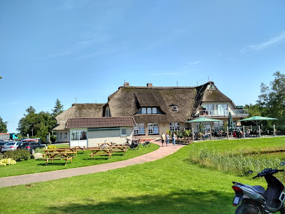
| Description | : | This is a very small, somewhat hidden rural cemetery in the enclave of Forlitz-Blaukirchen. town of Südbrookmerland. A second one is in the hamlet of Südwolde. The oldest grave plates dating back to the early 17th century. Please note that the graves in Germany are not perpetual. After a certain period of repose (20-30 years) the graves are being leveled and re-used. There is no toxic embalming being done in Germany, so the coffin and the corpse have decomposed naturally. If the family of the deceased decides to purchase another period the duration can be extended by another 30 years. War... Read More |
frequently asked questions (FAQ):
-
Where is Friedhof Forlitz-Blaukirchen?
Friedhof Forlitz-Blaukirchen is located at Schützenweg, Town of Südbrookmerland Landkreis Aurich ,Lower Saxony (Niedersachsen) , 26624Germany.
-
Friedhof Forlitz-Blaukirchen cemetery's updated grave count on graveviews.com?
0 memorials
-
Where are the coordinates of the Friedhof Forlitz-Blaukirchen?
Latitude: 53.4299767
Longitude: 7.3278897
Nearby Cemetories:
1. Friedhof Forlitz-Blaukirchen Südwolde
Landkreis Aurich, Germany
Coordinate: 53.4261329, 7.3023848
2. Friedhof Wiegboldsbur
Landkreis Aurich, Germany
Coordinate: 53.4492790, 7.3362930
3. Friedhof Ochtelbur
Ochtelbur, Landkreis Aurich, Germany
Coordinate: 53.4120450, 7.3756030
4. Friedhof Riepe
Landkreis Aurich, Germany
Coordinate: 53.3970680, 7.3543470
5. Friedhof Westerende
Westerende Kirchloog, Landkreis Aurich, Germany
Coordinate: 53.4428070, 7.4164820
6. Friedhof Marienwehr
Emden, Stadtkreis Emden, Germany
Coordinate: 53.3955860, 7.2541690
7. Friedhof Victorbur
Victorbur, Landkreis Aurich, Germany
Coordinate: 53.4858320, 7.3396980
8. Neuer Friedhof Loppersum
Hinte, Landkreis Aurich, Germany
Coordinate: 53.4289850, 7.2332520
9. Alter Friedhof Loppersum
Hinte, Landkreis Aurich, Germany
Coordinate: 53.4244880, 7.2316900
10. Friedhof Engerhafe
Engerhafe, Landkreis Aurich, Germany
Coordinate: 53.4878920, 7.3162940
11. Friedhof Moordorf
Landkreis Aurich, Germany
Coordinate: 53.4774410, 7.3929650
12. Friedhof Suurhusen
Hinte, Landkreis Aurich, Germany
Coordinate: 53.4135550, 7.2234350
13. Alter Friedhof Uphusen
Emden, Stadtkreis Emden, Germany
Coordinate: 53.3764860, 7.2540950
14. Neuer Friedhof Uphusen
Emden, Stadtkreis Emden, Germany
Coordinate: 53.3755620, 7.2559100
15. Neuer Friedhof Simonswolde
Simonswolde, Landkreis Aurich, Germany
Coordinate: 53.3727080, 7.3970540
16. Friedhof Ihlowerfehn
Ihlowerfehn, Landkreis Aurich, Germany
Coordinate: 53.4090680, 7.4428130
17. Alter Friedhof Simonswolde
Simonswolde, Landkreis Aurich, Germany
Coordinate: 53.3715750, 7.3989430
18. Friedhof Siegelsum
Siegelsum, Landkreis Aurich, Germany
Coordinate: 53.4978130, 7.2855320
19. Neuer Friedhof Hinte
Hinte, Landkreis Aurich, Germany
Coordinate: 53.4121300, 7.1968390
20. Alter Friedhof Hinte
Hinte, Landkreis Aurich, Germany
Coordinate: 53.4164530, 7.1949230
21. Friedhof Harsweg
Emden, Stadtkreis Emden, Germany
Coordinate: 53.3914260, 7.2065880
22. Friedhof Wolthusen
Emden, Stadtkreis Emden, Germany
Coordinate: 53.3701780, 7.2337400
23. Friedhof Tholenswehr
Emden, Stadtkreis Emden, Germany
Coordinate: 53.3759150, 7.2240770
24. Friedhof Walle
Walle, Landkreis Aurich, Germany
Coordinate: 53.4788190, 7.4419430