
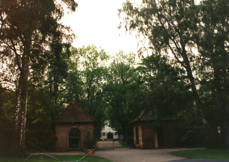
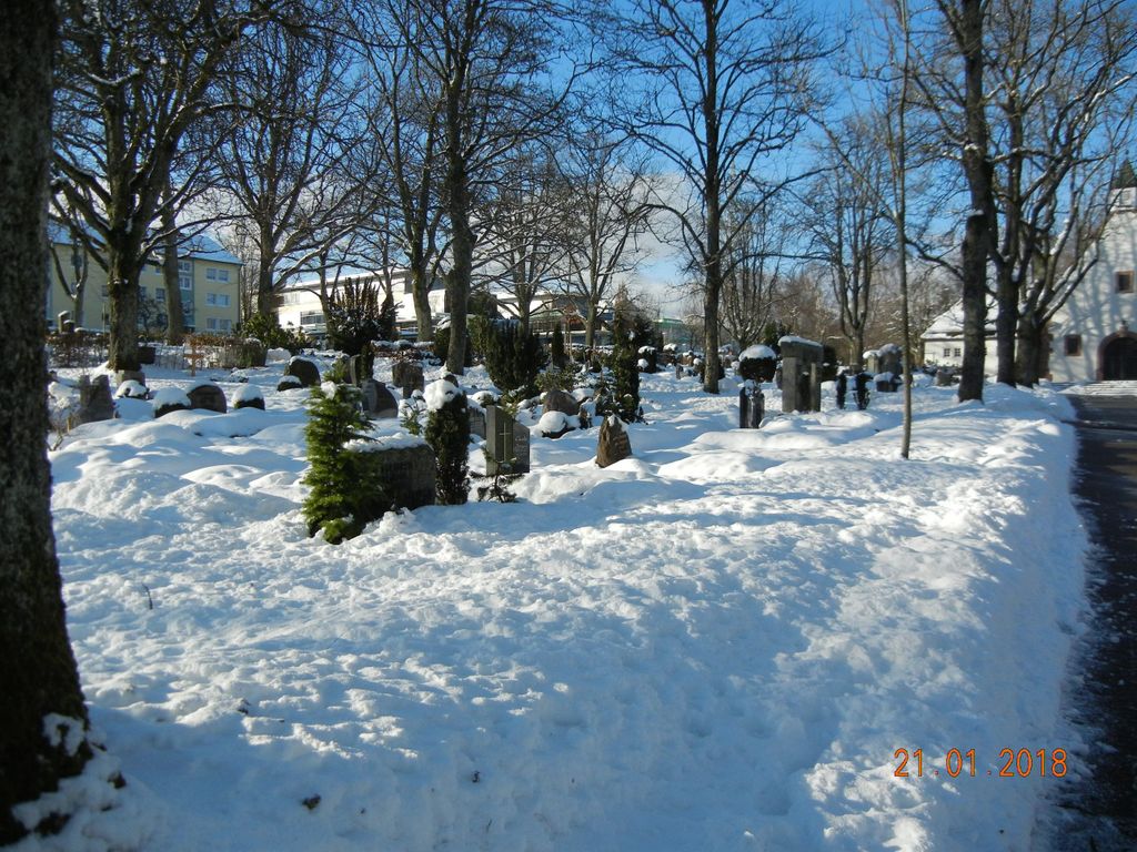
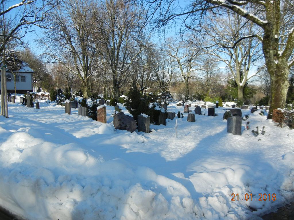
| Memorials | : | 0 |
| Location | : | Freudenstadt, Landkreis Freudenstadt, Germany |
| Website | : | www.freudenstadt.de/de/Unsere-Stadt/Rathaus/Service-Angebot/Friedhoefe |
| Coordinate | : | 48.4691040, 8.4215309 |
| Description | : | This entry is for the burial ground of the Protestant Church (evangelische Kirche) of Freudenstadt, Württemberg, in the present-day Freudenstädter Landkreis of Baden-Württemberg, Germany. The earliest registers of this church, dating back to the early-17th century, burned in 1945 at the end of World War II. Fortunately, genealogical extracts had been made previously by Max Cramer. These extracts and some of the church books are available on microfilm through the LDS Family History Library in Salt Lake City, UT, as follows: 1613-1808: reel #573697 & 1884470 1808-1852: reel #1884468 1851-1875: reel #1884469 Note that the extracts are difficult to decipher, and require the use of... Read More |
frequently asked questions (FAQ):
-
Where is Friedhof Freudenstadt?
Friedhof Freudenstadt is located at Freudenstadt, Landkreis Freudenstadt ,Baden-Württemberg ,Germany.
-
Friedhof Freudenstadt cemetery's updated grave count on graveviews.com?
0 memorials
-
Where are the coordinates of the Friedhof Freudenstadt?
Latitude: 48.4691040
Longitude: 8.4215309
Nearby Cemetories:
1. Friedhof Wittlensweiler
Wittlensweiler, Landkreis Freudenstadt, Germany
Coordinate: 48.4698530, 8.4473899
2. Wald der Erinnerung Freudenstadt
Freudenstadt, Landkreis Freudenstadt, Germany
Coordinate: 48.4420738, 8.4017089
3. Friedhof Frutenhof
Freudenstadt, Landkreis Freudenstadt, Germany
Coordinate: 48.4880774, 8.4595489
4. Friedhof Aach
Aach, Landkreis Freudenstadt, Germany
Coordinate: 48.4686980, 8.4715890
5. Friedhof Grüntal
Grüntal, Landkreis Freudenstadt, Germany
Coordinate: 48.4827665, 8.4730652
6. Alter Friedhof Aach
Aach, Landkreis Freudenstadt, Germany
Coordinate: 48.4714006, 8.4787687
7. Friedhof Dietersweiler
Dietersweiler, Landkreis Freudenstadt, Germany
Coordinate: 48.4546397, 8.4774533
8. Friedhof Untermusbach
Freudenstadt, Landkreis Freudenstadt, Germany
Coordinate: 48.4980378, 8.4710297
9. Friedhof Musbach
Freudenstadt, Landkreis Freudenstadt, Germany
Coordinate: 48.4981814, 8.4710472
10. Friedhof Obermusbach
Obermusbach, Landkreis Freudenstadt, Germany
Coordinate: 48.5058014, 8.4680885
11. Friedhof Baiersbronn
Baiersbronn, Landkreis Freudenstadt, Germany
Coordinate: 48.5070070, 8.3758830
12. Friedhof Dornstetten
Dornstetten, Landkreis Freudenstadt, Germany
Coordinate: 48.4703005, 8.4973207
13. Friedhof Hallwangen
Hallwangen, Landkreis Freudenstadt, Germany
Coordinate: 48.4877970, 8.4930435
14. Neuer Friedhof Klosterreichenbach
Klosterreichenbach, Landkreis Freudenstadt, Germany
Coordinate: 48.5168538, 8.3913737
15. Friedhof Loßburg-Rodt
Loßburg, Landkreis Freudenstadt, Germany
Coordinate: 48.4169791, 8.4436330
16. Friedhof Lombach
Lombach, Landkreis Freudenstadt, Germany
Coordinate: 48.4315372, 8.4821054
17. Alter Friedhof Klosterreichenbach
Klosterreichenbach, Landkreis Freudenstadt, Germany
Coordinate: 48.5228590, 8.3981380
18. Friedhof Loßburg
Loßburg, Landkreis Freudenstadt, Germany
Coordinate: 48.4136141, 8.4526851
19. Friedhof Glatten
Glatten, Landkreis Freudenstadt, Germany
Coordinate: 48.4401826, 8.5158914
20. Friedhof Igelsberg
Igelsberg, Landkreis Freudenstadt, Germany
Coordinate: 48.5375851, 8.4399454
21. Friedhof Kniebis
Freudenstadt, Landkreis Freudenstadt, Germany
Coordinate: 48.4724439, 8.3147383
22. Friedhof Heselbach
Heselbach, Landkreis Freudenstadt, Germany
Coordinate: 48.5393811, 8.4027707
23. Friedhof Tonbach
Tonbach, Landkreis Freudenstadt, Germany
Coordinate: 48.5302600, 8.3633000
24. Friedhof Schömberg
Schömberg, Landkreis Freudenstadt, Germany
Coordinate: 48.3957583, 8.4062364