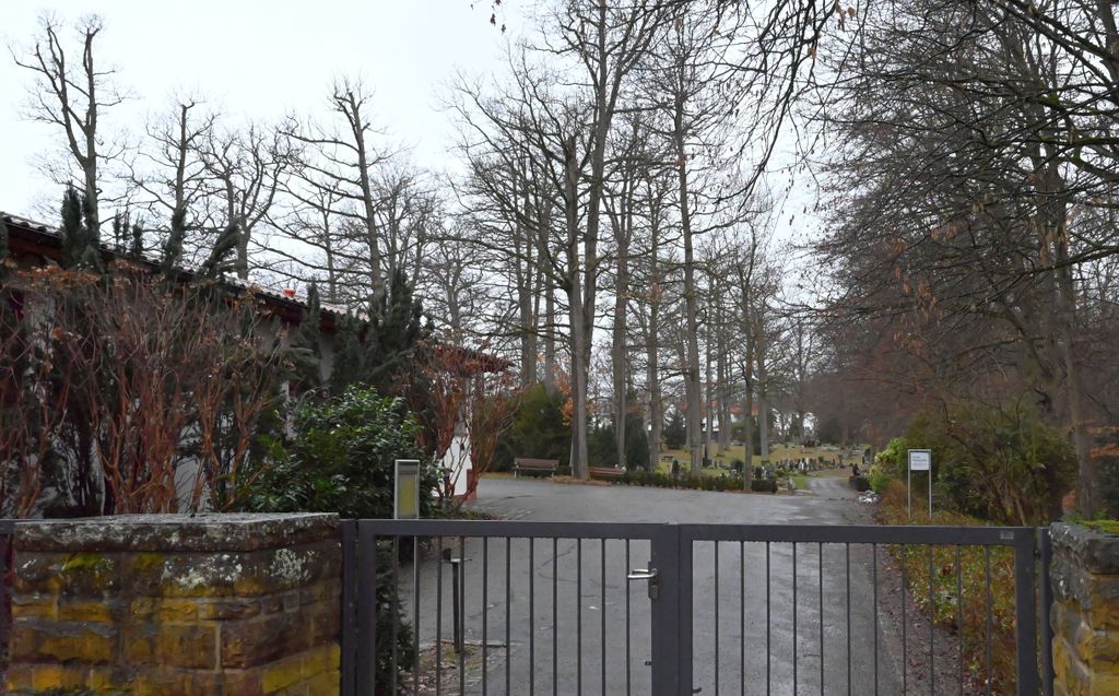
| Memorials | : | 0 |
| Location | : | Holzgerlingen, Landkreis Böblingen, Germany |
| Coordinate | : | 48.6498890, 9.0159450 |
| Description | : | Dedicated to the memory of deceased persons to prepare a worthy place as a secular or religious resting place. The cemetery in Holzgerlingen is an expression of a culture of remembrance, which extends far into pre-Christian times to make places of worship or burial an essential part of human civilization and, quite often, gives witness to rites or customs of the time. Resting places like the cemetery in Holzgerlingen can not differ only by their religious expression, but also in terms of their function. Many of these sites provide memorials that reflect social and cultural status. The cemetery in Holzgerlingen... Read More |
frequently asked questions (FAQ):
-
Where is Friedhof Holzgerlingen?
Friedhof Holzgerlingen is located at Maurener Weg 130 Holzgerlingen, Landkreis Böblingen ,Baden-Württemberg , 71034Germany.
-
Friedhof Holzgerlingen cemetery's updated grave count on graveviews.com?
0 memorials
-
Where are the coordinates of the Friedhof Holzgerlingen?
Latitude: 48.6498890
Longitude: 9.0159450
Nearby Cemetories:
1. Alter Friedhof Holzgerlingen
Holzgerlingen, Landkreis Böblingen, Germany
Coordinate: 48.6406900, 9.0129842
2. Friedhof Breitenstein
Weil im Schönbuch, Landkreis Böblingen, Germany
Coordinate: 48.6362552, 9.0433769
3. Friedhof Altdorf
Altdorf, Landkreis Böblingen, Germany
Coordinate: 48.6314966, 8.9943837
4. Waldfriedhof
Böblingen, Landkreis Böblingen, Germany
Coordinate: 48.6683148, 8.9919580
5. Friedhof Schönaich
Schönaich, Landkreis Böblingen, Germany
Coordinate: 48.6552990, 9.0596280
6. Friedhof Neuweiler
Weil im Schönbuch, Landkreis Böblingen, Germany
Coordinate: 48.6392183, 9.0615000
7. Friedhof Hägnach
Weil im Schönbuch, Landkreis Böblingen, Germany
Coordinate: 48.6324810, 9.0597680
8. Neuer Friedhof
Weil im Schönbuch, Landkreis Böblingen, Germany
Coordinate: 48.6323505, 9.0601000
9. Alter Friedhof Böblingen
Böblingen, Landkreis Böblingen, Germany
Coordinate: 48.6839990, 9.0228540
10. Alter Friedhof Weil im Schönbuch
Weil im Schönbuch, Landkreis Böblingen, Germany
Coordinate: 48.6205336, 9.0577844
11. Martinskirche
Weil im Schönbuch, Landkreis Böblingen, Germany
Coordinate: 48.6213102, 9.0615425
12. Friedhof Hildrizhausen
Hildrizhausen, Landkreis Böblingen, Germany
Coordinate: 48.6187377, 8.9678174
13. Waldfriedhof Ehningen
Ehningen, Landkreis Böblingen, Germany
Coordinate: 48.6560455, 8.9441118
14. Alter Friedhof Ehningen
Ehningen, Landkreis Böblingen, Germany
Coordinate: 48.6561231, 8.9439450
15. Friedhof Dagersheim
Böblingen, Landkreis Böblingen, Germany
Coordinate: 48.6908191, 8.9543693
16. Alter Friedhof Sindelfingen
Sindelfingen, Landkreis Böblingen, Germany
Coordinate: 48.7079410, 9.0048610
17. Friedhof Rohrau
Gärtringen, Landkreis Böblingen, Germany
Coordinate: 48.6263680, 8.9280380
18. Burghaldenfriedhof Sindelfingen
Sindelfingen, Landkreis Böblingen, Germany
Coordinate: 48.7141280, 9.0147940
19. Friedhof Dettenhausen
Dettenhausen, Landkreis Tübingen, Germany
Coordinate: 48.6113180, 9.0993660
20. Friedhof Steinenbronn
Steinenbronn, Landkreis Böblingen, Germany
Coordinate: 48.6559906, 9.1221714
21. Neuer Friedhof Darmsheim
Sindelfingen, Landkreis Böblingen, Germany
Coordinate: 48.6919409, 8.9295170
22. Friedhof Gärtringen
Gärtringen, Landkreis Böblingen, Germany
Coordinate: 48.6457600, 8.8936800
23. Friedhof Aidlingen
Aidlingen, Landkreis Böblingen, Germany
Coordinate: 48.6773821, 8.8974036
24. Waldfriedhof Maichingen
Sindelfingen, Landkreis Böblingen, Germany
Coordinate: 48.7316530, 8.9930280

