
| Memorials | : | 0 |
| Location | : | Sulz am Neckar, Landkreis Rottweil, Germany |
| Coordinate | : | 48.3636674, 8.6586897 |
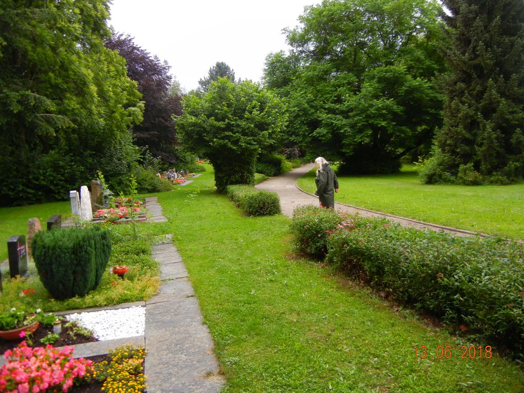
| Description | : | Is it a park, is it a cemetery, the local council have done an amazing job of amalgamating the two options into one. The plan is basically a circle or loop with memorials on the outside of the loop and the park created inside with a splendid selection of trees. The location is at the edge of town. |
frequently asked questions (FAQ):
-
Where is Friedhof Holzhausen?
Friedhof Holzhausen is located at AlbStr. Sulz am Neckar, Landkreis Rottweil ,Baden-Württemberg , 72172Germany.
-
Friedhof Holzhausen cemetery's updated grave count on graveviews.com?
0 memorials
-
Where are the coordinates of the Friedhof Holzhausen?
Latitude: 48.3636674
Longitude: 8.6586897
Nearby Cemetories:
1. Neuer Friedhof Sulz am Neckar
Sulz am Neckar, Landkreis Rottweil, Germany
Coordinate: 48.3622730, 8.6389354
2. Friedhof Bergfelden
Bergfelden, Landkreis Rottweil, Germany
Coordinate: 48.3459962, 8.6836336
3. Friedhof Sulz
Sulz am Neckar, Landkreis Rottweil, Germany
Coordinate: 48.3877515, 8.6721711
4. Friedhof Fischingen
Fischingen, Landkreis Rottweil, Germany
Coordinate: 48.3878919, 8.6724667
5. Friedhof Vöhringen
Vöhringen, Landkreis Rottweil, Germany
Coordinate: 48.3335929, 8.6665486
6. Friedhof Renfrizhausen
Renfrizhausen, Landkreis Rottweil, Germany
Coordinate: 48.3784232, 8.7020372
7. Friedhof Mühlheim
Mühlheim am Bach, Landkreis Rottweil, Germany
Coordinate: 48.3784438, 8.7020957
8. Friedhof Glatt
Glatt, Landkreis Rottweil, Germany
Coordinate: 48.3873161, 8.6170029
9. Friedhof Sigmarswangen
Sigmarswangen, Landkreis Rottweil, Germany
Coordinate: 48.3342335, 8.6105087
10. Friedhof Empfingen
Empfingen, Landkreis Freudenstadt, Germany
Coordinate: 48.3964117, 8.7073380
11. Friedhof Wittershausen
Wittershausen, Landkreis Rottweil, Germany
Coordinate: 48.3158294, 8.6391853
12. Kloster Kirchberg
Sulz am Neckar, Landkreis Rottweil, Germany
Coordinate: 48.3577900, 8.7340540
13. Friedhof Betra
Betra, Landkreis Freudenstadt, Germany
Coordinate: 48.4146479, 8.6713065
14. Friedhof Dürrenmettstetten
Dürrenmettstetten, Landkreis Rottweil, Germany
Coordinate: 48.3831812, 8.5861270
15. Friedhof Dettingen
Horb am Neckar, Landkreis Freudenstadt, Germany
Coordinate: 48.4129357, 8.6327063
16. Ruhewald Horb
Horb am Neckar, Landkreis Freudenstadt, Germany
Coordinate: 48.4211948, 8.6886005
17. Friedhof Isenburg
Horb am Neckar, Landkreis Freudenstadt, Germany
Coordinate: 48.4229400, 8.6796100
18. Haigerloch Jüdischer Friedhof
Haigerloch, Zollernalbkreis, Germany
Coordinate: 48.3592968, 8.7599466
19. Friedhof Bochingen
Oberndorf am Neckar, Landkreis Rottweil, Germany
Coordinate: 48.3011435, 8.6204117
20. Friedhof Ihlingen
Ihlingen, Landkreis Freudenstadt, Germany
Coordinate: 48.4320825, 8.6599926
21. Friedhof Brittheim
Brittheim, Zollernalbkreis, Germany
Coordinate: 48.2941471, 8.6853482
22. Jüdischer Friedhof Rexingen
Rexingen, Landkreis Freudenstadt, Germany
Coordinate: 48.4361870, 8.6503620
23. Friedhof Wiesenstetten
Hechingen, Zollernalbkreis, Germany
Coordinate: 48.3995370, 8.7540330
24. Friedhof Rexingen
Horb am Neckar, Landkreis Freudenstadt, Germany
Coordinate: 48.4363800, 8.6529900