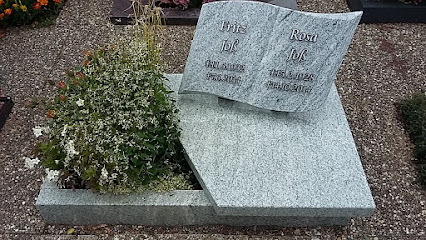
| Memorials | : | 0 |
| Location | : | Linkenheim, Landkreis Karlsruhe, Germany |
| Website | : | www.linkenheim-hochstetten.de/index.php/friedhoefe.html |
| Coordinate | : | 49.1243800, 8.4101900 |
| Description | : | Friedhof des Ortsteils Linkenheim der Gemeinde Linkenheim-Hochstetten. Fläche ca. 1,1 Hektar. Cemetery of the district Linkenheim in the commune Linkenheim-Hochstetten. Area about 1.1 hectares. |
frequently asked questions (FAQ):
-
Where is Friedhof Linkenheim?
Friedhof Linkenheim is located at Friedrichstraße Linkenheim, Landkreis Karlsruhe ,Baden-Württemberg , 76351Germany.
-
Friedhof Linkenheim cemetery's updated grave count on graveviews.com?
0 memorials
-
Where are the coordinates of the Friedhof Linkenheim?
Latitude: 49.1243800
Longitude: 8.4101900
Nearby Cemetories:
1. Friedhof Hochstetten
Hochstetten, Landkreis Karlsruhe, Germany
Coordinate: 49.1361400, 8.4151600
2. Friedhof Leopoldshafen
Leopoldshafen, Landkreis Karlsruhe, Germany
Coordinate: 49.0960000, 8.3959000
3. Waldfriedhof Friedrichstal
Friedrichstal, Landkreis Karlsruhe, Germany
Coordinate: 49.1065510, 8.4694500
4. Friedhof Leimersheim
Leimersheim, Landkreis Germersheim, Germany
Coordinate: 49.1273750, 8.3440230
5. Friedhof Eggenstein
Eggenstein, Landkreis Karlsruhe, Germany
Coordinate: 49.0809000, 8.3911000
6. Friedhof Kuhardt
Kuhardt, Landkreis Germersheim, Germany
Coordinate: 49.1463320, 8.3160220
7. Friedhof Hördt
Hordt, Landkreis Germersheim, Germany
Coordinate: 49.1631580, 8.3244620
8. Hauptfriedhof Neureut
Neureut, Stadtkreis Karlsruhe, Germany
Coordinate: 49.0578000, 8.3876000
9. Friedhof Blankenloch
Blankenloch, Landkreis Karlsruhe, Germany
Coordinate: 49.0636495, 8.4742513
10. Nordfriedhof Neureut
Neureut, Stadtkreis Karlsruhe, Germany
Coordinate: 49.0514237, 8.3828918
11. Friedhof
Neuthard, Landkreis Karlsruhe, Germany
Coordinate: 49.1257300, 8.5258400
12. Friedhof Staffort
Staffort, Landkreis Karlsruhe, Germany
Coordinate: 49.0893000, 8.5130000
13. Südfriedhof Neureut
Neureut, Stadtkreis Karlsruhe, Germany
Coordinate: 49.0463810, 8.3718930
14. Friedhof Rülzheim
Rülzheim, Landkreis Germersheim, Germany
Coordinate: 49.1520050, 8.2912460
15. Friedhof Rheinzabern
Rheinzabern, Landkreis Germersheim, Germany
Coordinate: 49.1209090, 8.2831460
16. Friedhof Karlsdorf
Karlsdorf, Landkreis Karlsruhe, Germany
Coordinate: 49.1396000, 8.5363000
17. Friedhof Büchig
Büchig (Stutensee), Landkreis Karlsruhe, Germany
Coordinate: 49.0496000, 8.4698000
18. Friedhof Germersheim
Germersheim, Landkreis Germersheim, Germany
Coordinate: 49.2137150, 8.3795910
19. Friedhof Jockgrim
Jockgrim, Landkreis Germersheim, Germany
Coordinate: 49.0911480, 8.2759520
20. Friedhof Nordweststadt
Nordweststadt, Stadtkreis Karlsruhe, Germany
Coordinate: 49.0342000, 8.3628000
21. Friedhof Knielingen
Knielingen, Stadtkreis Karlsruhe, Germany
Coordinate: 49.0354792, 8.3393088
22. Jüdischer Friedhof Huttenheim
Huttenheim, Landkreis Karlsruhe, Germany
Coordinate: 49.2160880, 8.4756450
23. Friedhof Hagsfeld
Hagsfeld, Stadtkreis Karlsruhe, Germany
Coordinate: 49.0274956, 8.4616035
24. Großherzogliche Grabkapelle Karlsruhe
Karlsruhe, Stadtkreis Karlsruhe, Germany
Coordinate: 49.0198590, 8.4201550

