
| Memorials | : | 0 |
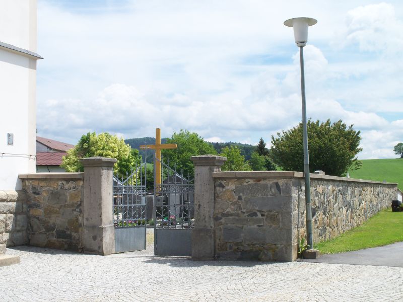
| Location | : | Hintereben, Landkreis Freyung-Grafenau, Germany |
| Coordinate | : | 48.7544722, 13.6666389 |
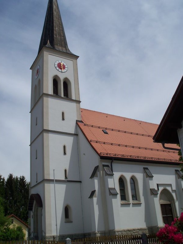
| Description | : | Die neugotische Pfarrkirche Maria Hilfe der Christen wurde 1899 erbaut. --------------------------------------- The neo-Gothic parish church of Mary Help of Christians was built in 1899. |
frequently asked questions (FAQ):
-
Where is Friedhof Maria Hilfe der Christen?
Friedhof Maria Hilfe der Christen is located at Kirchplatz 1 Hintereben, Landkreis Freyung-Grafenau ,Bavaria (Bayern) , 94116Germany.
-
Friedhof Maria Hilfe der Christen cemetery's updated grave count on graveviews.com?
0 memorials
-
Where are the coordinates of the Friedhof Maria Hilfe der Christen?
Latitude: 48.7544722
Longitude: 13.6666389
Nearby Cemetories:
1. Friedhof Sankt Bruder Konrad
Böhmzwiesel, Landkreis Freyung-Grafenau, Germany
Coordinate: 48.7635277, 13.6309722
2. Friedhof Maria Unbefleckte Empfängnis
Jandelsbrunn, Landkreis Freyung-Grafenau, Germany
Coordinate: 48.7296670, 13.6945550
3. Friedhof Sankt Ägidius
Wollaberg, Landkreis Freyung-Grafenau, Germany
Coordinate: 48.7226000, 13.6717600
4. Friedhof Heilige Dreifaltigkeit
Grainet, Landkreis Freyung-Grafenau, Germany
Coordinate: 48.7997500, 13.6504170
5. Friedhof Sankt Sigismund
Altreichenau, Landkreis Freyung-Grafenau, Germany
Coordinate: 48.7725280, 13.7321940
6. Friedhof St. Peter und Paul
Waldkirchen, Landkreis Freyung-Grafenau, Germany
Coordinate: 48.7290278, 13.6011667
7. Friedhof Sankt Josef
Karlsbach, Landkreis Freyung-Grafenau, Germany
Coordinate: 48.7661100, 13.5859400
8. Naturfriedhof Grainet
Unterseilberg, Landkreis Freyung-Grafenau, Germany
Coordinate: 48.8035179, 13.6260349
9. Friedhof Sankt Leonhard
Neureichenau, Landkreis Freyung-Grafenau, Germany
Coordinate: 48.7480278, 13.5643611
10. Friedhof Maria Himmelfahrt
Sonnen, Landkreis Passau, Germany
Coordinate: 48.6833619, 13.7234598
11. Friedhof Christus dem Auferstandenen
Hinterschmiding, Landkreis Freyung-Grafenau, Germany
Coordinate: 48.8240830, 13.6004440
12. Friedhof St. Oswald
Herzogsreut, Landkreis Freyung-Grafenau, Germany
Coordinate: 48.8353611, 13.6404444
13. Sankt Valentin Friedhof
Bischofsreut, Landkreis Freyung-Grafenau, Germany
Coordinate: 48.8356111, 13.6404444
14. Freyung, Neuer Friedhof
Freyung, Landkreis Freyung-Grafenau, Germany
Coordinate: 48.8060003, 13.5608079
15. Friedhof Freyung Neuer
Schönbrunn, Landkreis Freyung-Grafenau, Germany
Coordinate: 48.8063610, 13.5603610
16. Friedhof St. Konrad
Lackenhäuser, Landkreis Freyung-Grafenau, Germany
Coordinate: 48.7404125, 13.8087065
17. Freyung Alter Friedhof
Freyung, Landkreis Freyung-Grafenau, Germany
Coordinate: 48.8105560, 13.5482780
18. Friedhof Sankt Michael
Röhrnbach, Landkreis Freyung-Grafenau, Germany
Coordinate: 48.7387222, 13.5223889
19. Friedhof St. Raymund
Breitenberg, Landkreis Passau, Germany
Coordinate: 48.7039800, 13.7958800
20. St. Raymund Cemetery
Breitenberg, Kreis Steinburg, Germany
Coordinate: 48.7021521, 13.7950413
21. Friedhof St. Maximilian
Haidmühle, Landkreis Freyung-Grafenau, Germany
Coordinate: 48.8268889, 13.7763611
22. Friedhof Sankt Josef
Kumreut, Landkreis Freyung-Grafenau, Germany
Coordinate: 48.7751667, 13.5136944
23. Sankt Anna Friedhof
Kreuzberg, Landkreis Freyung-Grafenau, Germany
Coordinate: 48.8385600, 13.5529440
24. Philippsreut Friedhof
Philippsreut, Landkreis Freyung-Grafenau, Germany
Coordinate: 48.8694720, 13.6818050