
| Memorials | : | 0 |
| Location | : | Steinweiler, Landkreis Germersheim, Germany |
| Coordinate | : | 49.1192100, 8.1425300 |
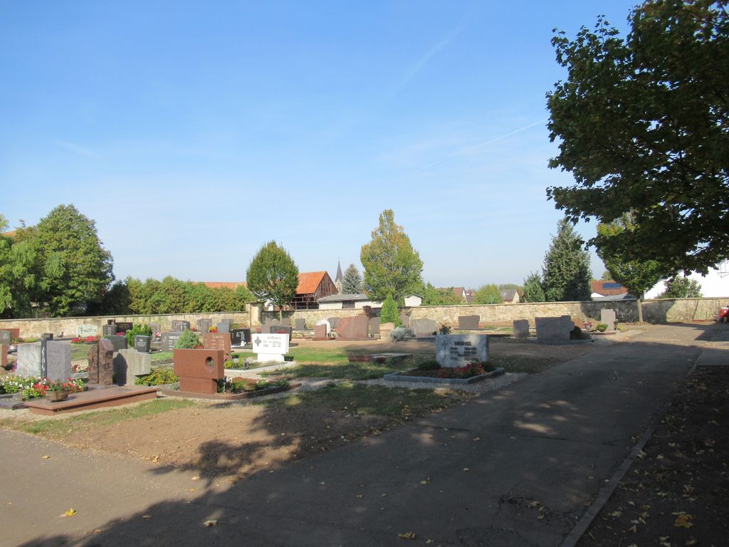
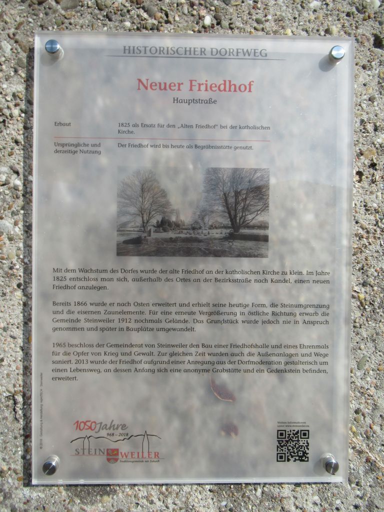
| Description | : | Steinweiler is a large village (population: 1870) in the German state of Rheinland-Pfalz and located northwest of Karlsruhe, approx. 30 minutes by car. The biggest towns closest to Steinweiler are Bad Bergzabern to the west and Landau to the north. The re-use of grave plots in Germany is very common. You or your family rent the plot for a period of 20 to 25 years (the time period varies from state to state). When this time period is up, church or civil authorities approach your family or next of kin concerning a rental renewal. If you have no next of kin,... Read More |
frequently asked questions (FAQ):
-
Where is Friedhof Steinweiler?
Friedhof Steinweiler is located at Klingbachstraße Steinweiler, Landkreis Germersheim ,Rheinland-Pfalz , 76872Germany.
-
Friedhof Steinweiler cemetery's updated grave count on graveviews.com?
0 memorials
-
Where are the coordinates of the Friedhof Steinweiler?
Latitude: 49.1192100
Longitude: 8.1425300
Nearby Cemetories:
1. Friedhof Rohrbach
Rohrbach, Landkreis Südliche Weinstraße, Germany
Coordinate: 49.1401300, 8.1286980
2. Friedhof Winden
Winden, Landkreis Germersheim, Germany
Coordinate: 49.0987460, 8.1103400
3. Friedhof Billigheim
Billigheim-Ingenheim, Landkreis Südliche Weinstraße, Germany
Coordinate: 49.1373800, 8.1027700
4. Friedhof Mühlhofen
Mühlhofen, Landkreis Südliche Weinstraße, Germany
Coordinate: 49.1273720, 8.0935100
5. Friedhof Insheim
Insheim, Landkreis Südliche Weinstraße, Germany
Coordinate: 49.1569000, 8.1378400
6. Friedhof Appenhofen
Billigheim-Ingenheim, Landkreis Südliche Weinstraße, Germany
Coordinate: 49.1407650, 8.0836960
7. Friedhof Minfeld
Minfeld, Landkreis Germersheim, Germany
Coordinate: 49.0739600, 8.1379300
8. Friedhof Ingenheim
Billigheim-Ingenheim, Landkreis Südliche Weinstraße, Germany
Coordinate: 49.1389400, 8.0800400
9. Friedhof Kandel
Kandel, Landkreis Germersheim, Germany
Coordinate: 49.0851460, 8.1929680
10. Friedhof Impflingen
Impflingen, Landkreis Südliche Weinstraße, Germany
Coordinate: 49.1640340, 8.1133950
11. Friedhof Barbelroth
Barbelroth, Landkreis Südliche Weinstraße, Germany
Coordinate: 49.1052060, 8.0688880
12. Friedhof Herxheim
Herxheim, Landkreis Südliche Weinstraße, Germany
Coordinate: 49.1490810, 8.2160500
13. Friedhof Freckenfeld
Freckenfeld, Landkreis Germersheim, Germany
Coordinate: 49.0669020, 8.1091930
14. Friedhof Oberhausen
Oberhausen, Landkreis Südliche Weinstraße, Germany
Coordinate: 49.1019820, 8.0594070
15. Friedhof Heuchelheim
Heuchelheim, Landkreis Südliche Weinstraße, Germany
Coordinate: 49.1443270, 8.0637740
16. Waldfriedhof Bienwaldruhe
Kandel, Landkreis Germersheim, Germany
Coordinate: 49.0640600, 8.1746390
17. Friedhof Dierbach
Dierbach, Landkreis Südliche Weinstraße, Germany
Coordinate: 49.0802660, 8.0653940
18. Friedhof Hatzenbühl
Hatzenbühl, Landkreis Germersheim, Germany
Coordinate: 49.1152100, 8.2427800
19. Friedhof Mörzheim
Stadtkreis Landau in der Pfalz, Germany
Coordinate: 49.1708590, 8.0757550
20. Friedhof Schaidt
Schaidt, Landkreis Germersheim, Germany
Coordinate: 49.0622200, 8.0836200
21. Friedhof Vollmersweiler
Vollmersweiler, Landkreis Germersheim, Germany
Coordinate: 49.0655390, 8.0740610
22. Friedhof Kapellen-Drusweiler
Kapellen-Drusweiler, Landkreis Südliche Weinstraße, Germany
Coordinate: 49.1058000, 8.0369000
23. Friedhof Wollmesheim
Landau, Stadtkreis Landau in der Pfalz, Germany
Coordinate: 49.1822490, 8.0836310
24. Friedhof Mörlheim
Landau, Stadtkreis Landau in der Pfalz, Germany
Coordinate: 49.1922630, 8.1623430