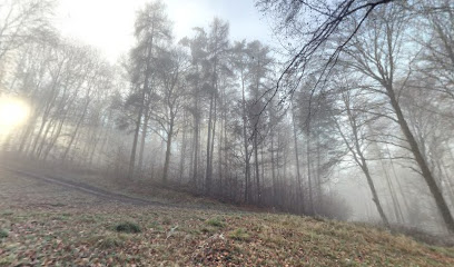
| Memorials | : | 0 |
| Location | : | Steinfeld, Landkreis Main-Spessart, Germany |
| Coordinate | : | 49.9425380, 9.6320520 |
| Description | : | Located in Waldzell, now part of Steinfeld n the Unterfranken district of Bayern, Germany. |
frequently asked questions (FAQ):
-
Where is Friedhof Waldzell?
Friedhof Waldzell is located at Friedhofstraße 16 Steinfeld, Landkreis Main-Spessart ,Bavaria (Bayern) , 97854Germany.
-
Friedhof Waldzell cemetery's updated grave count on graveviews.com?
0 memorials
-
Where are the coordinates of the Friedhof Waldzell?
Latitude: 49.9425380
Longitude: 9.6320520
Nearby Cemetories:
1. Kloster Neustadt am Main
Neustadt am Main, Landkreis Main-Spessart, Germany
Coordinate: 49.9301000, 9.5703000
2. Neustadt
Neustadt am Main, Landkreis Main-Spessart, Germany
Coordinate: 49.9276755, 9.5683666
3. Friedhof Sendelbach
Sendelbach, Landkreis Main-Spessart, Germany
Coordinate: 49.9858986, 9.5871406
4. Friedhof Lohr am Main
Lohr am Main, Landkreis Main-Spessart, Germany
Coordinate: 49.9887771, 9.5759869
5. Friedhof Wiesenfeld
Wiesenfeld, Landkreis Main-Spessart, Germany
Coordinate: 49.9945941, 9.6747622
6. St. Michael Lohr am Main
Lohr am Main, Landkreis Main-Spessart, Germany
Coordinate: 49.9930560, 9.5758330
7. Friedhof Karbach (bei Wertheim)
Karbach, Landkreis Main-Spessart, Germany
Coordinate: 49.8680520, 9.6383134
8. Friedhof Hafenlohr
Hafenlohr, Landkreis Main-Spessart, Germany
Coordinate: 49.8701429, 9.6017881
9. Friedhof Billingshausen (bei Marktheidenfeld)
Billingshausen, Landkreis Main-Spessart, Germany
Coordinate: 49.8721752, 9.7179038
10. Friedhof Birkenfeld
Birkenfeld, Landkreis Main-Spessart, Germany
Coordinate: 49.8570367, 9.6902454
11. St.-Georg-Kirche
Trennfeld, Landkreis Main-Spessart, Germany
Coordinate: 49.8500000, 9.6000000
12. Ostfriedhof Karlstadt
Karlstadt, Landkreis Main-Spessart, Germany
Coordinate: 49.9614734, 9.7800260
13. Schloss Hohenburg Schlosskapelle
Gemünden am Main, Landkreis Main-Spessart, Germany
Coordinate: 50.0497220, 9.7055560
14. Friedhof Langenprozelten
Langenprozelten, Landkreis Main-Spessart, Germany
Coordinate: 50.0640200, 9.6563800
15. Friedhof Gemünden am Main
Gemünden am Main, Landkreis Main-Spessart, Germany
Coordinate: 50.0599800, 9.6880010
16. Friedhof Zellingen
Zellingen, Landkreis Main-Spessart, Germany
Coordinate: 49.9009231, 9.8124830
17. Friedhof Partenstein
Partenstein, Landkreis Main-Spessart, Germany
Coordinate: 50.0427337, 9.5182633
18. Friedhof Eußenheim
Eussenheim, Landkreis Main-Spessart, Germany
Coordinate: 49.9895147, 9.8112055
19. Friedhof Retzbach
Retzbach, Landkreis Main-Spessart, Germany
Coordinate: 49.9029053, 9.8287932
20. Friedhof Michelrieth
Michelrieth, Landkreis Main-Spessart, Germany
Coordinate: 49.8288681, 9.5231760
21. Friedhof Unterleinach
Unterleinach, Landkreis Würzburg, Germany
Coordinate: 49.8636532, 9.8025210
22. Friedhof Remlingen
Remlingen, Landkreis Würzburg, Germany
Coordinate: 49.8066432, 9.6976671
23. Friedhof Rettersheim
Rettersheim, Landkreis Main-Spessart, Germany
Coordinate: 49.8005077, 9.5858191
24. Ruhewald Greußenheim
Greußenheim, Landkreis Würzburg, Germany
Coordinate: 49.8120470, 9.7326090

