
| Memorials | : | 0 |
| Location | : | Wollenberg, Landkreis Heilbronn, Germany |
| Coordinate | : | 49.2902326, 9.0391244 |
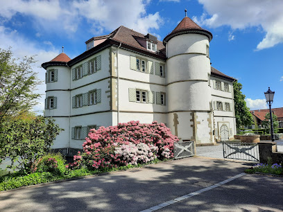
| Description | : | Wollenberg ist eine kleine Gemeinde mit ca. 400 Einwohnern und gehört zu Bad Rappenau |
frequently asked questions (FAQ):
-
Where is Friedhof Wollenberg?
Friedhof Wollenberg is located at Am Kirchberg Wollenberg, Landkreis Heilbronn ,Baden-Württemberg , 74906Germany.
-
Friedhof Wollenberg cemetery's updated grave count on graveviews.com?
0 memorials
-
Where are the coordinates of the Friedhof Wollenberg?
Latitude: 49.2902326
Longitude: 9.0391244
Nearby Cemetories:
1. Friedhof Bargen
Helmstadt-Bargen, Rhein-Neckar-Kreis, Germany
Coordinate: 49.3075225, 9.0238998
2. Friedhof Helmhof
Helmhof, Rhein-Neckar-Kreis, Germany
Coordinate: 49.2827260, 8.9992770
3. Untergimpern Friedhof
Untergimpern, Rhein-Neckar-Kreis, Germany
Coordinate: 49.2690700, 9.0104700
4. Friedhof Obergimpern
Obergimpern, Landkreis Heilbronn, Germany
Coordinate: 49.2562654, 9.0432099
5. Friedhof Hasselbach
Hasselbach, Rhein-Neckar-Kreis, Germany
Coordinate: 49.2601422, 8.9854384
6. Totenkirche Neckarbischofsheim
Waibstadt, Rhein-Neckar-Kreis, Germany
Coordinate: 49.2943610, 8.9601940
7. Jüdischer Friedhof Bad Rappenau
Bad Rappenau, Landkreis Heilbronn, Germany
Coordinate: 49.2460944, 9.0987333
8. Friedhof Adersbach
Adersbach, Rhein-Neckar-Kreis, Germany
Coordinate: 49.2633872, 8.9569143
9. Jüdischer Friedhof Heinsheim
Bad Rappenau, Landkreis Heilbronn, Germany
Coordinate: 49.2651390, 9.1236110
10. Friedhof Bad Rappenau
Bad Rappenau, Landkreis Heilbronn, Germany
Coordinate: 49.2428810, 9.0983930
11. Friedhof Zimmerhof - Bad Rappenau
Bad Rappenau, Landkreis Heilbronn, Germany
Coordinate: 49.2521444, 9.1148926
12. Jüdischer Friedhof Waibstadt
Waibstadt, Rhein-Neckar-Kreis, Germany
Coordinate: 49.2977310, 8.9342450
13. Friedhof Grombach
Grombach, Landkreis Heilbronn, Germany
Coordinate: 49.2274163, 8.9947365
14. Friedhof Obrigheim
Obrigheim, Neckar-Odenwald-Kreis, Germany
Coordinate: 49.3545400, 9.0960200
15. Friedhof Binau
Binau, Neckar-Odenwald-Kreis, Germany
Coordinate: 49.3674374, 9.0626862
16. Jüdischer Friedhof Binau
Binau, Neckar-Odenwald-Kreis, Germany
Coordinate: 49.3679600, 9.0646100
17. Friedhof Bonfeld
Bonfeld, Landkreis Heilbronn, Germany
Coordinate: 49.2154000, 9.0930400
18. Friedhof Kirchardt
Kirchardt, Landkreis Heilbronn, Germany
Coordinate: 49.2059878, 8.9901106
19. Stiftskirche St. Juliana
Mosbach, Neckar-Odenwald-Kreis, Germany
Coordinate: 49.3525000, 9.1465280
20. Offenau Friedhof
Heilbronn, Stadtkreis Heilbronn, Germany
Coordinate: 49.2468537, 9.1668231
21. Friedhof Rohrbach
Rohrbach, Rhein-Neckar-Kreis, Germany
Coordinate: 49.2531307, 8.9065364
22. Friedhof Steinsfurt
Steinsfurt, Rhein-Neckar-Kreis, Germany
Coordinate: 49.2346838, 8.9137940
23. Dominikanerkirche
Bad Wimpfen, Landkreis Heilbronn, Germany
Coordinate: 49.2285280, 9.1609720
24. Jüdischer Friedhof Mosbach
Mosbach, Neckar-Odenwald-Kreis, Germany
Coordinate: 49.3602300, 9.1512100