
| Memorials | : | 0 |
| Location | : | Milverton, Taunton Deane Borough, England |
| Phone | : | 01884 255926 |
| Website | : | www.spicelanduffculmequakers.com/wp-content/uploads/2015/07/Milverton-BG-leaflet.pdf |
| Coordinate | : | 51.0267290, -3.2756778 |
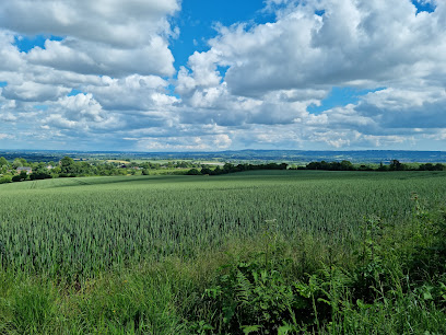
| Description | : | The Milverton Burial Ground is situated on Quaking House Lane about a mile to the west of Milverton. The Quaking House is signposted from the B3227 Milverton to Wiveliscombe road, and the Burial Ground is just beyond the house on the right. There are no formal parking spaces for the Burial Ground, although one or two cars may be parked immediately outside the gate for short periods, or in the layby passed on the right when approaching from the B3227. Visitors are asked to walk, cycle or car share whenever possible. Postcode: TA4 1NG Map ref: ST 10633 26037 |
frequently asked questions (FAQ):
-
Where is Friends' Burial Ground?
Friends' Burial Ground is located at Quaking House Lane Milverton, Taunton Deane Borough ,Somerset , TA4. 1NGEngland.
-
Friends' Burial Ground cemetery's updated grave count on graveviews.com?
0 memorials
-
Where are the coordinates of the Friends' Burial Ground?
Latitude: 51.0267290
Longitude: -3.2756778
Nearby Cemetories:
1. St Michael Churchyard
Milverton, Taunton Deane Borough, England
Coordinate: 51.0255170, -3.2537660
2. Saint James Churchyard
Fitzhead, Taunton Deane Borough, England
Coordinate: 51.0481000, -3.2571000
3. St. Andrew's Churchyard
Wiveliscombe, Taunton Deane Borough, England
Coordinate: 51.0410630, -3.3096850
4. Saint Peter's Churchyard
Langford Budville, Taunton Deane Borough, England
Coordinate: 50.9988720, -3.2673740
5. St Bartholomew's Churchyard
Bathealton, Taunton Deane Borough, England
Coordinate: 51.0086320, -3.3130130
6. Saint James Churchyard
Halse, Taunton Deane Borough, England
Coordinate: 51.0425680, -3.2285430
7. All Saints Churchyard
Nynehead, Taunton Deane Borough, England
Coordinate: 50.9973924, -3.2298043
8. St Nicholas' Church
Kittisford, Taunton Deane Borough, England
Coordinate: 50.9930799, -3.3149354
9. St. Bartholomew's Churchyard
Oake, Taunton Deane Borough, England
Coordinate: 51.0196440, -3.2094170
10. St. Margaret's Churchyard
Thorne St Margaret, Taunton Deane Borough, England
Coordinate: 50.9821349, -3.2854411
11. St. John the Baptist Churchyard
Heathfield, Taunton Deane Borough, England
Coordinate: 51.0314500, -3.1990400
12. Holy Trinity Churchyard
Ash Priors, Taunton Deane Borough, England
Coordinate: 51.0584700, -3.2118200
13. St John the Baptist Churchyard
Wellington, Taunton Deane Borough, England
Coordinate: 50.9811590, -3.2253540
14. Holy Cross at Hillfarrance
Wellington, Taunton Deane Borough, England
Coordinate: 51.0150260, -3.1884860
15. St John The Baptist Churchyard
Tolland, Taunton Deane Borough, England
Coordinate: 51.0826570, -3.2856680
16. Quaker Burial Ground at Wellington Meeting House
Wellington, Taunton Deane Borough, England
Coordinate: 50.9788260, -3.2263490
17. All Saints Churchyard
Wellington, Taunton Deane Borough, England
Coordinate: 50.9727340, -3.2455050
18. All Saints Cemetery
Chipstable, Taunton Deane Borough, England
Coordinate: 51.0354480, -3.3665950
19. Wellington Cemetery
Wellington, Taunton Deane Borough, England
Coordinate: 50.9733000, -3.2403000
20. Lydeard St Lawrence Churchyard
Lydeard St Lawrence, Taunton Deane Borough, England
Coordinate: 51.0818820, -3.2462470
21. St. Peter's Churchyard
Wellington, Taunton Deane Borough, England
Coordinate: 50.9736319, -3.3136284
22. St. Peter's Churchyard Huish Champflower
Chipstable, Taunton Deane Borough, England
Coordinate: 51.0543700, -3.3580940
23. Blessed Virgin Mary Churchyard
Brompton Ralph, West Somerset District, England
Coordinate: 51.0830230, -3.3077060
24. St Peter and St Paul Churchyard
Combe Florey, Taunton Deane Borough, England
Coordinate: 51.0735250, -3.2139050