
| Memorials | : | 0 |
| Location | : | Honea Path, Anderson County, USA |
| Coordinate | : | 34.4975014, -82.3835983 |
frequently asked questions (FAQ):
-
Where is Friendship Baptist Church Cemetery #2?
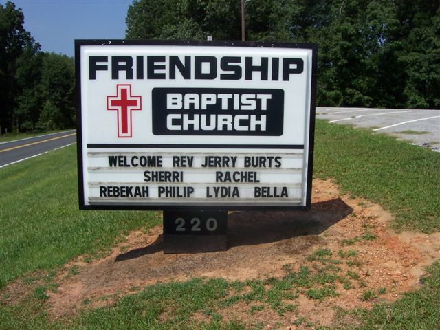
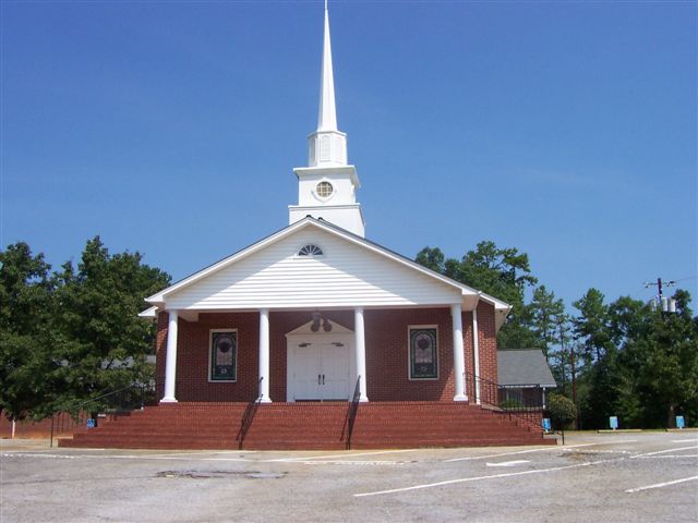
Friendship Baptist Church Cemetery #2 is located at 220 Friendship Church Road Honea Path, Anderson County ,South Carolina , 29654USA.
-
Friendship Baptist Church Cemetery #2 cemetery's updated grave count on graveviews.com?
0 memorials
-
Where are the coordinates of the Friendship Baptist Church Cemetery #2?
Latitude: 34.4975014
Longitude: -82.3835983
Nearby Cemetories:
1. New Broadmouth Baptist Church Cemetery
Honea Path, Anderson County, USA
Coordinate: 34.4936640, -82.4023680
2. Saint James United Methodist Church Cemetery
Honea Path, Anderson County, USA
Coordinate: 34.4970880, -82.4034090
3. Cox Family Cemetery #1
Anderson County, USA
Coordinate: 34.5094130, -82.4022880
4. Perrit Family Cemetery
Laurens County, USA
Coordinate: 34.4706001, -82.3851013
5. Poole Family Cemetery
Laurens County, USA
Coordinate: 34.4706001, -82.3851013
6. Kay Plantation Cemetery
Honea Path, Anderson County, USA
Coordinate: 34.4746700, -82.3603800
7. Clinkscales Family Cemetery
Anderson County, USA
Coordinate: 34.4766770, -82.3525090
8. Cooley-Whitt Family Cemetery
Greenville County, USA
Coordinate: 34.5313988, -82.3619003
9. East View Cemetery
Honea Path, Anderson County, USA
Coordinate: 34.4528008, -82.3778000
10. Broadmouth Church Cemetery
Honea Path, Abbeville County, USA
Coordinate: 34.4597015, -82.3516998
11. Liberty Baptist Church Cemetery
Honea Path, Anderson County, USA
Coordinate: 34.4460610, -82.3822590
12. Gambrell Cemetery
Honea Path, Anderson County, USA
Coordinate: 34.4843000, -82.3205500
13. Honea Path Presbyterian Church Cemetery
Honea Path, Anderson County, USA
Coordinate: 34.4441986, -82.3917007
14. Garden of Memories Cemetery
Belton, Anderson County, USA
Coordinate: 34.4777985, -82.4464035
15. Sally Reed Cemetery
Belton, Anderson County, USA
Coordinate: 34.5238495, -82.4465637
16. Shady Grove Baptist Church Cemetery
Belton, Anderson County, USA
Coordinate: 34.5370598, -82.4362411
17. Massey Family Cemetery
Honea Path, Anderson County, USA
Coordinate: 34.4534000, -82.4405170
18. Oak Hill United Methodist Church Cemetery
Greenville County, USA
Coordinate: 34.5593987, -82.3566971
19. McDavid Cemetery
Belton, Anderson County, USA
Coordinate: 34.5530520, -82.3403290
20. Oak Hill United Methodist Church Cemetery
Belton, Anderson County, USA
Coordinate: 34.5597980, -82.3563350
21. Gaines Cemetery
Greenville County, USA
Coordinate: 34.5088997, -82.3041992
22. Hiram Cooley Plantation Cemetery
Greenville County, USA
Coordinate: 34.5594788, -82.4152985
23. Columbia Baptist Church Cemetery
Greenville County, USA
Coordinate: 34.5231018, -82.3080978
24. Smith Family Cemetery
High Point, Anderson County, USA
Coordinate: 34.4896170, -82.4647500