
| Memorials | : | 0 |
| Location | : | Zolfo Springs, Hardee County, USA |
| Coordinate | : | 27.4553697, -81.7752567 |
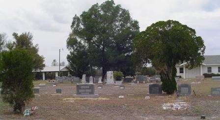
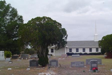
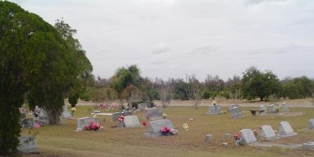
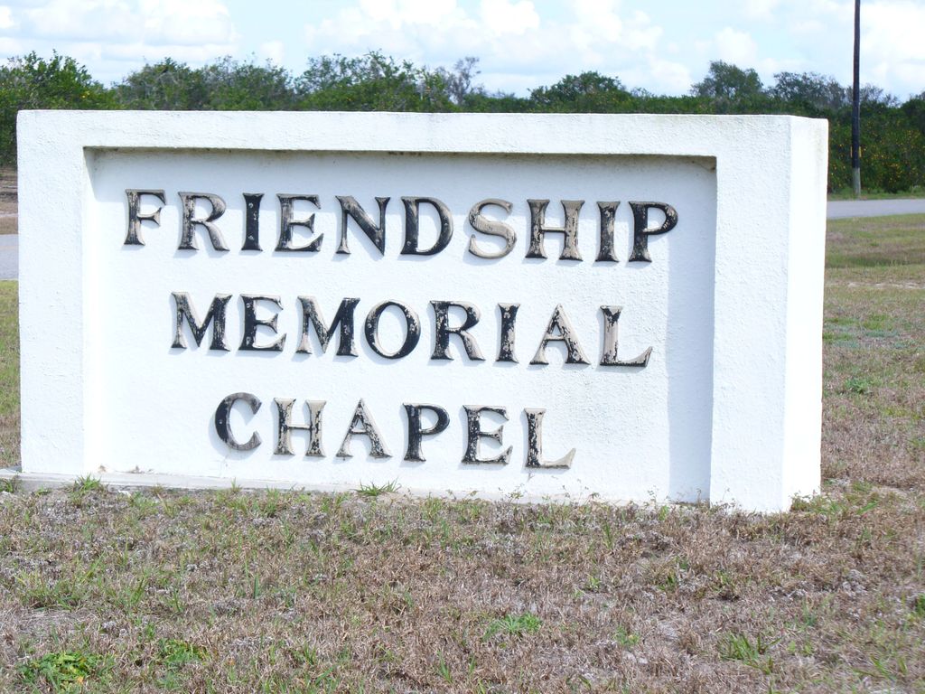
| Description | : | On US 17, south of Zolfo Springs, go about 3 miles to Moffet Road. Turn East, the church is 2 miles ahead on the south side of the road. This small church and its cemetery are in the heart of Florida citrus and cattle country. The families that poured their lives into the this land represent the backbone of our country, simple people that worked the land, raised their children to be God fearing, tended their groves and herds, and served their country in peace and in war. |
frequently asked questions (FAQ):
-
Where is Friendship Methodist Cemetery?
Friendship Methodist Cemetery is located at 804 Moffitt Road Zolfo Springs, Hardee County ,Florida , 33890USA.
-
Friendship Methodist Cemetery cemetery's updated grave count on graveviews.com?
0 memorials
-
Where are the coordinates of the Friendship Methodist Cemetery?
Latitude: 27.4553697
Longitude: -81.7752567
Nearby Cemetories:
1. Zolfo Springs Baptist Church Cemetery
Zolfo Springs, Hardee County, USA
Coordinate: 27.4888990, -81.7914080
2. New Hope Baptist Cemetery
Wauchula, Hardee County, USA
Coordinate: 27.5234910, -81.7506030
3. Oak Grove Community Cemetery
Hardee County, USA
Coordinate: 27.4710999, -81.8600006
4. Magnolia Manor Cemetery
Wauchula, Hardee County, USA
Coordinate: 27.5294740, -81.8001560
5. Wauchula Cemetery
Wauchula, Hardee County, USA
Coordinate: 27.5314007, -81.8116989
6. Sweetwater Cemetery
Sweetwater, Hardee County, USA
Coordinate: 27.4055784, -81.7002807
7. Locklar Cemetery
Zolfo Springs, Hardee County, USA
Coordinate: 27.4012990, -81.7026930
8. Gardner Cemetery
Zolfo Springs, Hardee County, USA
Coordinate: 27.3480000, -81.8029010
9. Coker Cemetery
Limestone, Hardee County, USA
Coordinate: 27.3514004, -81.8510971
10. Lake Dale Baptist Church Cemetery
Wauchula, Hardee County, USA
Coordinate: 27.5871240, -81.7678760
11. Midway Cemetery
Crewsville, Hardee County, USA
Coordinate: 27.3985996, -81.6164017
12. Paynes Creek Historic State Park Monument
Bowling Green, Hardee County, USA
Coordinate: 27.6167890, -81.8078850
13. Hart Cemetery
Lemon Grove, Hardee County, USA
Coordinate: 27.6019001, -81.6746979
14. Crewsville Cemetery
Crewsville, Hardee County, USA
Coordinate: 27.4237090, -81.5829530
15. Bowling Green City Cemetery
Bowling Green, Hardee County, USA
Coordinate: 27.6408815, -81.8195102
16. Mount Olive Branch Cemetery
Bowling Green, Hardee County, USA
Coordinate: 27.6191998, -81.8893967
17. Bowling Green Memorial Gardens
Bowling Green, Hardee County, USA
Coordinate: 27.6462710, -81.8346580
18. Lily Cemetery
Lily, Hardee County, USA
Coordinate: 27.3643980, -81.9773480
19. Prescott Cemetery
Highlands County, USA
Coordinate: 27.4472008, -81.5444031
20. Mount Pisgah Cemetery
Fort Meade, Polk County, USA
Coordinate: 27.6643658, -81.7913818
21. Paynes Creek Primitive Baptist Church Cemetery
Bowling Green, Hardee County, USA
Coordinate: 27.6439476, -81.8792572
22. Fort Green Methodist Church Cemetery
Fort Green, Hardee County, USA
Coordinate: 27.6028461, -81.9565201
23. Fort Green Baptist Church Cemetery
Fort Green, Hardee County, USA
Coordinate: 27.6006413, -81.9598541
24. New Zion Cemetery
Ona, Hardee County, USA
Coordinate: 27.4901600, -82.0189400