
| Memorials | : | 30 |
| Location | : | Rock Hill, York County, USA |
| Phone | : | (803) 324-0172 |
| Coordinate | : | 34.9066457, -80.9084393 |
frequently asked questions (FAQ):
-
Where is Friendship United Methodist Church Cemetery?
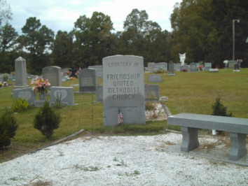
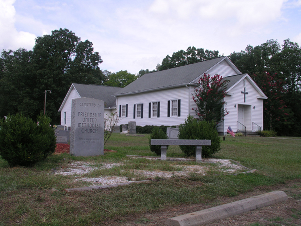
Friendship United Methodist Church Cemetery is located at 1200 Neely Store Road Rock Hill, York County ,South Carolina , 29730USA.
-
Friendship United Methodist Church Cemetery cemetery's updated grave count on graveviews.com?
30 memorials
-
Where are the coordinates of the Friendship United Methodist Church Cemetery?
Latitude: 34.9066457
Longitude: -80.9084393
Nearby Cemetories:
1. Providence Baptist Church Cemetery
Rock Hill, York County, USA
Coordinate: 34.9082480, -80.9071590
2. Church of Jesus Christ of Latter-day Sts Cemetery
Catawba, York County, USA
Coordinate: 34.9071007, -80.9012985
3. Foundation AME Zion Church Cemetery
Rock Hill, York County, USA
Coordinate: 34.9194412, -80.9269409
4. Catawba Indian Nation Cemetery
Rock Hill, York County, USA
Coordinate: 34.9043999, -80.8824005
5. Tabernacle AME Zion Church Cemetery
Rock Hill, York County, USA
Coordinate: 34.8749847, -80.9308090
6. Mount Hebron Baptist Church Cemetery
Rock Hill, York County, USA
Coordinate: 34.8943270, -80.9506690
7. Macedonia Baptist Church
Indian Land, Lancaster County, USA
Coordinate: 34.8975580, -80.8555820
8. Catawba Baptist Church Cemetery
Rock Hill, York County, USA
Coordinate: 34.9066887, -80.9643478
9. Gold Hill AME Zion Church Cemetery
Van Wyck, Lancaster County, USA
Coordinate: 34.9094340, -80.8472940
10. Hopewell Presbyterian Church Cemetery
Lesslie, York County, USA
Coordinate: 34.8835320, -80.9648800
11. Catawba Chapel A.M.E. Zion Church Cemetery
Catawba, York County, USA
Coordinate: 34.8555500, -80.9262500
12. Catawba Methodist Church Cemetery
Catawba, York County, USA
Coordinate: 34.8506851, -80.9131012
13. Neely's Creek ARP Church Cemetery
Rock Hill, York County, USA
Coordinate: 34.8673260, -80.9651080
14. Indian Land Baptist Church Cemetery
Indian Land, Lancaster County, USA
Coordinate: 34.9318840, -80.8367260
15. Six Mile Cemetery
Indian Land, Lancaster County, USA
Coordinate: 34.9308014, -80.8319016
16. Belair Methodist Church Cemetery
Lancaster County, USA
Coordinate: 34.9509964, -80.8433228
17. Rock Grove AME Zion Church Cemetery
Rock Hill, York County, USA
Coordinate: 34.9106910, -80.9970110
18. Van Wyck Presbyterian Church
Van Wyck, Lancaster County, USA
Coordinate: 34.8537520, -80.8471870
19. Van Wyck United Methodist Church Cemetery
Van Wyck, Lancaster County, USA
Coordinate: 34.8563970, -80.8403790
20. White Oak AME Zion Church Cemetery
Van Wyck, Lancaster County, USA
Coordinate: 34.8487570, -80.8484340
21. Higher Ground Church Cemetery
Indian Land, Lancaster County, USA
Coordinate: 34.9713300, -80.8597020
22. Center Grove Memorial Park
Indian Land, Lancaster County, USA
Coordinate: 34.9205500, -80.8122100
23. Edwards Cemetery
Indian Land, Lancaster County, USA
Coordinate: 34.9770010, -80.8607570
24. Osceola United Methodist Church Cemetery
Lancaster, Lancaster County, USA
Coordinate: 34.9056920, -80.8091770