
| Memorials | : | 2 |
| Location | : | Frink, Calhoun County, USA |
| Coordinate | : | 30.3550660, -85.1944780 |
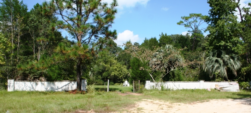
| Description | : | Directions: Leave Clarksville, FL on Hwy 73 going south. Go 6.3 miles to the Frink Baptist Church Road. Turn left and drive .8 miles. You will pass the dirt road for McClellan Cemetery on the left and then the road will turn into a dirt road. Drive about 1000 ft. where the road will dead end into SW McClellan Farm Road, R9. Turn left on this dirt road and drive about 800 ft to where the road turns to the right. The cemetery will be straight ahead prior to the right hand turn. |
frequently asked questions (FAQ):
-
Where is Frink Community Cemetery?
Frink Community Cemetery is located at Frink, Calhoun County ,Florida ,USA.
-
Frink Community Cemetery cemetery's updated grave count on graveviews.com?
2 memorials
-
Where are the coordinates of the Frink Community Cemetery?
Latitude: 30.3550660
Longitude: -85.1944780
Nearby Cemetories:
1. McClellan Cemetery
Calhoun County, USA
Coordinate: 30.3591995, -85.2005997
2. Open Arms Assembly of God Cemetery
Frink, Calhoun County, USA
Coordinate: 30.3317750, -85.2239120
3. Abe Spring Cemetery Old
Blountstown, Calhoun County, USA
Coordinate: 30.3938430, -85.1545610
4. Abe Springs Baptist Church Cemetery
Calhoun County, USA
Coordinate: 30.3934870, -85.1507760
5. Williams Cemetery
Calhoun County, USA
Coordinate: 30.4239006, -85.1757965
6. Lost Cemetery
Blountstown, Calhoun County, USA
Coordinate: 30.4209200, -85.1581200
7. Scotts Ferry Cemetery
Scotts Ferry, Calhoun County, USA
Coordinate: 30.2923200, -85.1502300
8. Williams Memorial United Methodist Church Cemetery
Scotts Ferry, Calhoun County, USA
Coordinate: 30.3035990, -85.1293020
9. Clarksville Baptist Church Cemetery
Clarksville, Calhoun County, USA
Coordinate: 30.4333770, -85.1880100
10. Billy Cook Family Cemetery
Kinard, Calhoun County, USA
Coordinate: 30.2732204, -85.2036173
11. Cypress Creek Missionary Baptist Church Cemetery
Kinard, Calhoun County, USA
Coordinate: 30.2848400, -85.2465300
12. Ayers Cemetery
Calhoun County, USA
Coordinate: 30.4344006, -85.1549988
13. Pine Memorial Cemetery
Blountstown, Calhoun County, USA
Coordinate: 30.3698480, -85.0949330
14. Pippin Cemetery
Clarksville, Calhoun County, USA
Coordinate: 30.4433002, -85.2097015
15. Poplar Head Baptist Church Cemetery
Clarksville, Calhoun County, USA
Coordinate: 30.4507100, -85.1850600
16. Clark and Jones Cemetery
Kinard, Calhoun County, USA
Coordinate: 30.2637900, -85.2399800
17. Newsome Family Cemetery
Clarksville, Calhoun County, USA
Coordinate: 30.4546937, -85.1975155
18. Travelers Rest Freewill Baptist Church Cemetery
Clarksville, Calhoun County, USA
Coordinate: 30.4569400, -85.1886300
19. Old Shiloh Cemetery #2
Scotts Ferry, Calhoun County, USA
Coordinate: 30.2927300, -85.0974100
20. Hugh Creek Cemetery
New Hope, Calhoun County, USA
Coordinate: 30.3545400, -85.0688600
21. Herndon Cemetery
Calhoun County, USA
Coordinate: 30.4639000, -85.2053300
22. Woods Cemetery
Calhoun County, USA
Coordinate: 30.3425007, -85.0639038
23. Red Oak Cemetery
Calhoun County, USA
Coordinate: 30.4621700, -85.1448500
24. Saint John Cemetery
Blountstown, Calhoun County, USA
Coordinate: 30.3920200, -85.0670600