
| Memorials | : | 71 |
| Location | : | Blackwood, Camden County, USA |
| Coordinate | : | 39.7934550, -75.0453840 |
frequently asked questions (FAQ):
-
Where is Fruit of the Spirit Church Cemetery?
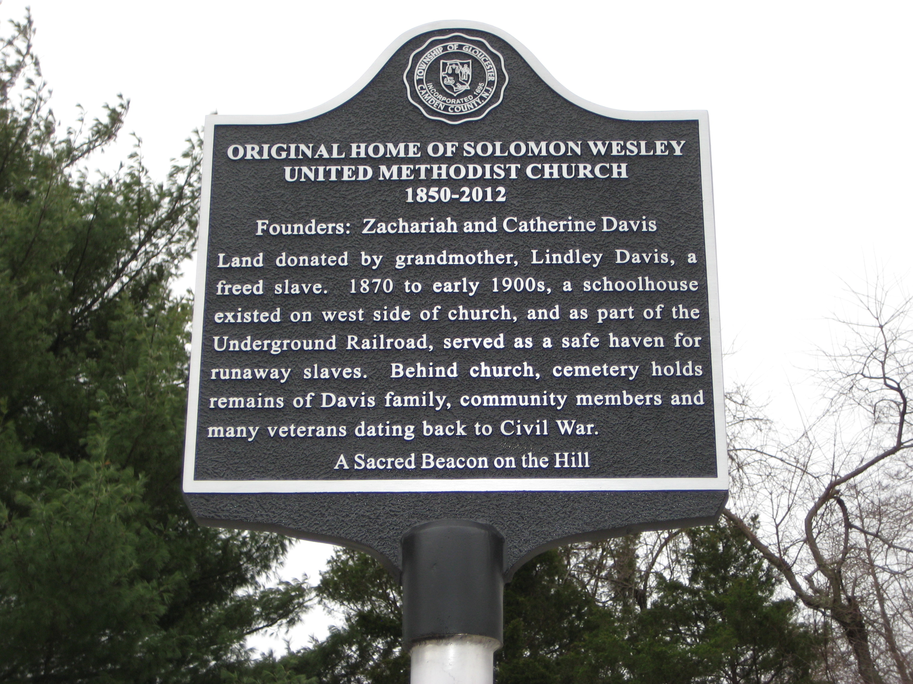
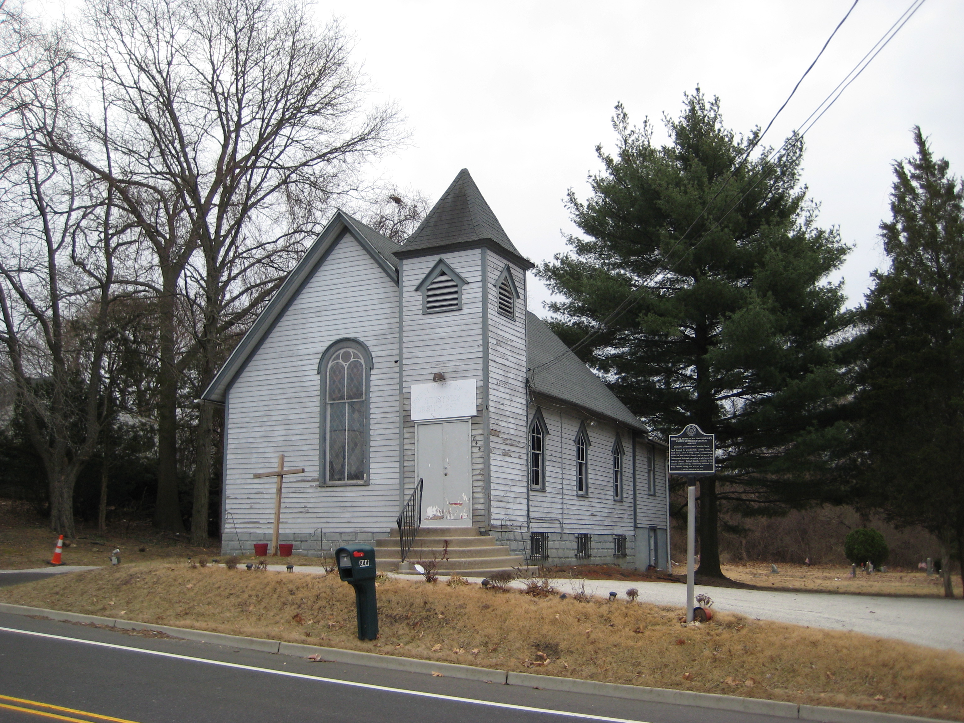
Fruit of the Spirit Church Cemetery is located at 846 Davistown Rd Blackwood, Camden County ,New Jersey , 08012USA.
-
Fruit of the Spirit Church Cemetery cemetery's updated grave count on graveviews.com?
1 memorials
-
Where are the coordinates of the Fruit of the Spirit Church Cemetery?
Latitude: 39.7934550
Longitude: -75.0453840
Nearby Cemetories:
1. Grenloch First Presbyterian Church Memorial Garden
Grenloch Terrace, Gloucester County, USA
Coordinate: 39.7806000, -75.0587000
2. Grenloch First Presbyterian Church Memory Garden
Camden County, USA
Coordinate: 39.7806000, -75.0587000
3. Blackwood Methodist Cemetery
Blackwood, Camden County, USA
Coordinate: 39.8023148, -75.0648041
4. First Presbyterian Church Cemetery
Blackwood, Camden County, USA
Coordinate: 39.8022385, -75.0666656
5. Blackwood Baptist Cemetery
Blackwood, Camden County, USA
Coordinate: 39.8010521, -75.0709305
6. Wallings-Chew Cemetery
Blackwood, Camden County, USA
Coordinate: 39.8067130, -75.0770470
7. Alms House Cemetery
Lakeland, Camden County, USA
Coordinate: 39.7878700, -75.0823500
8. Shades of Worship International Cemetery
Erial, Camden County, USA
Coordinate: 39.7781698, -75.0104479
9. Saint Johns United Methodist Cemetery
Turnersville, Gloucester County, USA
Coordinate: 39.7598300, -75.0487100
10. Buffalo Soldiers Cemetery
Franklinville, Gloucester County, USA
Coordinate: 39.8010180, -75.0899580
11. Bunker Hill Presbyterian Church Cemetery
Sewell, Gloucester County, USA
Coordinate: 39.7767514, -75.0931293
12. Saint Josephs Cemetery
Chews, Camden County, USA
Coordinate: 39.8300018, -75.0689011
13. Saint Johns Episcopal Churchyard
Chews, Camden County, USA
Coordinate: 39.8322700, -75.0629800
14. Erial Cemetery
Erial, Camden County, USA
Coordinate: 39.7665600, -75.0037500
15. Perce Family Burial Ground
Deptford, Gloucester County, USA
Coordinate: 39.8176079, -75.0917969
16. Memorial Garden of the Church of the Atonement
Laurel Springs, Camden County, USA
Coordinate: 39.8221060, -75.0012760
17. Almonesson United Methodist Church Cemetery
Almonesson, Gloucester County, USA
Coordinate: 39.8229100, -75.0906700
18. Chews United Methodist Church Cemetery
Glendora, Camden County, USA
Coordinate: 39.8371100, -75.0689900
19. Ashbrooks Burial Ground
Glendora, Camden County, USA
Coordinate: 39.8397400, -75.0805200
20. Bunker Hill Presbyterian Church Cemetery
Gloucester County, USA
Coordinate: 39.7451600, -75.0849200
21. Mapes Cemetery
Somerdale, Camden County, USA
Coordinate: 39.8518670, -75.0241330
22. Bethel Methodist Church Cemetery
Hurffville, Gloucester County, USA
Coordinate: 39.7571983, -75.1110992
23. Magnolia Methodist Cemetery
Magnolia, Camden County, USA
Coordinate: 39.8557100, -75.0303000
24. Greenland Cemetery
Magnolia, Camden County, USA
Coordinate: 39.8557860, -75.0303340