
| Memorials | : | 0 |
| Location | : | Falmouth, Pendleton County, USA |
| Coordinate | : | 38.7921010, -84.3541090 |
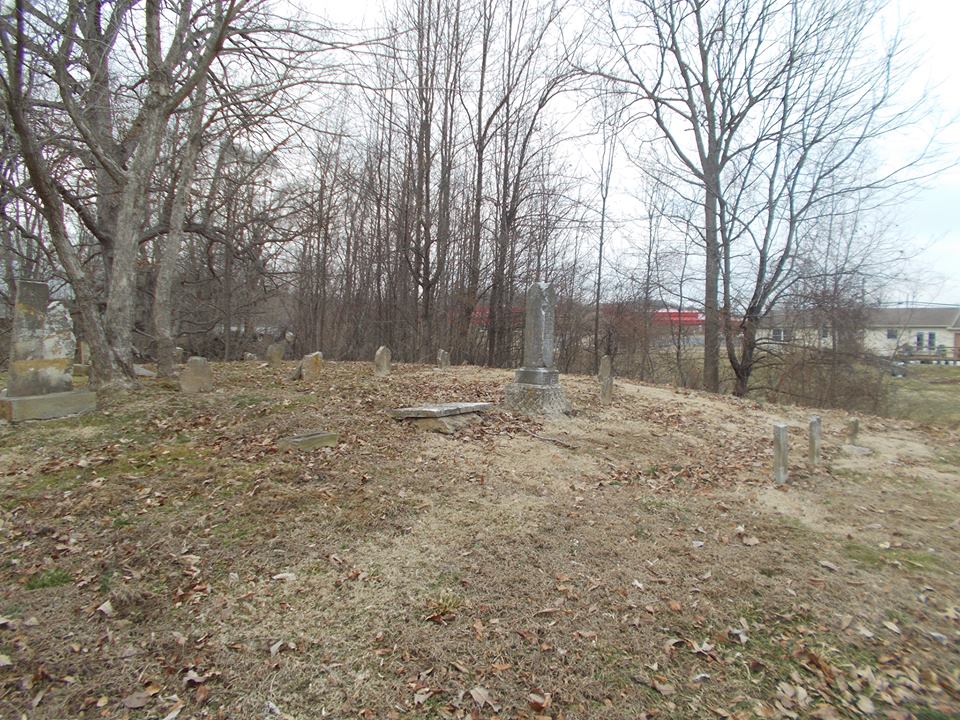
| Description | : | LOCATION OF FRYER CEMETERY - Behind the BP Station at the corner of State Route 177 and U. S. Route 27 on a knoll. Destroyed. |
frequently asked questions (FAQ):
-
Where is Fryer Cemetery?
Fryer Cemetery is located at Kentucky State Route 177 Falmouth, Pendleton County ,Kentucky , 41006USA.
-
Fryer Cemetery cemetery's updated grave count on graveviews.com?
0 memorials
-
Where are the coordinates of the Fryer Cemetery?
Latitude: 38.7921010
Longitude: -84.3541090
Nearby Cemetories:
1. Butler Cemetery
Butler, Pendleton County, USA
Coordinate: 38.7933006, -84.3480988
2. Edwards Cemetery
Pendleton County, USA
Coordinate: 38.7909660, -84.3602400
3. Hart Cemetery
Mount Auburn, Pendleton County, USA
Coordinate: 38.7868605, -84.3422899
4. Hicks Family Graveyard
Butler, Pendleton County, USA
Coordinate: 38.7799420, -84.3309750
5. MCCullough Family Graveyard
Butler, Pendleton County, USA
Coordinate: 38.7980660, -84.3814120
6. Beckett Family Cemetery
Pendleton County, USA
Coordinate: 38.7638209, -84.3535753
7. Boston Union Church Cemetery
Boston, Pendleton County, USA
Coordinate: 38.7623850, -84.3552110
8. Hornbeck Family Graveyard
Grants Lick, Campbell County, USA
Coordinate: 38.8254000, -84.3772520
9. John Gosney Family Cemetery
Grants Lick, Campbell County, USA
Coordinate: 38.8334980, -84.3598650
10. Norris Cemetery
Pendleton County, USA
Coordinate: 38.7797012, -84.3005981
11. Pleasant Hill Cemetery
Butler, Pendleton County, USA
Coordinate: 38.7775002, -84.3013992
12. Vandiver Cemetery
Alexandria, Campbell County, USA
Coordinate: 38.8071380, -84.4121530
13. Bowling Family Cemetery
Campbell County, USA
Coordinate: 38.8096000, -84.4117500
14. Plum Creek Christian Church Cemetery
Grants Lick, Campbell County, USA
Coordinate: 38.8407600, -84.3720900
15. Old Rardin Graveyard
Peach Grove, Pendleton County, USA
Coordinate: 38.8383200, -84.3183900
16. Richard Tarvin Cemetery
Grants Lick, Campbell County, USA
Coordinate: 38.8471070, -84.3594710
17. Harris Family Cemetery
California, Campbell County, USA
Coordinate: 38.8471790, -84.3596420
18. Grassy Creek Church Cemetery
DeMossville, Pendleton County, USA
Coordinate: 38.7937280, -84.4262570
19. Mullins Cemetery
DeMossville, Pendleton County, USA
Coordinate: 38.7933780, -84.4264320
20. Ellis Cemetery
Pendleton County, USA
Coordinate: 38.7532997, -84.3007965
21. Payne Cemetery
Mount Auburn, Pendleton County, USA
Coordinate: 38.7855660, -84.2795080
22. Mount Auburn Cemetery
Mount Auburn, Pendleton County, USA
Coordinate: 38.7849998, -84.2789001
23. Old Peach Grove Cemetery
Peach Grove, Pendleton County, USA
Coordinate: 38.8299540, -84.2942510
24. Stamper Cemetery
Grants Lick, Campbell County, USA
Coordinate: 38.8289080, -84.4211670