
| Memorials | : | 0 |
| Location | : | Coulstone, Dent County, USA |
| Coordinate | : | 37.5298760, -91.7310330 |
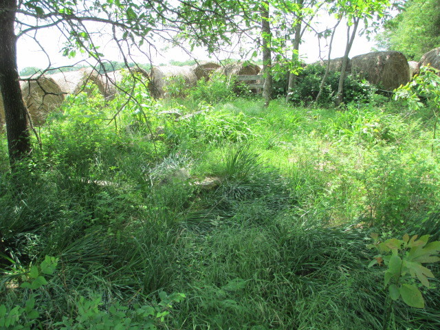
| Description | : | The Fudge Family Cemetery has nine graves. It is located off highway 32, eight miles east of Licking, Missouri. If traveling east Dent county road 2480 is on the left, go past it a few yards and on the right side of highway 32 there is an approach that leads back into a privately owned field where the cemetery is located. There is no cemetery sign along the highway. This commumity was once named Coulstone and it is three miles west of another community once named Rhyse. |
frequently asked questions (FAQ):
-
Where is Fudge Family Cemetery?
Fudge Family Cemetery is located at Coulstone, Dent County ,Missouri ,USA.
-
Fudge Family Cemetery cemetery's updated grave count on graveviews.com?
0 memorials
-
Where are the coordinates of the Fudge Family Cemetery?
Latitude: 37.5298760
Longitude: -91.7310330
Nearby Cemetories:
1. Wallace Cemetery
Rhyse, Dent County, USA
Coordinate: 37.5313988, -91.7078018
2. Campbell Cemetery
Dent County, USA
Coordinate: 37.5505981, -91.7118988
3. Campbell Cemetery
Rhyse, Dent County, USA
Coordinate: 37.5511100, -91.7100910
4. Johnson Cemetery
Dent County, USA
Coordinate: 37.5466995, -91.6797028
5. Patterson Cemetery
Dent County, USA
Coordinate: 37.4852982, -91.7331009
6. Kissock Cemetery
Dent County, USA
Coordinate: 37.5868988, -91.7444000
7. Robnett Cemetery
Dent County, USA
Coordinate: 37.5752983, -91.6785965
8. Berry Cemetery
Salem, Dent County, USA
Coordinate: 37.5560989, -91.6519012
9. Cole Cemetery
Montauk, Dent County, USA
Coordinate: 37.4613020, -91.7121930
10. Mount Olive Cemetery
Montauk, Dent County, USA
Coordinate: 37.4523600, -91.7459200
11. Montauk Cemetery
Montauk, Dent County, USA
Coordinate: 37.4542970, -91.6868580
12. Mount Hermon Cemetery
Lenox, Dent County, USA
Coordinate: 37.6186409, -91.7134018
13. Dry Fork Cemetery
Jack, Dent County, USA
Coordinate: 37.5755997, -91.6260986
14. Enon Cemetery
Dent County, USA
Coordinate: 37.6371994, -91.7110977
15. Mitchell Cemetery
Dent County, USA
Coordinate: 37.6316986, -91.6686020
16. Reed Cemetery
Craddock, Phelps County, USA
Coordinate: 37.6174500, -91.8339200
17. McNeill Cemetery
Salem, Dent County, USA
Coordinate: 37.6375008, -91.6600037
18. Roseberry Cemetery
Phelps County, USA
Coordinate: 37.6281013, -91.8249969
19. Johns Cemetery
Salem, Dent County, USA
Coordinate: 37.6492004, -91.6828003
20. Johi Cemetery
Dent County, USA
Coordinate: 37.6492004, -91.6821976
21. Love Cemetery
Dent County, USA
Coordinate: 37.6077995, -91.5969009
22. Cage Cemetery
Dent County, USA
Coordinate: 37.5233002, -91.5635986
23. Enke Cemetery
Dent County, USA
Coordinate: 37.6603012, -91.7658005
24. Corinth Baptist Church Cemetery
Jadwin, Dent County, USA
Coordinate: 37.5194435, -91.5633316