
| Memorials | : | 0 |
| Location | : | New Trenton, Franklin County, USA |
| Coordinate | : | 39.3748000, -84.9114000 |
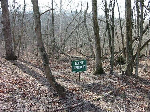
| Description | : | The cemetery is located in Whitewater Township (SE quadrant of the NE quadrant of the NE quadrant of Section 7 Township 8N Range 1W) on the northeast side of Possum Hollow Road about 1.4 miles east of its intersection with Big Cedar Road. Indiana Cemetery Locations, Volume 4, published by the Indiana Genealogical Society (April 2009), gives the primary cemetery name as Gant Cemetery. The cemetery is listed in the Cemetery and Burial Grounds Registry of the Indiana Department of Natural Resources (DNR) and in the State Historical Architectural and Archaeological Research Database (SHAARD) with Cemetery Record Number... Read More |
frequently asked questions (FAQ):
-
Where is Gant Cemetery?
Gant Cemetery is located at Possum Hollow Road New Trenton, Franklin County ,Indiana , 47016USA.
-
Gant Cemetery cemetery's updated grave count on graveviews.com?
0 memorials
-
Where are the coordinates of the Gant Cemetery?
Latitude: 39.3748000
Longitude: -84.9114000
Nearby Cemetories:
1. Ashton Cemetery
Mount Carmel, Franklin County, USA
Coordinate: 39.3786280, -84.9013750
2. Eldon Family Cemetery
Brookville, Franklin County, USA
Coordinate: 39.3931860, -84.9338530
3. Holy Guardian Angels Cemetery
Cedar Grove, Franklin County, USA
Coordinate: 39.3580170, -84.9380500
4. Free Church Cemetery
Cedar Grove, Franklin County, USA
Coordinate: 39.3552860, -84.9380010
5. Holliday Cemetery
Franklin County, USA
Coordinate: 39.3977140, -84.9358110
6. Zion Methodist Cemetery
Sharptown, Franklin County, USA
Coordinate: 39.3539000, -84.8839000
7. Miller Family Cemetery
Cedar Grove, Franklin County, USA
Coordinate: 39.3459583, -84.8988906
8. Whitney Cemetery
Franklin County, USA
Coordinate: 39.3486000, -84.9319000
9. Hinds Cemetery
Mount Carmel, Franklin County, USA
Coordinate: 39.4096550, -84.9084310
10. Sisters of Saint Francis Convent Cemetery
Oldenburg, Franklin County, USA
Coordinate: 39.3436000, -84.9378000
11. Mount Carmel Cemetery
Mount Carmel, Franklin County, USA
Coordinate: 39.4071999, -84.8863983
12. Quick Cemetery
Mound Haven, Franklin County, USA
Coordinate: 39.3828000, -84.9614000
13. Crawford Family Cemetery
Brookville, Franklin County, USA
Coordinate: 39.3681000, -84.9664000
14. Wesley Chapel Cemetery
Sharptown, Franklin County, USA
Coordinate: 39.3781013, -84.8553009
15. James Cemetery
Franklin County, USA
Coordinate: 39.4183006, -84.9072037
16. Mount Carmel Presbyterian Cemetery
Mount Carmel, Franklin County, USA
Coordinate: 39.4083000, -84.8747000
17. Seely Burial Grounds
Drewersburg, Franklin County, USA
Coordinate: 39.3469000, -84.8567000
18. Berry Cemetery
Brookville, Franklin County, USA
Coordinate: 39.4161340, -84.9539200
19. West Family Cemetery
Brookville, Franklin County, USA
Coordinate: 39.4019300, -84.9700200
20. Cooksey Cemetery
Brookville, Franklin County, USA
Coordinate: 39.3714000, -84.9800000
21. Bertenshaw Cemetery
Drewersburg, Franklin County, USA
Coordinate: 39.3722220, -84.8416670
22. Little Cedar Grove Baptist Meeting House Cemetery
Franklin County, USA
Coordinate: 39.3872414, -84.9817886
23. Sater North Cemetery
Drewersburg, Franklin County, USA
Coordinate: 39.3639000, -84.8358000
24. Little Cedar Public Cemetery
Mound Haven, Franklin County, USA
Coordinate: 39.3911066, -84.9868303