
| Memorials | : | 0 |
| Location | : | Garden Grove, Decatur County, USA |
| Coordinate | : | 40.8275070, -93.6285160 |
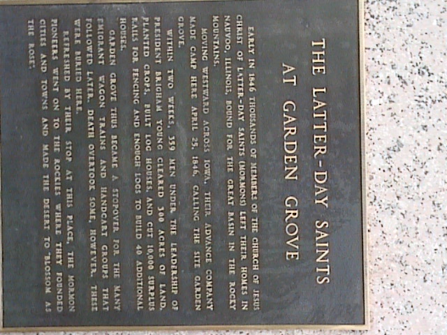
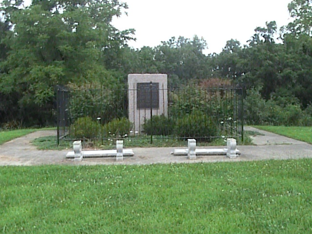
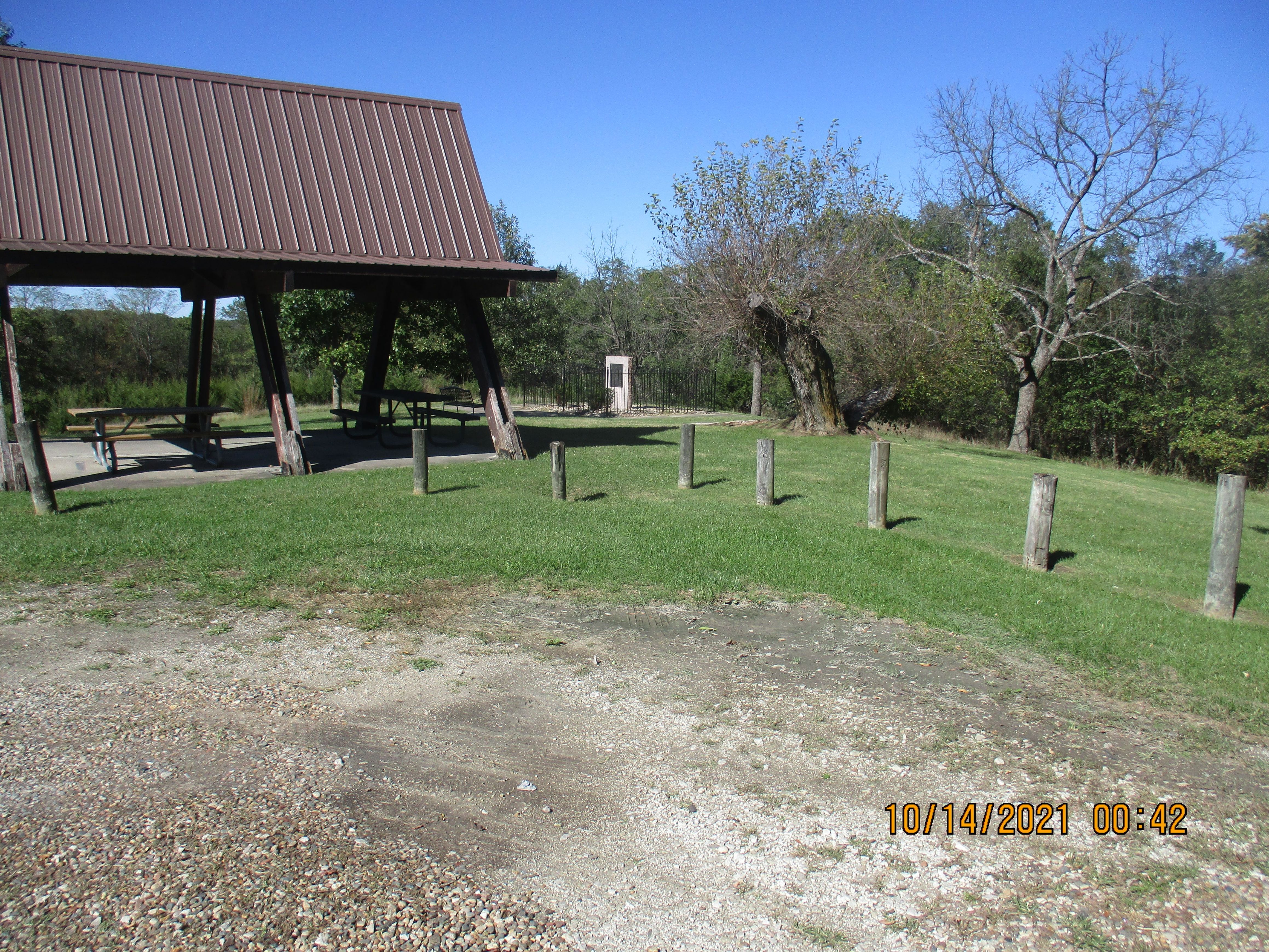
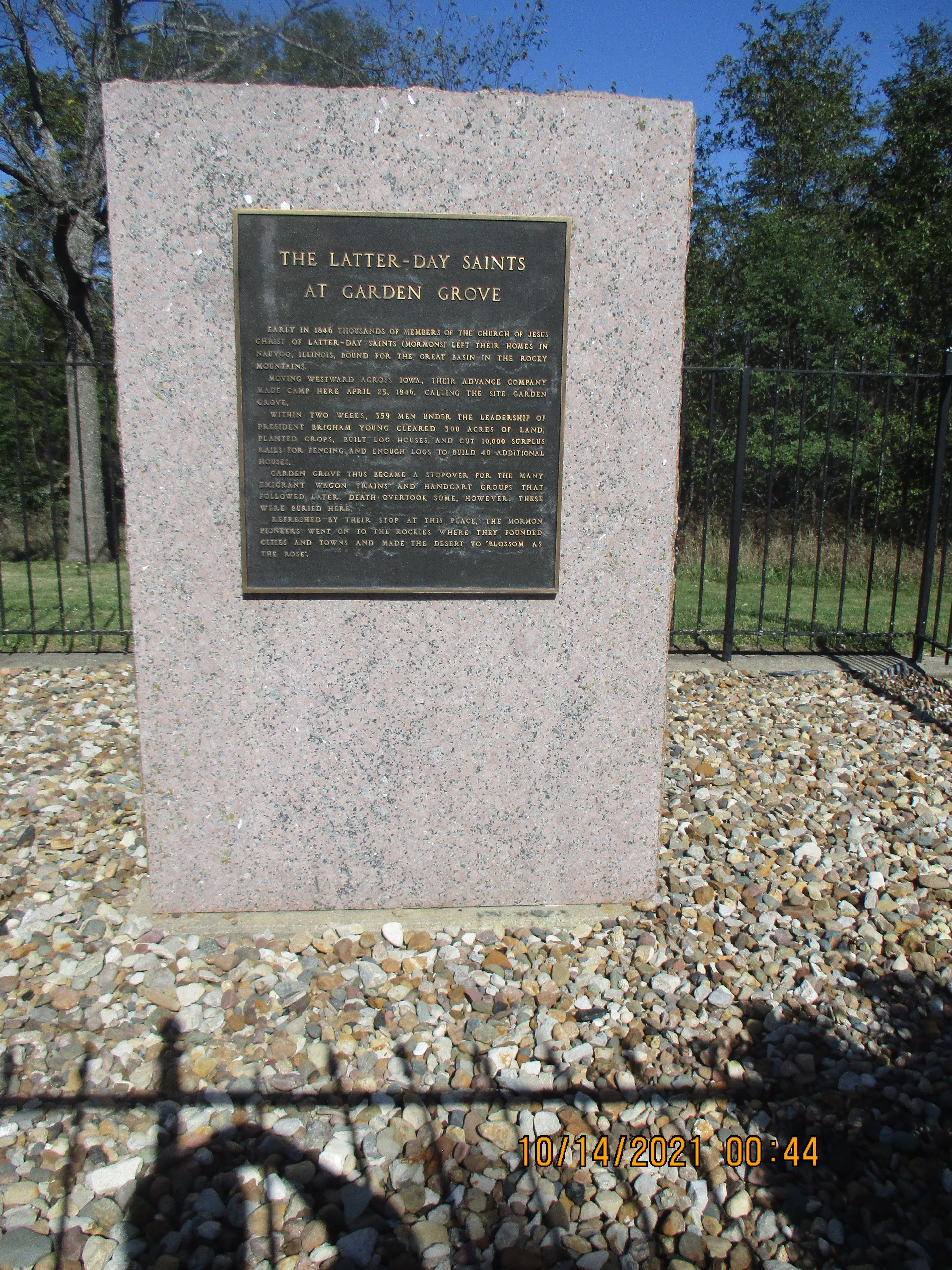
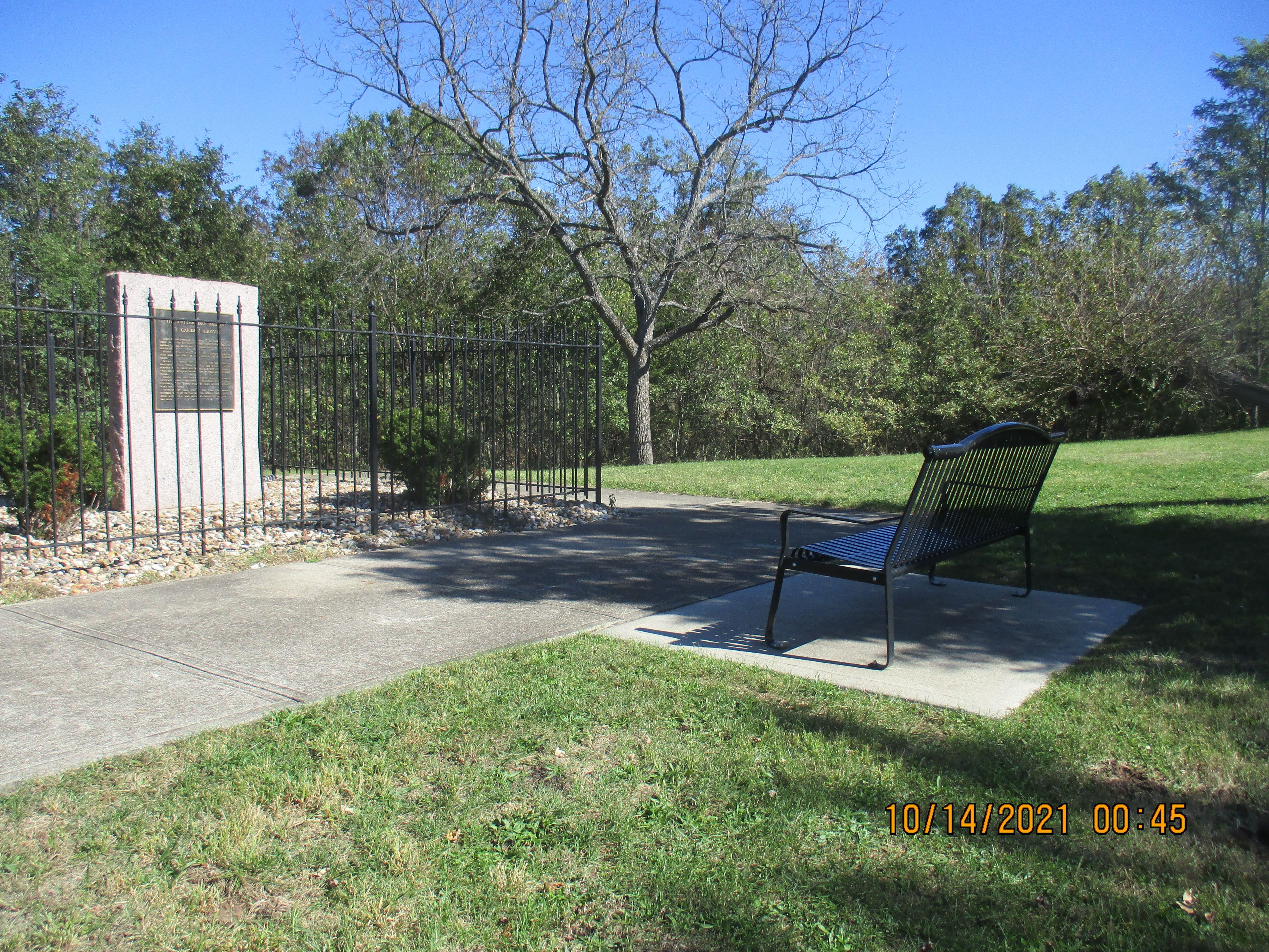
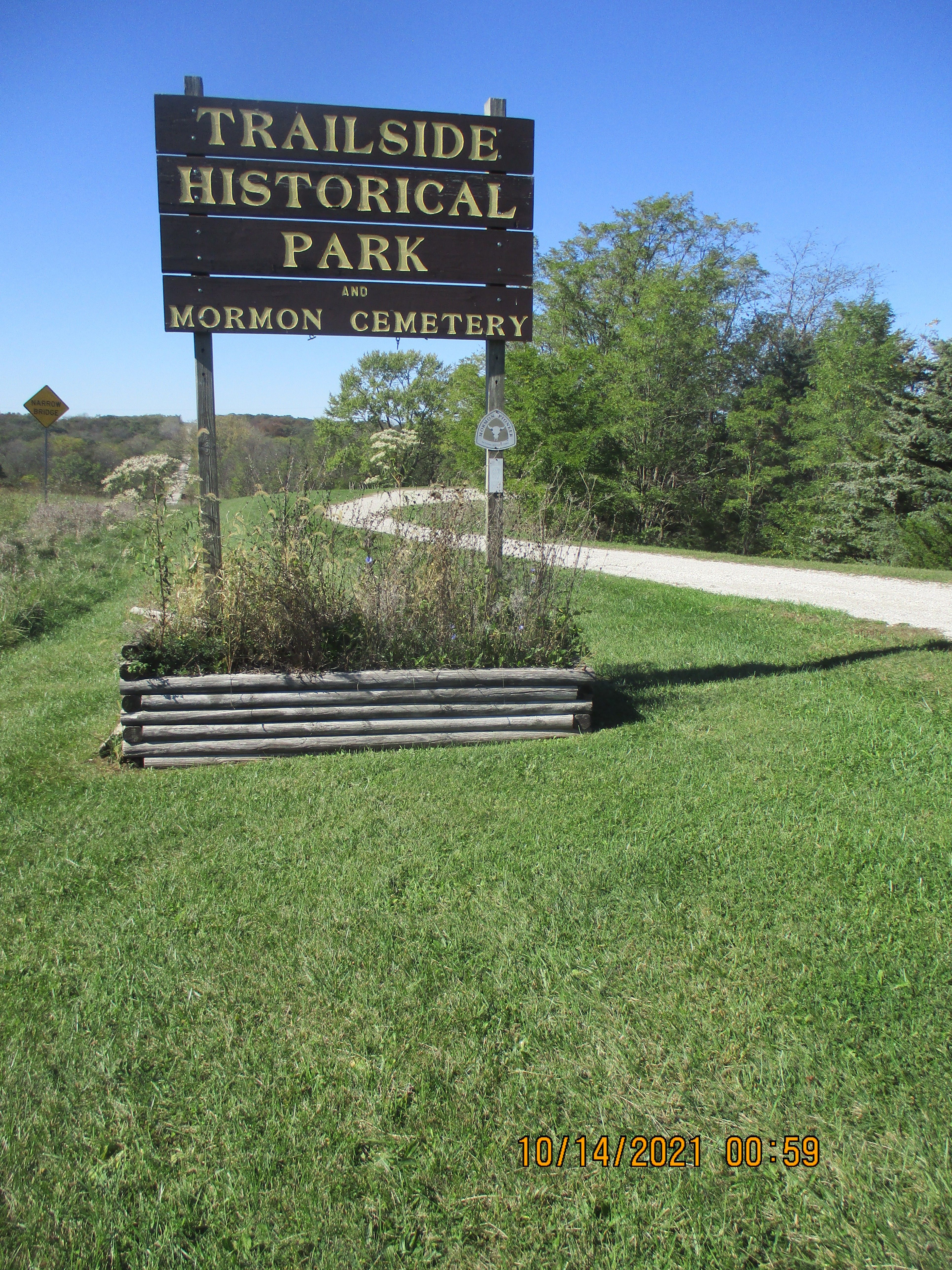
| Description | : | On April 24, 1846 the Mormons settled Garden Grove to form a stopover settlement for thousands of Mormons moving west. Their cemetery, 1/4 mile west of town, was no doubt the first in Garden Grove Township. According to an account from the book, Discovering Historic Iowa, 1975 edition by the Iowa Dept. of Public Instruction, the cemetery contained 6 graves and the 16 foot square area was surrounded by a picket fence until about 1910. After that the cemetery was neglected and the grave markers disappeared. The Mormons left in 1852. There are no stones now, although 2 small... Read More |
frequently asked questions (FAQ):
-
Where is Garden Grove Mormon Burial Grounds?
Garden Grove Mormon Burial Grounds is located at Mormon Trail Road Garden Grove, Decatur County ,Iowa , 50103USA.
-
Garden Grove Mormon Burial Grounds cemetery's updated grave count on graveviews.com?
0 memorials
-
Where are the coordinates of the Garden Grove Mormon Burial Grounds?
Latitude: 40.8275070
Longitude: -93.6285160
Nearby Cemetories:
1. Garden Grove Cemetery
Garden Grove, Decatur County, USA
Coordinate: 40.8305580, -93.5957730
2. McAllister Cemetery
Garden Grove, Decatur County, USA
Coordinate: 40.8041992, -93.6433029
3. Doze Cemetery
Garden Grove, Decatur County, USA
Coordinate: 40.8611120, -93.6418850
4. Winters Cemetery
Garden Grove, Decatur County, USA
Coordinate: 40.8614006, -93.6532974
5. Trullinger Cemetery
Garden Grove, Decatur County, USA
Coordinate: 40.7827988, -93.6331024
6. Metier Cemetery
Weldon, Decatur County, USA
Coordinate: 40.8807983, -93.6502991
7. Johnson Cemetery
Leon, Decatur County, USA
Coordinate: 40.8244019, -93.7144012
8. High Point Cemetery
High Point, Decatur County, USA
Coordinate: 40.7591392, -93.5911989
9. Green Bay Cemetery
Humeston, Wayne County, USA
Coordinate: 40.8264008, -93.5286026
10. Blair Cemetery
Smyrna, Clarke County, USA
Coordinate: 40.9098816, -93.6254883
11. Franklin Cemetery
Leon, Decatur County, USA
Coordinate: 40.7818413, -93.7224770
12. Lewisburg Cemetery
Humeston, Wayne County, USA
Coordinate: 40.7677994, -93.5274963
13. Gwinn Cemetery
Humeston, Wayne County, USA
Coordinate: 40.8917007, -93.5239029
14. Salem Mennonite Cemetery
Leon, Decatur County, USA
Coordinate: 40.7392000, -93.7060000
15. Kline Cemetery
Weldon, Decatur County, USA
Coordinate: 40.8916660, -93.7418870
16. Old Smyrna Cemetery
Smyrna, Clarke County, USA
Coordinate: 40.9361000, -93.6159500
17. Smyrna Cemetery
Smyrna, Clarke County, USA
Coordinate: 40.9364014, -93.6156006
18. Hebron Cemetery
Clarke County, USA
Coordinate: 40.9291992, -93.6911011
19. Humeston Cemetery
Humeston, Wayne County, USA
Coordinate: 40.8849983, -93.4982986
20. Chaney Cemetery
Clarke County, USA
Coordinate: 40.9207993, -93.7161026
21. Lost Chord Cemetery
Smyrna, Clarke County, USA
Coordinate: 40.9412689, -93.6088333
22. Cunningham Cemetery
Wayne County, USA
Coordinate: 40.7360992, -93.5369034
23. Hall Cemetery
Decatur County, USA
Coordinate: 40.7107000, -93.6321000
24. Mount Tabor Cemetery
Decatur County, USA
Coordinate: 40.7178000, -93.6818000