
| Memorials | : | 0 |
| Location | : | Tom, McCurtain County, USA |
| Coordinate | : | 33.7471600, -94.4980400 |
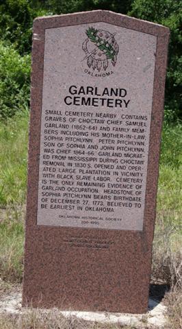
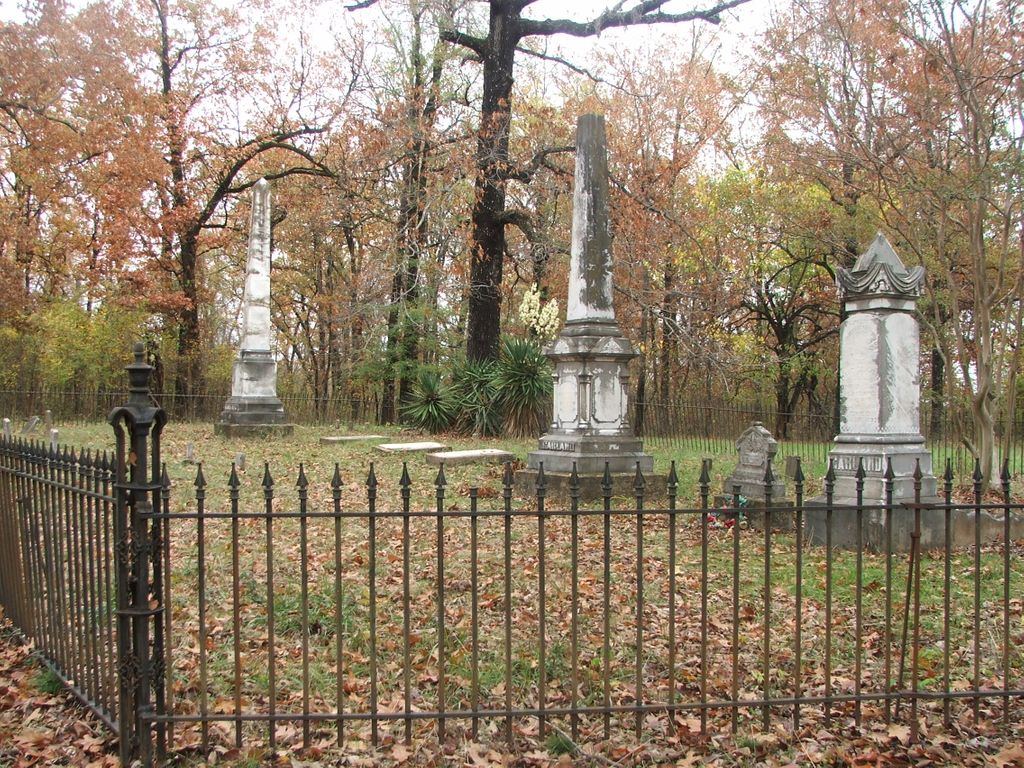
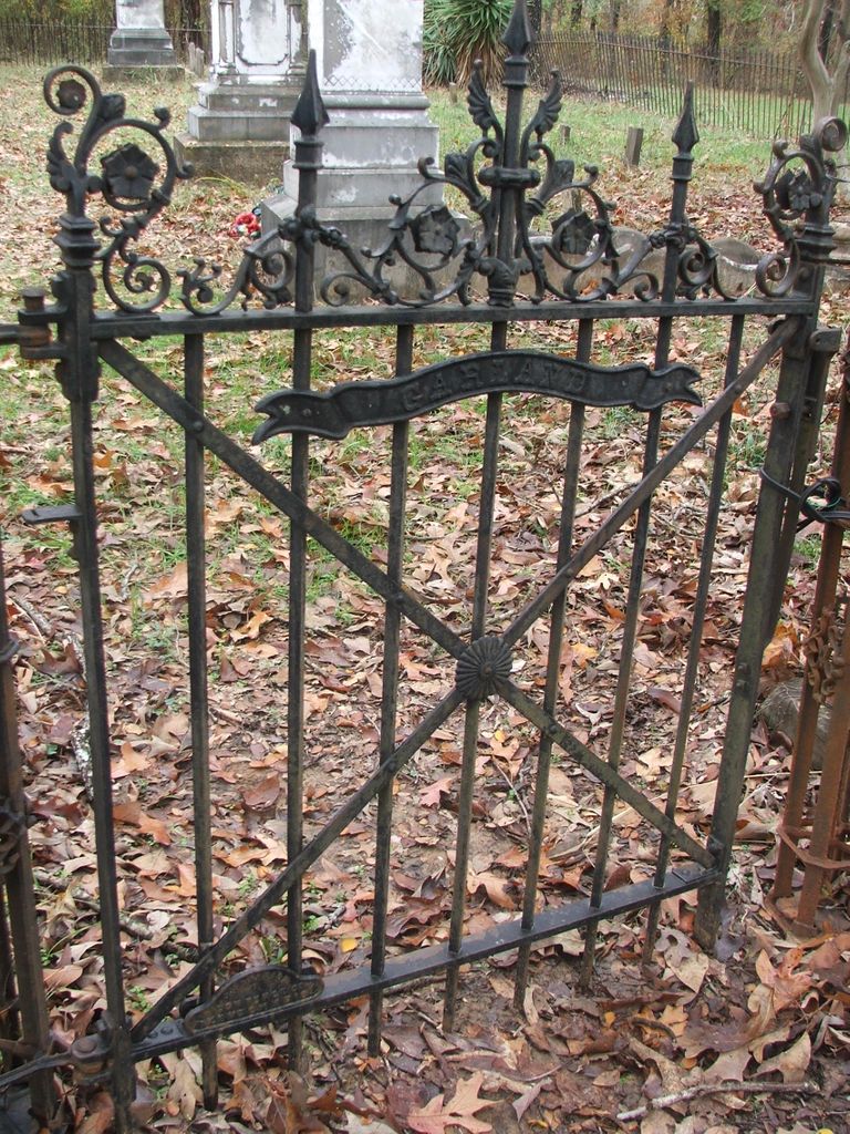
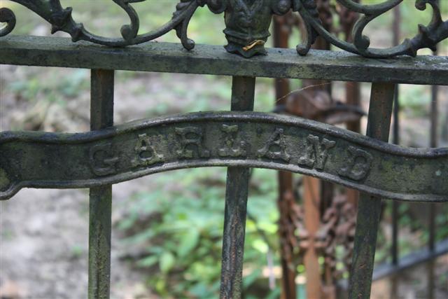
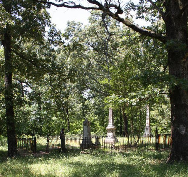
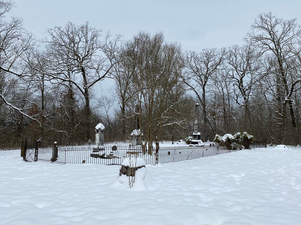
| Description | : | "The old Garland family cemetery is situated three miles east and three quarters of a mile north of the present inland town of Tom in the extreme southeastern part of McCurtain County, Oklahoma. It is located near where stood the palatial plantation home of Chief Samuel Garland." "There are some twelve or fifteen graves in the old Garland cemetery which is enclosed by a wrought iron fence. The cemetery site has been deeded to the State for the use and benefit of the Oklahoma Historical Society." Statement came from CHRONICLES OF OKLAHOMA, Vol. 20, No. 1, March 1942, Chief George Hudson and... Read More |
frequently asked questions (FAQ):
-
Where is Garland Family Cemetery?
Garland Family Cemetery is located at Tom, McCurtain County ,Oklahoma ,USA.
-
Garland Family Cemetery cemetery's updated grave count on graveviews.com?
0 memorials
-
Where are the coordinates of the Garland Family Cemetery?
Latitude: 33.7471600
Longitude: -94.4980400
Nearby Cemetories:
1. Sand Hill Cemetery
McCurtain County, USA
Coordinate: 33.7252998, -94.4982986
2. Blackland Cemetery
Foreman, Little River County, USA
Coordinate: 33.7386017, -94.4669037
3. Eastport Cemetery
McCurtain County, USA
Coordinate: 33.7849998, -94.4875031
4. Hopson Cemetery
Little River County, USA
Coordinate: 33.7057991, -94.4494019
5. Pine Ridge Cemetery
McCurtain County, USA
Coordinate: 33.7249985, -94.5725021
6. New Home Cemetery
Little River County, USA
Coordinate: 33.7930984, -94.4291992
7. French Cemetery
Foreman, Little River County, USA
Coordinate: 33.7341300, -94.4086500
8. Della Simpson Cemetery
Tom, McCurtain County, USA
Coordinate: 33.7243996, -94.5896988
9. Tom Cemetery
Tom, McCurtain County, USA
Coordinate: 33.7280998, -94.5916977
10. Dollarhide Cemetery
Foreman, Little River County, USA
Coordinate: 33.7111015, -94.4111023
11. Hawkins Cemetery
Little River County, USA
Coordinate: 33.7019005, -94.4163971
12. Holy Cross Cemetery
Foreman, Little River County, USA
Coordinate: 33.7017000, -94.4078000
13. Piney Cemetery
Little River County, USA
Coordinate: 33.8344002, -94.4747009
14. Alfred French Cemetery
Little River County, USA
Coordinate: 33.6768990, -94.4197006
15. Cooper Cemetery
Little River County, USA
Coordinate: 33.8424988, -94.4796982
16. Gravelly Cemetery
Foreman, Little River County, USA
Coordinate: 33.7372017, -94.3692017
17. Green Cemetery
Little River County, USA
Coordinate: 33.8102989, -94.3867035
18. Bokhoma Cemetery
McCurtain County, USA
Coordinate: 33.8367004, -94.5821991
19. Campground Cemetery
Winthrop, Little River County, USA
Coordinate: 33.8260994, -94.3771973
20. Piney Grove Cemetery
Wallace, Little River County, USA
Coordinate: 33.6949997, -94.3486023
21. Pauley Cemetery
Cerrogordo, Little River County, USA
Coordinate: 33.8806000, -94.4527969
22. Strawn Cemetery
Little River County, USA
Coordinate: 33.8650017, -94.4092026
23. Marvin Cemetery
Wallace, Little River County, USA
Coordinate: 33.6671250, -94.3596790
24. Lenox Hill Cemetery
De Kalb, Bowie County, USA
Coordinate: 33.6348160, -94.5991300