
| Memorials | : | 0 |
| Location | : | Wolfsburg, Stadtkreis Wolfsburg, Germany |
| Coordinate | : | 52.4533092, 10.8033766 |
frequently asked questions (FAQ):
-
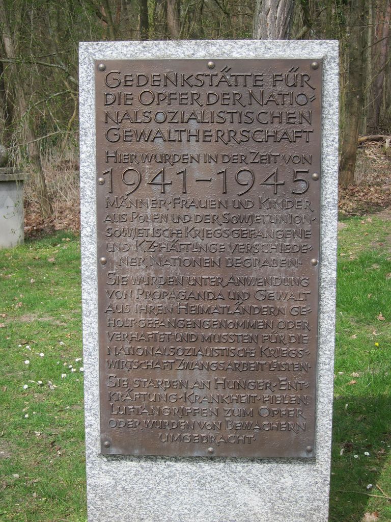
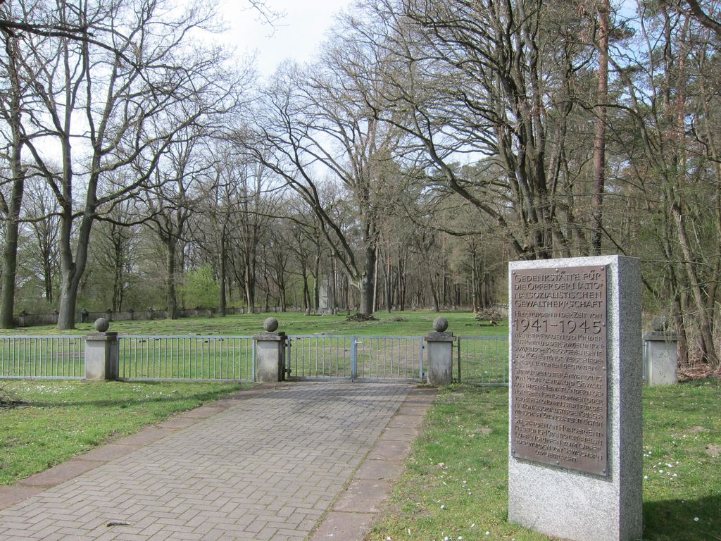
Where is Gedenkstätte Opfer der Nazi Gewaltherrschaft?
Gedenkstätte Opfer der Nazi Gewaltherrschaft is located at Lydia-Stowbun-Weg Wolfsburg, Stadtkreis Wolfsburg ,Lower Saxony (Niedersachsen) , D-38448Germany.
-
Gedenkstätte Opfer der Nazi Gewaltherrschaft cemetery's updated grave count on graveviews.com?
0 memorials
-
Where are the coordinates of the Gedenkstätte Opfer der Nazi Gewaltherrschaft?
Latitude: 52.4533092
Longitude: 10.8033766
Nearby Cemetories:
1. Waldfriedhof Wolfsburg
Wolfsburg, Stadtkreis Wolfsburg, Germany
Coordinate: 52.4561140, 10.8015310
2. Kästorf
Wolfsburg, Stadtkreis Wolfsburg, Germany
Coordinate: 52.4453624, 10.7839738
3. St. Annen-Friedhof
Wolfsburg, Stadtkreis Wolfsburg, Germany
Coordinate: 52.4268036, 10.7974499
4. Friedhof Wolfsburg-Vorsfelde Meinstrasse
Wolfsburg, Stadtkreis Wolfsburg, Germany
Coordinate: 52.4212600, 10.7874100
5. Wolfsburg-Fallersleben
Fallersleben, Stadtkreis Wolfsburg, Germany
Coordinate: 52.4147597, 10.7215936
6. Alter Kirchhof der Markuskirche
Sülfeld, Stadtkreis Wolfsburg, Germany
Coordinate: 52.4120129, 10.6875516
7. Neuer Friedhof Ehmen
Ehmen, Stadtkreis Wolfsburg, Germany
Coordinate: 52.3970554, 10.7021917
8. Friedhof Sülfeld
Sülfeld, Stadtkreis Wolfsburg, Germany
Coordinate: 52.4099490, 10.6835428
9. Friedhof Hattorf
Hattorf, Stadtkreis Wolfsburg, Germany
Coordinate: 52.3615120, 10.7456570
10. Friedhof Allerbüttel
Calberlah, Landkreis Gifhorn, Germany
Coordinate: 52.4187605, 10.6340399
11. Friedhof Calberlah
Isenbuttel, Landkreis Gifhorn, Germany
Coordinate: 52.4217943, 10.6267371
12. Friedhof Flechtorf
Flechtorf, Landkreis Helmstedt, Germany
Coordinate: 52.3563136, 10.7106449
13. Friedhof Wahrstedt
Wahrstedt, Landkreis Helmstedt, Germany
Coordinate: 52.4114719, 10.9762760
14. Friedhof Groß Brunsrode
Lehre, Landkreis Helmstedt, Germany
Coordinate: 52.3537746, 10.6734478
15. Mausoleum der Familie von Campe
Isenbuttel, Landkreis Gifhorn, Germany
Coordinate: 52.4372231, 10.5845365
16. Friedhof Wasbüttel
Wasbuttel, Landkreis Gifhorn, Germany
Coordinate: 52.4161951, 10.5893502
17. Friedhof Martinsbüttel
Meine, Landkreis Gifhorn, Germany
Coordinate: 52.3929651, 10.5997709
18. Friedhof Isenbüttel
Isenbuttel, Landkreis Gifhorn, Germany
Coordinate: 52.4305487, 10.5766910
19. Friedhof Lehre
Lehre, Landkreis Helmstedt, Germany
Coordinate: 52.3310724, 10.6739099
20. Kirche Zum Heiligen Kreuz
Lehre, Landkreis Helmstedt, Germany
Coordinate: 52.3314781, 10.6702855
21. Friedhof Wedelheine
Meine, Landkreis Gifhorn, Germany
Coordinate: 52.3867007, 10.5850796
22. Pappelhof in Rieseberg
Königslutter am Elm, Landkreis Helmstedt, Germany
Coordinate: 52.2957591, 10.7994979
23. Friedhof Grassel
Grassel, Landkreis Gifhorn, Germany
Coordinate: 52.3601899, 10.5931090
24. Friedhof Ohnhorst-Gravenhorst
Ohnhorst, Landkreis Gifhorn, Germany
Coordinate: 52.3976137, 10.5595772