
| Memorials | : | 1 |
| Location | : | Roane County, USA |
| Coordinate | : | 35.9385400, -84.3726600 |
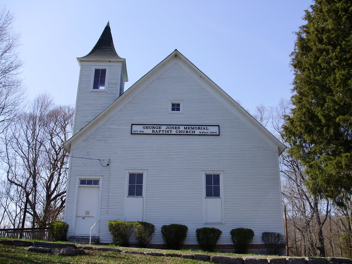
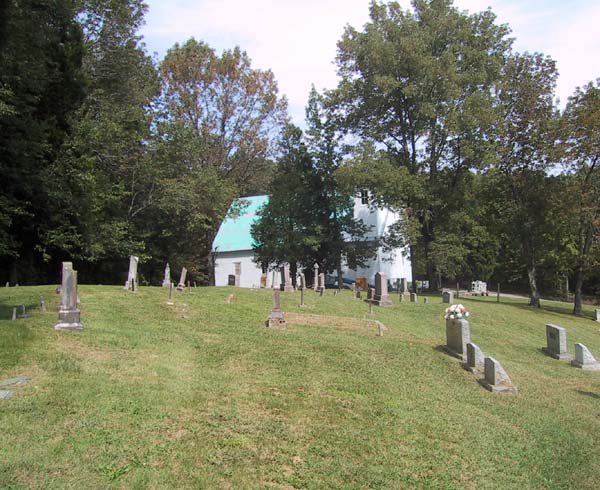
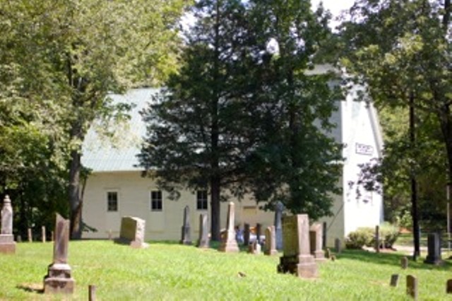
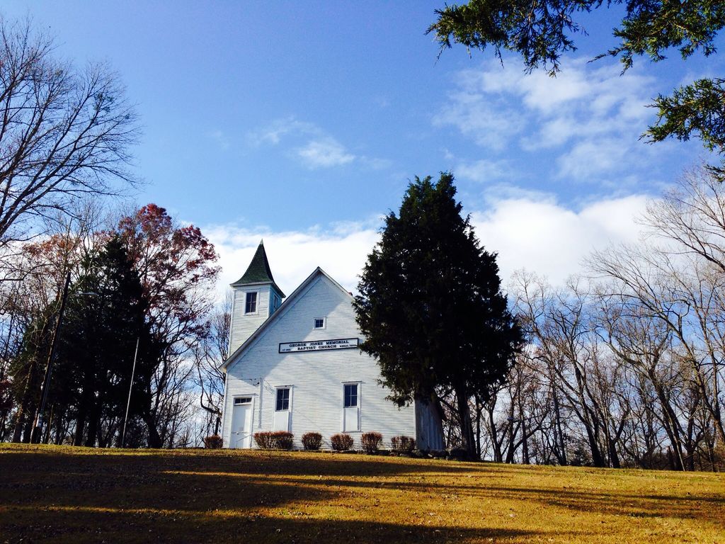
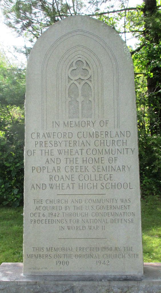
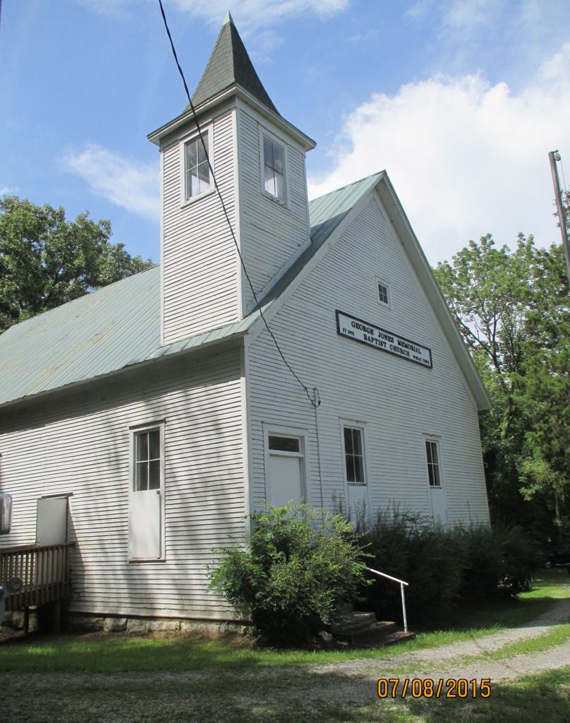
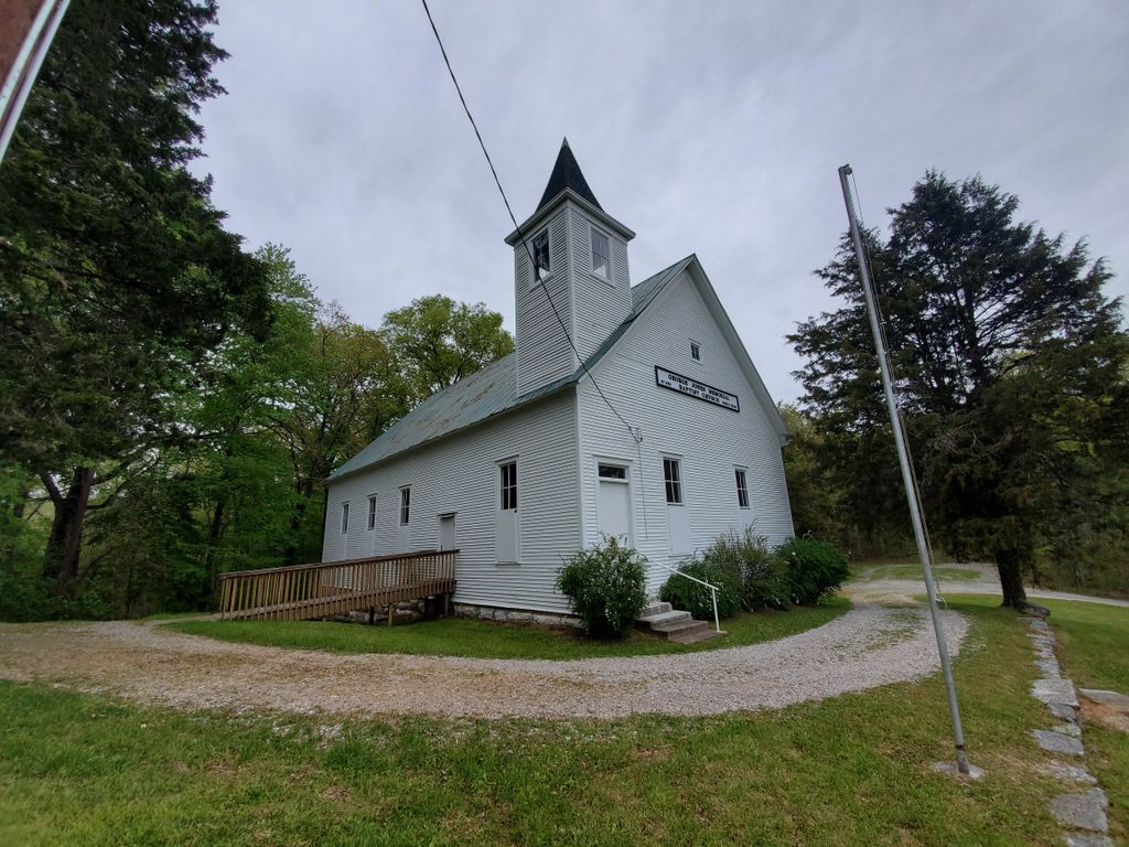
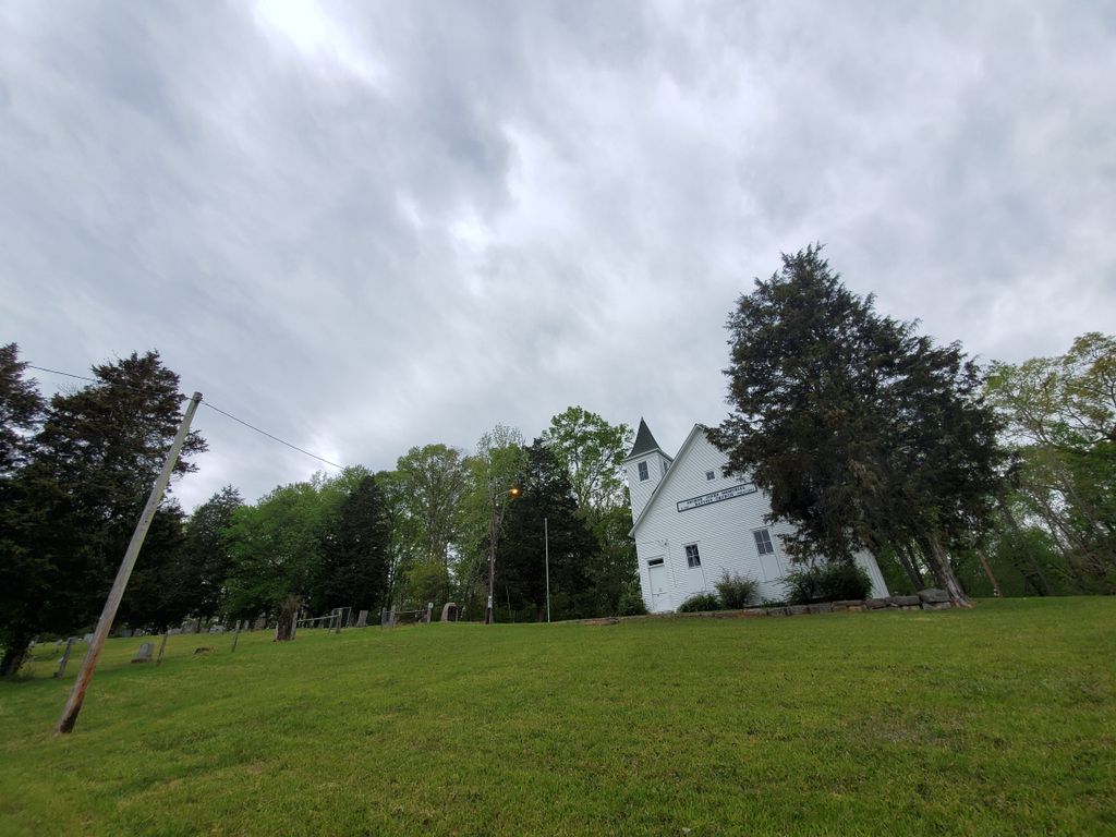
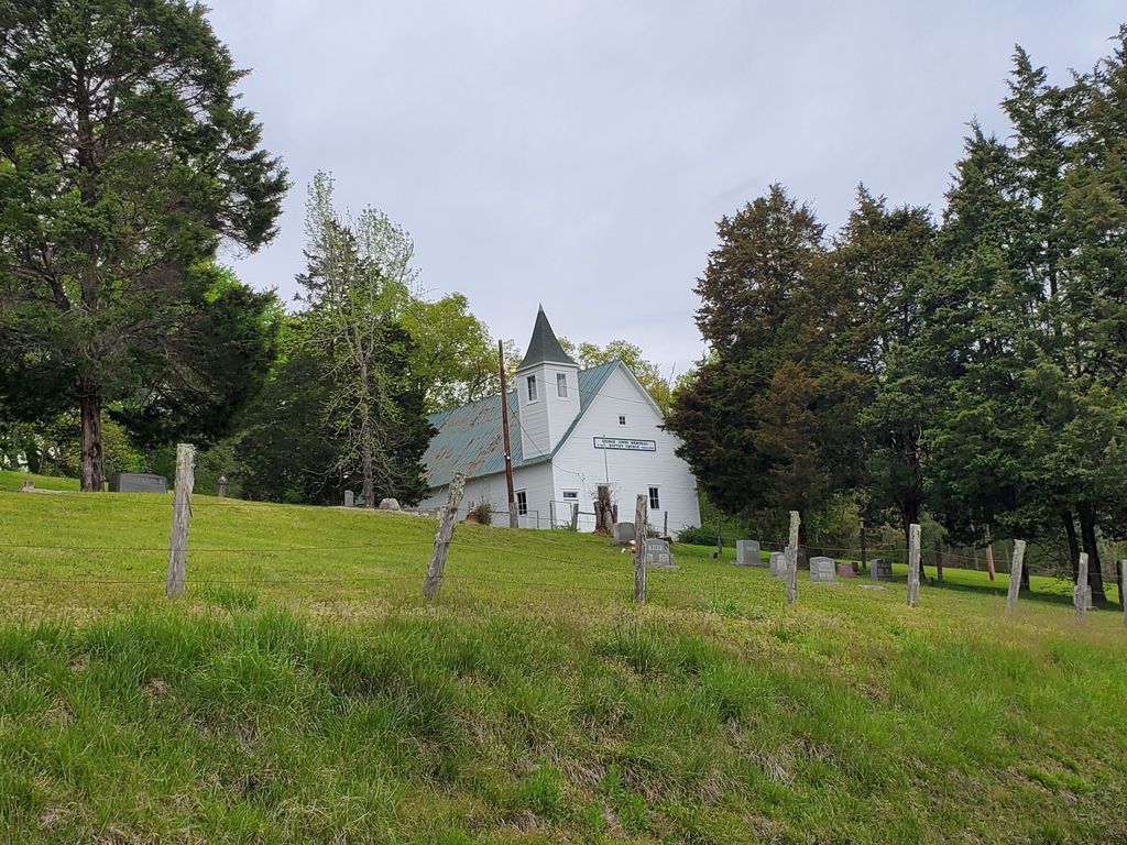
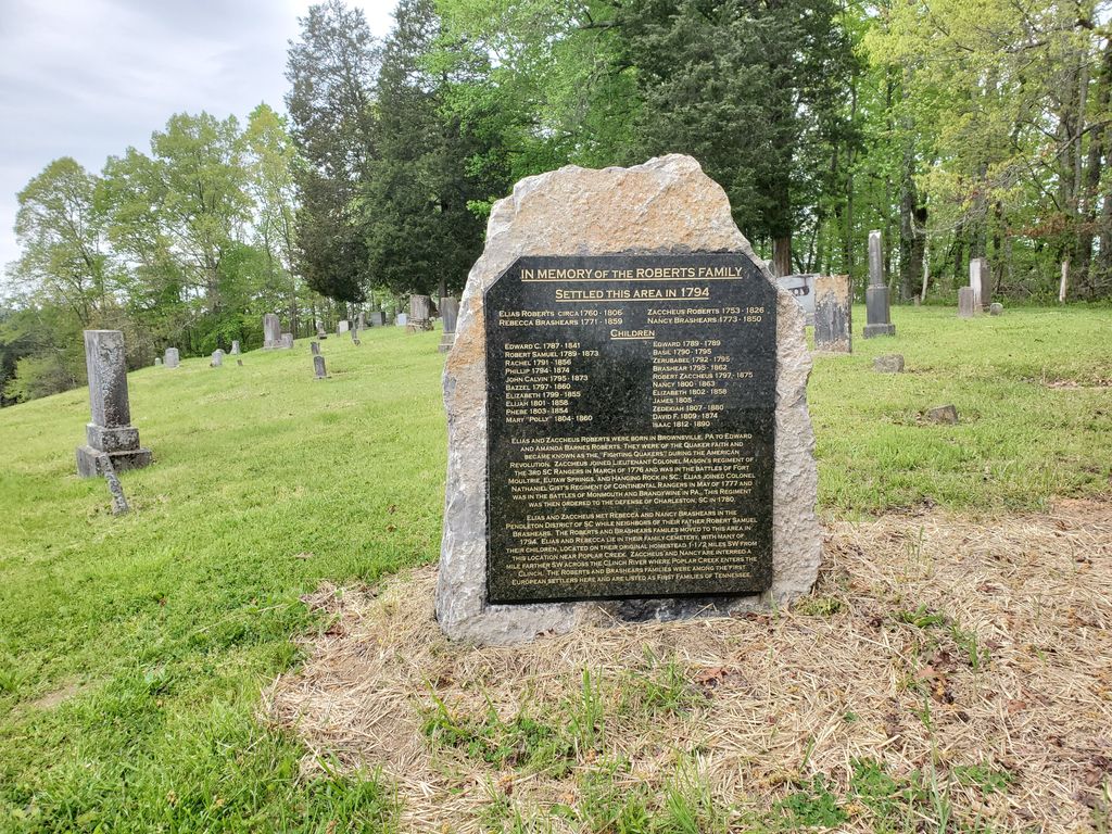
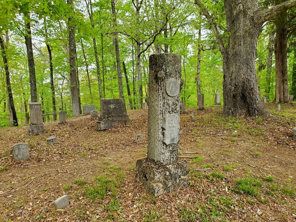
| Description | : | The Wheat Community was settled during the middle of the 19th Century and took its name from the first postmaster, Frank Wheat. The area had originally been known as Bald Hill. Roane College, a liberal arts college, operated here from 1886-1908. Wheat was one of four area communities acquired by the federal government, in 1942, for the Manhattan Project." George Jones Memorial Baptist Church and Cemetery is about a half mile down a gated gravel road from Route 327, just off the "Oak Ridge Turnpike" to the west of Oak Ridge, Tennessee. The Wheat Community Monument is about another half mile... Read More |
frequently asked questions (FAQ):
-
Where is George Jones Memorial Baptist Cemetery AEC 4?
George Jones Memorial Baptist Cemetery AEC 4 is located at Roane County ,Tennessee ,USA.
-
George Jones Memorial Baptist Cemetery AEC 4 cemetery's updated grave count on graveviews.com?
1 memorials
-
Where are the coordinates of the George Jones Memorial Baptist Cemetery AEC 4?
Latitude: 35.9385400
Longitude: -84.3726600
Nearby Cemetories:
1. Crawford Memorial Cemetery AEC #7
Roane County, USA
Coordinate: 35.9413700, -84.3649200
2. Ellis-Keath Cemetery AEC #03
Roane County, USA
Coordinate: 35.9407997, -84.3891983
3. Hembree Cemetery AEC #10
Roane County, USA
Coordinate: 35.9458008, -84.3488998
4. Gallaher Cemetery AEC #59
Roane County, USA
Coordinate: 35.9174995, -84.3705978
5. Africian Burial Grounds AEC #2
Roane County, USA
Coordinate: 35.9180984, -84.3949966
6. Currier Cemetery AEC #58
Roane County, USA
Coordinate: 35.9406013, -84.3371964
7. Burns Cemetery AEC #9
Roane County, USA
Coordinate: 35.9280000, -84.3389170
8. Gallaher Cemetery AEC #12
Roane County, USA
Coordinate: 35.9730600, -84.3516500
9. Kirklan Cemetery
Dyllis, Roane County, USA
Coordinate: 35.9714012, -84.4094009
10. Dyllis Church Cemetery
Dyllis, Roane County, USA
Coordinate: 35.9603004, -84.4216995
11. Jaynes Cemetery
Roane County, USA
Coordinate: 35.8931007, -84.3688965
12. Jonesville Cemetery
Jonesville, Roane County, USA
Coordinate: 35.9827995, -84.3925018
13. Copeland-Cox Cemetery AEC #17
Roane County, USA
Coordinate: 35.9492000, -84.3157300
14. Waller Cemetery
Bradbury, Roane County, USA
Coordinate: 35.8944016, -84.3507996
15. Clough-Christenberry Cemetery AEC #18
Roane County, USA
Coordinate: 35.9746400, -84.3313700
16. Hensley-Peters Cemetery AEC #61
Roane County, USA
Coordinate: 35.8852997, -84.3786011
17. Crowder Cemetery
Monroe County, USA
Coordinate: 35.9055768, -84.4253147
18. Douglas Chapel Cemetery AEC #22
Roane County, USA
Coordinate: 35.9575005, -84.3091965
19. Bradley Cemetery AEC #20 (Defunct)
Roane County, USA
Coordinate: 35.9820000, -84.3297000
20. McKinney Cemetery AEC #13
Roane County, USA
Coordinate: 35.9067001, -84.4328003
21. Lockett Cemetery
Roane County, USA
Coordinate: 35.9947014, -84.3460999
22. Langley Cemetery AEC #23
Jonesville, Roane County, USA
Coordinate: 35.9844000, -84.3244000
23. Thomas Family Cemetery
Harriman, Roane County, USA
Coordinate: 35.9503000, -84.4458000
24. Ollis Cemetery
Blair, Roane County, USA
Coordinate: 35.9982986, -84.4005966