
| Memorials | : | 1 |
| Location | : | Georgia, Lawrence County, USA |
| Coordinate | : | 38.7049200, -86.5722230 |
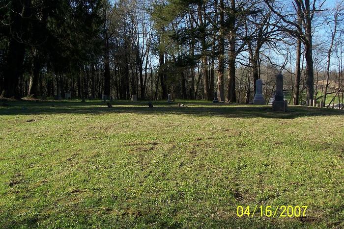
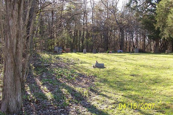
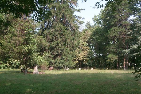
| Description | : | The cemetery is located in Spice Valley Township on the west side of Tolliver Road / Tolliver Cemetery Road about 0.2 miles north of its intersection with Copperhead Valley Road / Land Rent Hollow Road. Indiana Cemetery Locations, Volume 3, published by the Indiana Genealogical Society (April 2007), gives the primary cemetery name as Landreth Cemetery with an alternate name of Georgia Cemetery and as Toliver Cemetery. The cemetery is listed in the Cemetery and Burial Grounds Registry of the Indiana Department of Natural Resources (DNR) and in the State Historical Architectural and Archaeological Research Database (SHAARD) with... Read More |
frequently asked questions (FAQ):
-
Where is Georgia Cemetery?
Georgia Cemetery is located at Tolliver Road Georgia, Lawrence County ,Indiana , 47446USA.
-
Georgia Cemetery cemetery's updated grave count on graveviews.com?
1 memorials
-
Where are the coordinates of the Georgia Cemetery?
Latitude: 38.7049200
Longitude: -86.5722230
Nearby Cemetories:
1. Burton Cemetery
Bedford, Lawrence County, USA
Coordinate: 38.7094002, -86.5783005
2. Eli Burton Family Cemetery
Mitchell, Lawrence County, USA
Coordinate: 38.7208000, -86.5840000
3. Isom Cemetery
Lawrence County, USA
Coordinate: 38.7149450, -86.5445420
4. Liberty Baptist Cemetery
Mitchell, Lawrence County, USA
Coordinate: 38.6918411, -86.5446472
5. Olivert Burnett Cemetery
Georgia, Lawrence County, USA
Coordinate: 38.7062000, -86.5396000
6. Hall Cemetery
Lawrence County, USA
Coordinate: 38.7233009, -86.5402985
7. Tincher Cemetery
Lawrence County, USA
Coordinate: 38.7392006, -86.5717010
8. Carl Isom Farm Cemetery
Mitchell, Lawrence County, USA
Coordinate: 38.7228200, -86.5323680
9. Janets Hill Cemetery
Mitchell, Lawrence County, USA
Coordinate: 38.7389200, -86.5519900
10. Spice Valley Cemetery
Mitchell, Lawrence County, USA
Coordinate: 38.7383423, -86.5495758
11. Grodey Cemetery
Lawrence County, USA
Coordinate: 38.7172012, -86.6196976
12. Hardin Burton Cemetery
Moorestown, Lawrence County, USA
Coordinate: 38.7208380, -86.6216090
13. Brunner Cemetery
Lawrence County, USA
Coordinate: 38.6872890, -86.6263870
14. Johnson Cemetery
Spice Valley Township, Lawrence County, USA
Coordinate: 38.7344110, -86.6215760
15. Connerley Switch Cemetery
Lawrence County, USA
Coordinate: 38.7195358, -86.6324463
16. Bonds Chapel Cemetery
Bonds, Orange County, USA
Coordinate: 38.6728592, -86.6205673
17. Burton Gap Cemetery
Mitchell, Lawrence County, USA
Coordinate: 38.7192000, -86.5098000
18. Rigg Cemetery
Orleans, Orange County, USA
Coordinate: 38.6739000, -86.5150000
19. Burton Cemetery
Mitchell, Lawrence County, USA
Coordinate: 38.7145230, -86.5024260
20. Bethel Cemetery
Orangeville, Orange County, USA
Coordinate: 38.6515045, -86.5534286
21. Old Horeb Graveyard
Orleans Township, Orange County, USA
Coordinate: 38.6633100, -86.5151910
22. Bryantsville Cemetery
Bryantsville, Lawrence County, USA
Coordinate: 38.7669983, -86.5734711
23. Mount Horeb Baptist Cemetery
Orleans, Orange County, USA
Coordinate: 38.6741982, -86.5017014
24. Connelly Cemetery
Lawrence County, USA
Coordinate: 38.7655740, -86.5476970