
| Memorials | : | 0 |
| Location | : | Foxborough, Norfolk County, USA |
| Coordinate | : | 42.0483000, -71.2691800 |
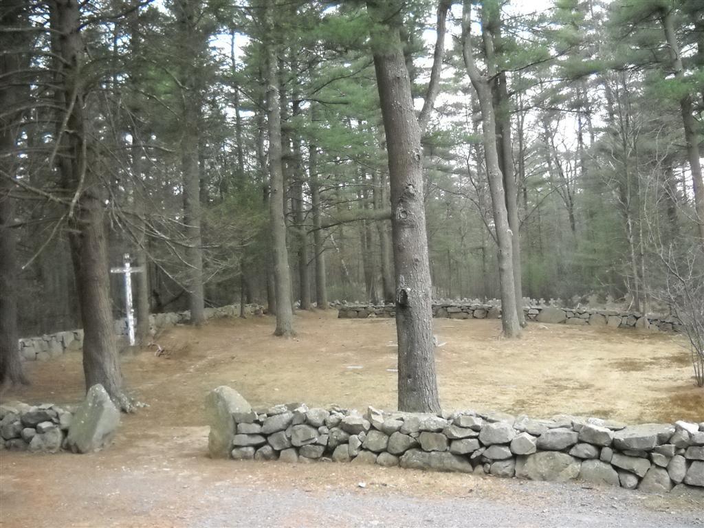
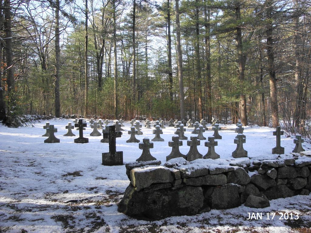
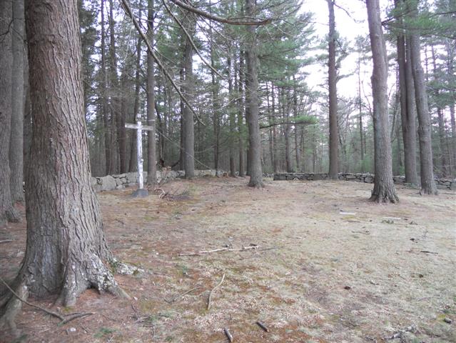
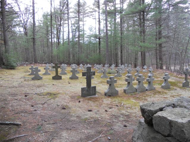
| Description | : | This cemetery is owned by the Town of Foxboro. Prior to 2003, the cemetery was part of Camp Saint Augustine. The camp is now part of the Cocasset River Recreation Area. The cemetery is the burial ground of two religous orders and several children. The Brothers section is the eastern portion of the cemetery. The entrance is here, along with a large wooden cross. All but one stone in this section are flat. The ground here is bare. The men here were all brothers of the Anglican Order of the Society of St. John the Evangelist (SSJE) of... Read More |
frequently asked questions (FAQ):
-
Where is Gethsemane Cemetery?
Gethsemane Cemetery is located at Mill Street Foxborough, Norfolk County ,Massachusetts ,USA.
-
Gethsemane Cemetery cemetery's updated grave count on graveviews.com?
0 memorials
-
Where are the coordinates of the Gethsemane Cemetery?
Latitude: 42.0483000
Longitude: -71.2691800
Nearby Cemetories:
1. Pet Memorial Park
Foxborough, Norfolk County, USA
Coordinate: 42.0335600, -71.2719200
2. Rock Hill Cemetery
Foxborough, Norfolk County, USA
Coordinate: 42.0621986, -71.2574997
3. Sherman Burial Ground
Foxborough, Norfolk County, USA
Coordinate: 42.0311300, -71.2588600
4. Centre Burial Ground
Foxborough, Norfolk County, USA
Coordinate: 42.0639400, -71.2498600
5. Wading River Burial Ground
Foxborough, Norfolk County, USA
Coordinate: 42.0243988, -71.2750015
6. Foxborough State Hospital Cemetery
Foxborough, Norfolk County, USA
Coordinate: 42.0793400, -71.2641900
7. Payson-Morse Burial Ground
Foxborough, Norfolk County, USA
Coordinate: 42.0760200, -71.2487000
8. Foxborough State Hospital Cemetery
Foxborough, Norfolk County, USA
Coordinate: 42.0807740, -71.2637560
9. Saint Marys Cemetery
Foxborough, Norfolk County, USA
Coordinate: 42.0734500, -71.2390800
10. Shepardville Cemetery
Plainville, Norfolk County, USA
Coordinate: 42.0254200, -71.3089400
11. Happy Hollow Burial Ground
Mansfield, Bristol County, USA
Coordinate: 42.0106239, -71.2635269
12. Morton Chapel Burial Ground
Mansfield, Bristol County, USA
Coordinate: 42.0082900, -71.2573700
13. Pondville Cemetery
Norfolk, Norfolk County, USA
Coordinate: 42.0854800, -71.2950000
14. Spring Brook Cemetery
Mansfield, Bristol County, USA
Coordinate: 42.0200005, -71.2236023
15. Trinity Episcopal Cemetery
Wrentham, Norfolk County, USA
Coordinate: 42.0663590, -71.3253290
16. Old Town Cemetery
Mansfield, Bristol County, USA
Coordinate: 42.0237400, -71.2174500
17. Boyden Burial Ground
Foxborough, Norfolk County, USA
Coordinate: 42.0638600, -71.2107400
18. Wrentham Center Cemetery
Wrentham, Norfolk County, USA
Coordinate: 42.0681600, -71.3257000
19. Louise Johnson Memorial Cemetery
Wrentham, Norfolk County, USA
Coordinate: 42.0758500, -71.3232300
20. Sweet Family Burial Ground
Mansfield, Bristol County, USA
Coordinate: 41.9932050, -71.2620230
21. Fisher-Richardson Burial Ground
Mansfield, Bristol County, USA
Coordinate: 42.0093680, -71.2147020
22. Hodges-Pratt Burial Ground
Foxborough, Norfolk County, USA
Coordinate: 42.0669800, -71.1968200
23. West Cemetery
Sharon, Norfolk County, USA
Coordinate: 42.0956100, -71.2207200
24. Terrace Hill Cemetery
Walpole, Norfolk County, USA
Coordinate: 42.1075800, -71.2587300