
| Memorials | : | 0 |
| Location | : | Leidy, Clinton County, USA |
| Coordinate | : | 41.4336813, -77.8941314 |
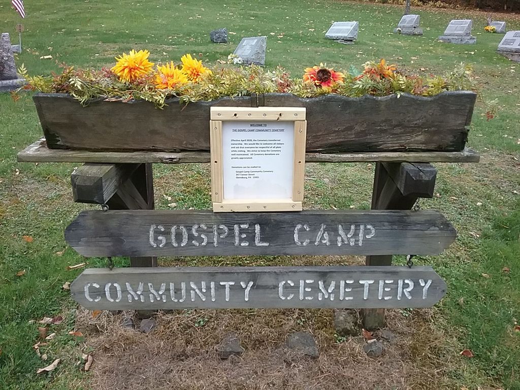
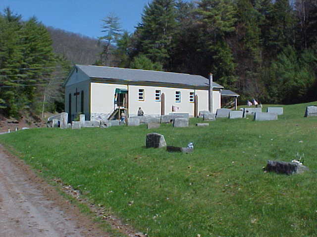
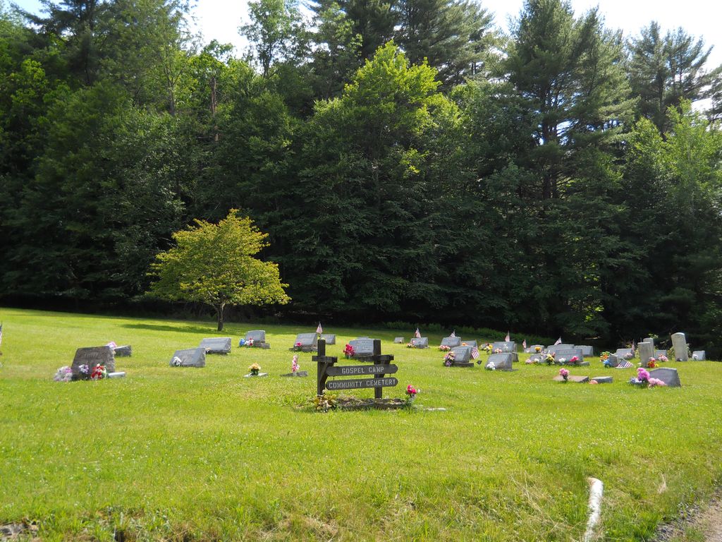
| Description | : | Directions/GPS: From the intersection of Jay and Water Streets in Lock Haven (the Lock Haven Courthouse), travel west on Water Street for 1 mile. Turn right onto PA Route 120 (Susquehanna Avenue) and travel 29.3 miles. Turn right onto Route 144 (Drury Run Road). Travel 11.3 miles. The cemetery will be on your left at the Assembly of God Church. It is well kept. History: William H. and Mary Ann Summerson deeded a tract of 2000 square feet to the Trustees of the Gospel Camp Association on Sept. 15, 1920. The church was likely built... Read More |
frequently asked questions (FAQ):
-
Where is Gospel Camp Cemetery?
Gospel Camp Cemetery is located at Leidy, Clinton County ,Pennsylvania ,USA.
-
Gospel Camp Cemetery cemetery's updated grave count on graveviews.com?
0 memorials
-
Where are the coordinates of the Gospel Camp Cemetery?
Latitude: 41.4336813
Longitude: -77.8941314
Nearby Cemetories:
1. Hammersley Fork Cemetery
Leidy Township, Clinton County, USA
Coordinate: 41.4495280, -77.8686390
2. Wilson Family Cemetery
Leidy Township, Clinton County, USA
Coordinate: 41.4542920, -77.8621040
3. New Maple Grove Cemetery
Leidy Township, Clinton County, USA
Coordinate: 41.3994000, -77.9144000
4. Red Hill Cemetery
Leidy, Clinton County, USA
Coordinate: 41.4196850, -77.8458180
5. McCoy Cemetery
Clinton County, USA
Coordinate: 41.4002991, -77.9253006
6. Summerson Cemetery
Clinton County, USA
Coordinate: 41.3861008, -77.9255981
7. Laurel Hill Cemetery
Clinton County, USA
Coordinate: 41.4743996, -77.8221970
8. Cross Fork Cemetery
Cross Fork, Potter County, USA
Coordinate: 41.4837000, -77.8163000
9. Smith Cemetery
Cameron County, USA
Coordinate: 41.4028015, -78.0180969
10. Gilmore Cemetery
First Fork, Cameron County, USA
Coordinate: 41.4453900, -78.0507800
11. Old Gilmore Cemetery
Sinnamahoning, Cameron County, USA
Coordinate: 41.4547960, -78.0522880
12. Brooks Cemetery
Potter County, USA
Coordinate: 41.5459000, -77.9736000
13. Brooks Cemetery
Wharton, Potter County, USA
Coordinate: 41.5457993, -77.9738998
14. Wharton Cemetery
Potter County, USA
Coordinate: 41.5135994, -78.0333023
15. Saint Mary's Catholic Cemetery
Bitumen, Clinton County, USA
Coordinate: 41.2993140, -77.8797780
16. Robbins Cemetery
Clinton County, USA
Coordinate: 41.3013992, -77.8447037
17. Caldwell Family Cemetery
Westport, Clinton County, USA
Coordinate: 41.3018820, -77.8387280
18. Noyes Cemetery
Westport, Clinton County, USA
Coordinate: 41.2989006, -77.8480988
19. Saint Josephs Cemetery
Renovo, Clinton County, USA
Coordinate: 41.3272018, -77.7746964
20. Shintown Methodist Cemetery
Shintown, Clinton County, USA
Coordinate: 41.3082930, -77.8012300
21. Kepler Cemetery
Shintown, Clinton County, USA
Coordinate: 41.3039000, -77.8044000
22. Miller Cemetery
Grove Township, Cameron County, USA
Coordinate: 41.3503000, -78.0654000
23. Fairview Cemetery
Farwell, Clinton County, USA
Coordinate: 41.3320032, -77.7266502
24. North Bend Cemetery
North Bend, Clinton County, USA
Coordinate: 41.3490000, -77.7029000