
| Memorials | : | 0 |
| Location | : | Hopkins, Richland County, USA |
| Coordinate | : | 33.8991486, -80.8568582 |
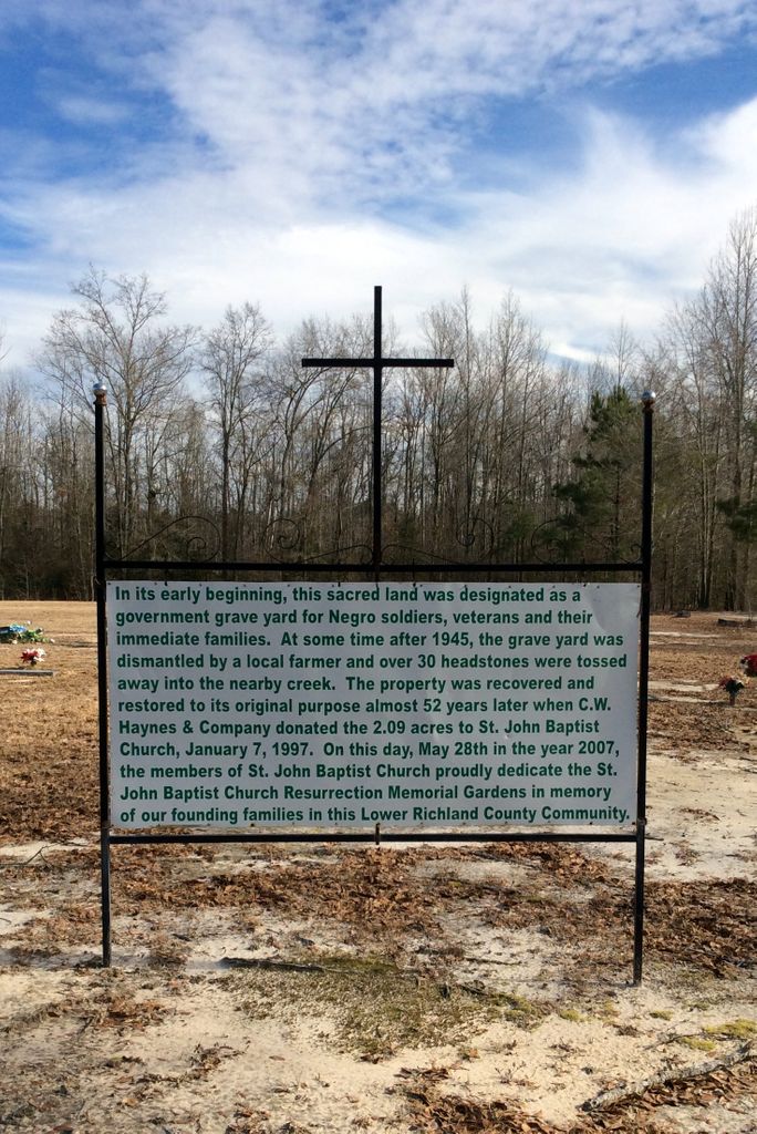
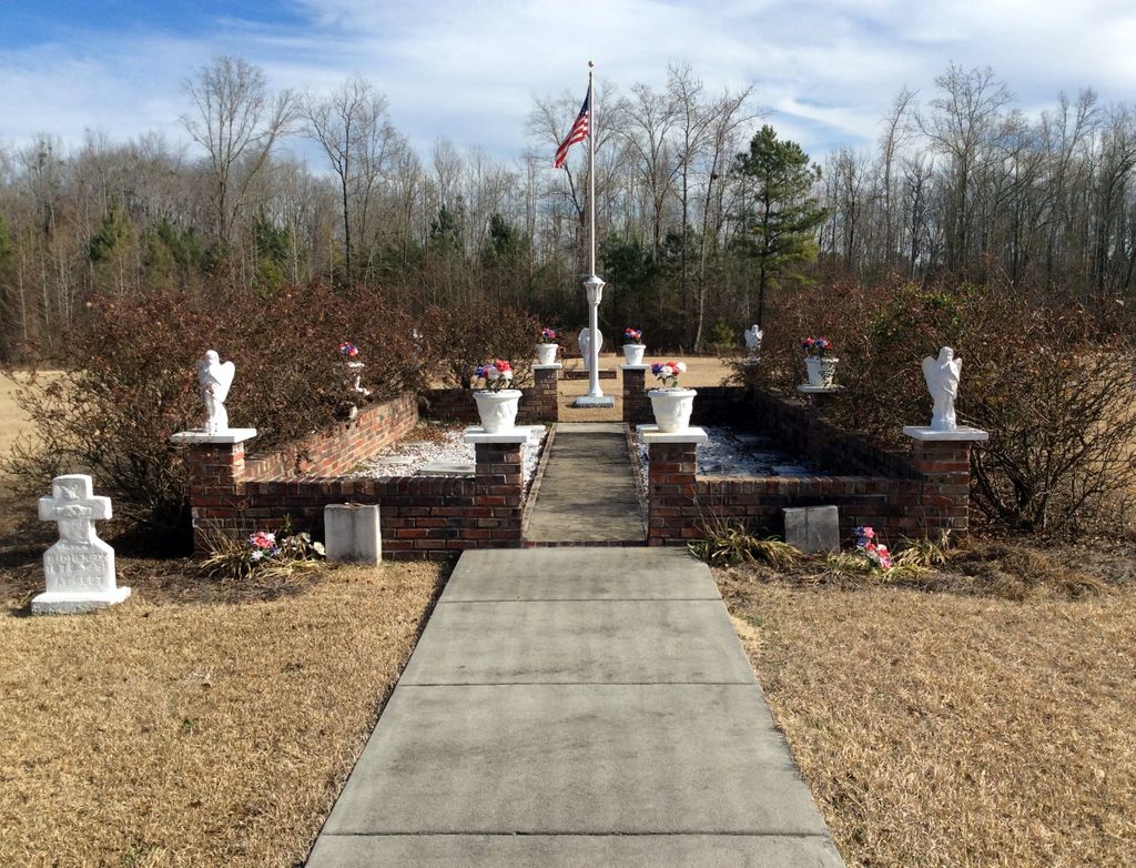
| Description | : | Cemetery is located within the gates of the St. John Resurrection Memorial Garden. The cemetery was originally designated a government cemetery for Negro soldiers, veterans and their immediate family members. However, after 1940, a local farmer began using it as farmland and disposed of more than 30 grave markers by throwing them into the creek! The land was eventually purchased by C.W. Haynes & Company, who in 1997 donated 2 acres of the land to St. John Baptist Church. The church has restored the land to a cemetery and put the remaining markers into a small, fenced area as a... Read More |
frequently asked questions (FAQ):
-
Where is Government Cemetery?
Government Cemetery is located at off Ault Rd Hopkins, Richland County ,South Carolina ,USA.
-
Government Cemetery cemetery's updated grave count on graveviews.com?
0 memorials
-
Where are the coordinates of the Government Cemetery?
Latitude: 33.8991486
Longitude: -80.8568582
Nearby Cemetories:
1. Saint John Resurrection Memorial Garden
Hopkins, Richland County, USA
Coordinate: 33.8991486, -80.8568582
2. Saint John Baptist Church Cemetery
Hopkins, Richland County, USA
Coordinate: 33.8964680, -80.8606170
3. Goodwyn Cemetery
Hopkins, Richland County, USA
Coordinate: 33.8960180, -80.8526170
4. Jerusalem Baptist Church Cemetery
Hopkins, Richland County, USA
Coordinate: 33.9027320, -80.8722610
5. Hopkins Presbyterian Church Cemetery
Hopkins, Richland County, USA
Coordinate: 33.9099920, -80.8734580
6. Progressive Church of Our Lord Cemetery
Hopkins, Richland County, USA
Coordinate: 33.8860690, -80.8837310
7. Zion Benevolent Church Cemetery
Hopkins, Richland County, USA
Coordinate: 33.8949270, -80.8257290
8. Ladson's Chapel Baptist Church Cemetery
Hopkins, Richland County, USA
Coordinate: 33.8963740, -80.8243790
9. Hopkins Family Cemetery
Hopkins, Richland County, USA
Coordinate: 33.9106710, -80.8956210
10. New Birth Tabernacle Church Cemetery
Hopkins, Richland County, USA
Coordinate: 33.9239370, -80.8275140
11. Horrell Hill Baptist Church Cemetery
Horrell Hill, Richland County, USA
Coordinate: 33.9332490, -80.8412500
12. Zion Damascus Baptist Church Cemetery #2
Hopkins, Richland County, USA
Coordinate: 33.8611320, -80.8604680
13. Myers Cemetery
Hopkins, Richland County, USA
Coordinate: 33.8652992, -80.8814011
14. New Light Beulah Baptist Church Cemetery
Horrell Hill, Richland County, USA
Coordinate: 33.9285236, -80.8216981
15. Bethel Cemetery
Richland County, USA
Coordinate: 33.8608017, -80.8806000
16. Siloam Baptist Church Cemetery
Hopkins, Richland County, USA
Coordinate: 33.9348763, -80.8256444
17. Zion Damascus Baptist Church Cemetery #1
Hopkins, Richland County, USA
Coordinate: 33.8568080, -80.8725800
18. Oldfield Cemetery
Hopkins, Richland County, USA
Coordinate: 33.9426860, -80.8667750
19. Saint Johns Episcopal Church Congaree Cemetery
Congaree, Richland County, USA
Coordinate: 33.9010180, -80.8034560
20. Beulah Baptist Church Cemetery
Horrell Hill, Richland County, USA
Coordinate: 33.9491720, -80.8535170
21. Faith Temple Holiness Church Cemetery
Hopkins, Richland County, USA
Coordinate: 33.8488760, -80.8606960
22. Zion Chapel Baptist #2
Hopkins, Richland County, USA
Coordinate: 33.8949630, -80.9176110
23. Zion Pilgrim Baptist Church Cemetery #1
Hopkins, Richland County, USA
Coordinate: 33.8494250, -80.8716730
24. Reese Family Plantation Cemetery
Hopkins, Richland County, USA
Coordinate: 33.9230490, -80.9126810