
| Memorials | : | 0 |
| Location | : | Rotenberg, Stadtkreis Stuttgart, Germany |
| Website | : | www.grabkapelle-rotenberg.de |
| Coordinate | : | 48.7823029, 9.2687807 |
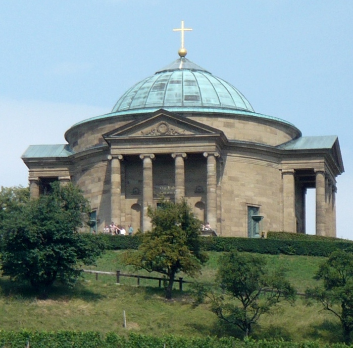
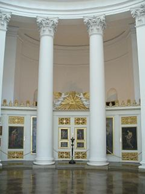
| Description | : | The mausoleam (also known as Grabkapelle auf dem Württemberg) is a memorial in the Rotenberg part of Untertürkheim in Stuttgart, Germany. The mausoleum stands on the peak of Württemberg Hill at the westernmost end of Schurwald woods overlooking the Neckar river. The memorial was built for Catherine Pavlovna of Russia (1788–1819), the second wife of William I of Württemberg (1781–1864). It was built between 1820 and 1822 on the spot of the former Fortress Württemberg, which gave the dynasty and the kingdom its name. Between 1825 and 1899 it was also used as a Russian-Orthodox Church. Designed by Italian architect... Read More |
frequently asked questions (FAQ):
-
Where is Grabkapelle auf dem Württemberg?
Grabkapelle auf dem Württemberg is located at Württembergstraße 350 Rotenberg, Stadtkreis Stuttgart ,Baden-Württemberg , 70327Germany.
-
Grabkapelle auf dem Württemberg cemetery's updated grave count on graveviews.com?
0 memorials
-
Where are the coordinates of the Grabkapelle auf dem Württemberg?
Latitude: 48.7823029
Longitude: 9.2687807
Nearby Cemetories:
1. Friedhof Rotenberg
Rotenberg, Stadtkreis Stuttgart, Germany
Coordinate: 48.7840098, 9.2735259
2. Friedhof Untertürkheim
Untertürkheim, Stadtkreis Stuttgart, Germany
Coordinate: 48.7857370, 9.2602160
3. Friedhof Uhlbach
Uhlbach, Stadtkreis Stuttgart, Germany
Coordinate: 48.7753859, 9.2793055
4. Friedhof Obertürkheim
Obertürkheim, Stadtkreis Stuttgart, Germany
Coordinate: 48.7685444, 9.2682585
5. Friedhof Wangen
Wangen, Stadtkreis Stuttgart, Germany
Coordinate: 48.7692000, 9.2414000
6. Friedhof Hedelfingen
Hedelfingen, Stadtkreis Stuttgart, Germany
Coordinate: 48.7592600, 9.2563900
7. Friedhof Sulzgries
Sulzgries, Landkreis Esslingen, Germany
Coordinate: 48.7604200, 9.2910600
8. Kleinfeldfriedhof
Fellbach, Rems-Murr-Kreis, Germany
Coordinate: 48.8100722, 9.2842961
9. Friedhof Rohracker
Rohracker, Stadtkreis Stuttgart, Germany
Coordinate: 48.7589000, 9.2363000
10. Friedhof Mettingen
Mettingen, Landkreis Esslingen, Germany
Coordinate: 48.7490468, 9.2797991
11. Uff-Kirchhof
Bad Cannstatt, Stadtkreis Stuttgart, Germany
Coordinate: 48.8042575, 9.2261982
12. Friedhof Gaisburg
Gaisburg, Stadtkreis Stuttgart, Germany
Coordinate: 48.7808000, 9.2135000
13. Friedhof Rommelshausen
Rommelshausen, Rems-Murr-Kreis, Germany
Coordinate: 48.8066160, 9.3163570
14. Friedhof Heumaden
Heumaden, Stadtkreis Stuttgart, Germany
Coordinate: 48.7473000, 9.2348000
15. Bergfriedhof Stuttgart
Stuttgart-Ost, Stadtkreis Stuttgart, Germany
Coordinate: 48.7881600, 9.2057300
16. Friedhof Gablenberg
Gablenberg, Stadtkreis Stuttgart, Germany
Coordinate: 48.7773820, 9.2042560
17. Friedhof Sillenbuch
Sillenbuch, Stadtkreis Stuttgart, Germany
Coordinate: 48.7516084, 9.2220013
18. Hauptfriedhof Bad Cannstadt
Bad Cannstatt, Stadtkreis Stuttgart, Germany
Coordinate: 48.8226810, 9.2369130
19. Alter Friedhof Stetten im Remstal
Stetten im Remstal, Rems-Murr-Kreis, Germany
Coordinate: 48.7931274, 9.3385453
20. Friedhof St. Bernhardt
Esslingen am Neckar, Landkreis Esslingen, Germany
Coordinate: 48.7479036, 9.3181253
21. Steigfriedhof Bad Cannstatt
Bad Cannstatt, Stadtkreis Stuttgart, Germany
Coordinate: 48.8119030, 9.2078190
22. Kloster Sirnau
Esslingen am Neckar, Landkreis Esslingen, Germany
Coordinate: 48.7380700, 9.3058170
23. Ostfilderfriedhof
Sillenbuch, Stadtkreis Stuttgart, Germany
Coordinate: 48.7411110, 9.2222220
24. Friedhof Ruit
Ostfildern, Landkreis Esslingen, Germany
Coordinate: 48.7299527, 9.2542536