
| Memorials | : | 20 |
| Location | : | Latham, Moniteau County, USA |
| Coordinate | : | 38.5782800, -92.7176400 |
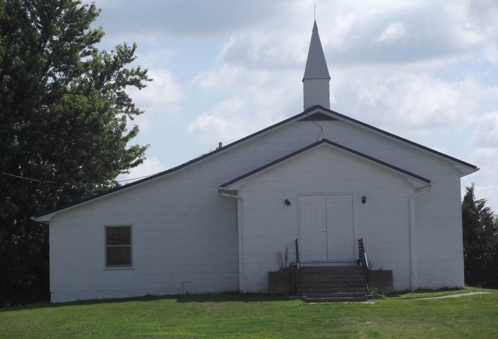
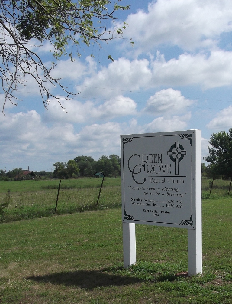
| Description | : | Green Grove is located northwest of Latham. From California go west on Hwy 50 to Rt E or from Tipton go east on Hwy 50 to Rt E. Turn south on Rt E towards Latham. From there 2 ways to get to the cemetery. The first is to turn on Oak Dale Rd and follow the signs to Green Grove, approximately 1.9 miles. The church and cemetery will be on the left. The other option is to go through Latham and take Rt W west to Green Grove Rd. Turn north on Green Grove Rd and go approximately 1.3 miles... Read More |
frequently asked questions (FAQ):
-
Where is Green Grove Cemetery?
Green Grove Cemetery is located at Latham, Moniteau County ,Missouri ,USA.
-
Green Grove Cemetery cemetery's updated grave count on graveviews.com?
17 memorials
-
Where are the coordinates of the Green Grove Cemetery?
Latitude: 38.5782800
Longitude: -92.7176400
Nearby Cemetories:
1. Peter Newkirk Family Cemetery
Moniteau County, USA
Coordinate: 38.5564100, -92.7422200
2. Newkirk Cemetery
Moniteau County, USA
Coordinate: 38.5593987, -92.7553024
3. Spring Hill Mennonite Cemetery
Latham, Moniteau County, USA
Coordinate: 38.5537900, -92.6824100
4. Highland Cemetery
Moniteau County, USA
Coordinate: 38.5400009, -92.7003021
5. Latham Cemetery
Latham, Moniteau County, USA
Coordinate: 38.5643997, -92.6680984
6. McPherson Family Cemetery
Tipton, Moniteau County, USA
Coordinate: 38.6091100, -92.7537200
7. Christian Cemetery
Tipton, Moniteau County, USA
Coordinate: 38.5971200, -92.7671900
8. Woods Cemetery
Tipton, Moniteau County, USA
Coordinate: 38.6034100, -92.7650700
9. Moreau Cemetery
Tipton, Moniteau County, USA
Coordinate: 38.6241989, -92.7335968
10. Thixton Cemetery
Latham, Moniteau County, USA
Coordinate: 38.5494100, -92.7684700
11. Mount Moriah Cemetery
Clarksburg, Moniteau County, USA
Coordinate: 38.6302190, -92.6828370
12. Bethel Mennonite Church Cemetery
Pilot Grove Township, Moniteau County, USA
Coordinate: 38.5224900, -92.7435600
13. Pleasant Hill Cemetery
Moniteau County, USA
Coordinate: 38.5329500, -92.6590800
14. Clearview Mennonite Cemetery
Versailles, Morgan County, USA
Coordinate: 38.5145300, -92.7436100
15. Dorner Cemetery
Moniteau County, USA
Coordinate: 38.6241200, -92.7882600
16. Williams Cemetery
Clarksburg, Moniteau County, USA
Coordinate: 38.6385994, -92.6594009
17. Elliott Cemetery
Moniteau County, USA
Coordinate: 38.5244500, -92.6408700
18. Flag Spring Cemetery
California, Moniteau County, USA
Coordinate: 38.6102900, -92.6187800
19. Clarksburg Cemetery
Clarksburg, Moniteau County, USA
Coordinate: 38.6528015, -92.6688995
20. Hickman Cemetery
Clarksburg, Moniteau County, USA
Coordinate: 38.6530170, -92.6694220
21. Liberty Cemetery
Moniteau County, USA
Coordinate: 38.6044006, -92.8233032
22. Sappington Community Chapel Cemetery
California, Moniteau County, USA
Coordinate: 38.5770500, -92.6026700
23. Odd Fellows Cemetery
Tipton, Moniteau County, USA
Coordinate: 38.6634100, -92.7653500
24. Saint Andrews Catholic Cemetery
Tipton, Moniteau County, USA
Coordinate: 38.6494200, -92.7972400