
| Memorials | : | 0 |
| Location | : | Waterford, Marshall County, USA |
| Coordinate | : | 34.6137140, -89.4745280 |
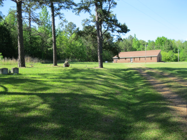
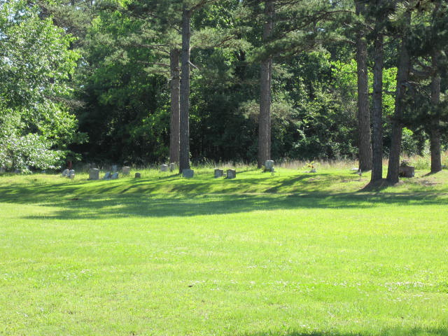
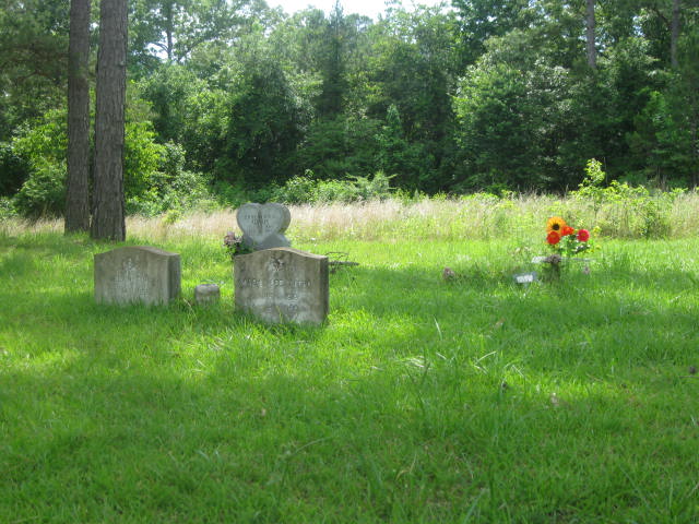
| Description | : | From intersection of Wilkins Chapel Rd. & Old Mississippi 7 in Waterford, head south on Old Mississippi & for 2.8 mi. to the driveway for the Greenfield Presb. Church. The cemetery is past the church building on the west (right) side of the driveway at the south entrance. |
frequently asked questions (FAQ):
-
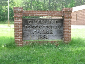
Where is Greenfield Presbyterian Church Cemetery?
Greenfield Presbyterian Church Cemetery is located at Old Highway 7 South Waterford, Marshall County ,Mississippi ,USA.
-
Greenfield Presbyterian Church Cemetery cemetery's updated grave count on graveviews.com?
0 memorials
-
Where are the coordinates of the Greenfield Presbyterian Church Cemetery?
Latitude: 34.6137140
Longitude: -89.4745280
Nearby Cemetories:
1. Malone Cemetery
Malone, Marshall County, USA
Coordinate: 34.6139100, -89.4714300
2. Ebenezer Cemetery
Marshall County, USA
Coordinate: 34.6096992, -89.4916992
3. Hamilton Cemetery
Marshall County, USA
Coordinate: 34.6044006, -89.4891968
4. Spring Hill M B Cemetery
Waterford, Marshall County, USA
Coordinate: 34.6080340, -89.4474690
5. Asberry Methodist Cemetery
Waterford, Marshall County, USA
Coordinate: 34.5874700, -89.4661500
6. Waterford Cemetery
Waterford, Marshall County, USA
Coordinate: 34.6478004, -89.4552994
7. Old Waterford Cemetery
Marshall County, USA
Coordinate: 34.6514100, -89.4735500
8. Spring Creek Presbyterian Church Cemetery
Waterford, Marshall County, USA
Coordinate: 34.5813190, -89.4415290
9. Spring Hill Baptist Church Cemetery
Waterford, Marshall County, USA
Coordinate: 34.6184830, -89.4208210
10. Brooks Family Cemetery
Waterford, Marshall County, USA
Coordinate: 34.6528000, -89.5033000
11. Mount Vernon Cemetery
Marshall County, USA
Coordinate: 34.5647011, -89.4383011
12. Mount Comfort C.M.E Church Cemetery
Laws Hill, Marshall County, USA
Coordinate: 34.5984280, -89.5449650
13. Old McAuley Cemetery
Waterford, Marshall County, USA
Coordinate: 34.6603000, -89.5205800
14. Nevill Cemetery
Chulahoma, Marshall County, USA
Coordinate: 34.6611910, -89.5412630
15. Sauls Chapel Cemetery
Lake Center, Marshall County, USA
Coordinate: 34.6751250, -89.4232240
16. Mount Moriah Cemetery
Laws Hill, Marshall County, USA
Coordinate: 34.6074982, -89.5682983
17. Mount Maria Cemetery
Bethlehem, Marshall County, USA
Coordinate: 34.5625980, -89.4036570
18. Peel Cemetery
Laws Hill, Marshall County, USA
Coordinate: 34.6164780, -89.5695740
19. Yarbrough Cemetery
Holly Springs, Marshall County, USA
Coordinate: 34.6865280, -89.5263060
20. Mount Teamor Cemetery
Lake Center, Marshall County, USA
Coordinate: 34.6846200, -89.4182730
21. Harris Chapel Cemetery
Laws Hill, Marshall County, USA
Coordinate: 34.5845020, -89.5723140
22. Mount Gilead CME Church Cemetery
Holly Springs, Marshall County, USA
Coordinate: 34.6560000, -89.5652800
23. Mount Gillie Church Cemetery
Chulahoma, Marshall County, USA
Coordinate: 34.6563230, -89.5656840
24. Lebanon Cemetery
Marshall County, USA
Coordinate: 34.6161003, -89.3675003