
| Memorials | : | 0 |
| Location | : | Greenland, Douglas County, USA |
| Coordinate | : | 39.1384500, -104.8779500 |
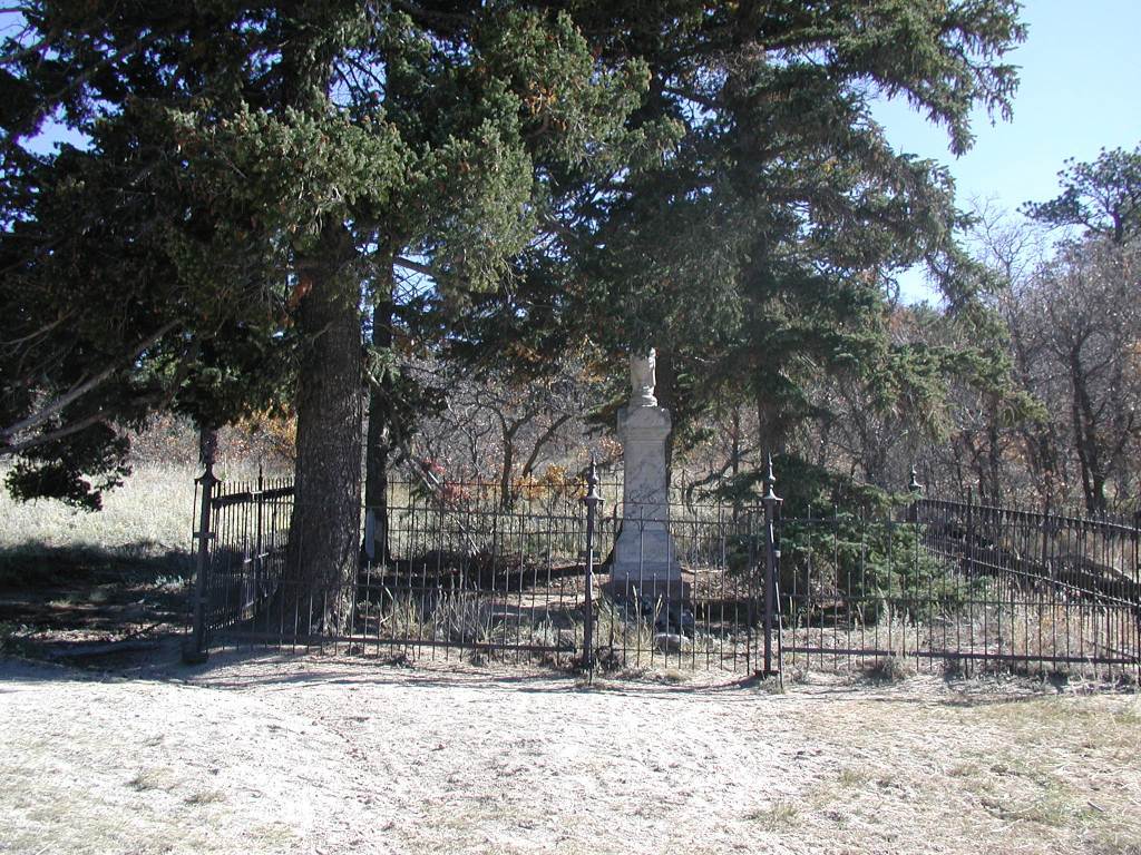
| Description | : | This cemetery is/was also known as "the Old Palmer Lake Cemetery". It is located in southern Douglas County on land owned by Douglas County Open Space, in Section 34, T10S, R67W, 2-3 miles NE of the town of Palmer Lake. The cemetery was in active use in the early 1900s. Sometime in the 1920s most of the graves were moved to the Monument Cemetery, at the town of Monument, east of Palmer Lake, because the Palmer Lake Cemetery was somewhat remote and difficult to get to. There are at least two marked burial sites remaining at... Read More |
frequently asked questions (FAQ):
-
Where is Greenmont Cemetery?
Greenmont Cemetery is located at Greenland, Douglas County ,Colorado ,USA.
-
Greenmont Cemetery cemetery's updated grave count on graveviews.com?
0 memorials
-
Where are the coordinates of the Greenmont Cemetery?
Latitude: 39.1384500
Longitude: -104.8779500
Nearby Cemetories:
1. Monument Cemetery
Monument, El Paso County, USA
Coordinate: 39.1010017, -104.8669968
2. Trinity Lutheran Columbarium
Monument, El Paso County, USA
Coordinate: 39.0897000, -104.8524000
3. Saint Matthias Cemetery
Monument, El Paso County, USA
Coordinate: 39.0974922, -104.8302536
4. Church at Woodmoor Columbarium
Monument, El Paso County, USA
Coordinate: 39.0961990, -104.8295975
5. Stone Canyon Cemetery
Larkspur, Douglas County, USA
Coordinate: 39.2027700, -104.9125980
6. Family of Christ Church Columbarium
Monument, El Paso County, USA
Coordinate: 39.0563000, -104.8399000
7. Spring Valley Cemetery
Douglas County, USA
Coordinate: 39.1592674, -104.7680130
8. Saint Benedict Cemetery
El Paso County, USA
Coordinate: 39.0619316, -104.7633133
9. United States Air Force Academy Cemetery
Colorado Springs, El Paso County, USA
Coordinate: 39.0155487, -104.8555374
10. Glen Grove Cemetery
Douglas County, USA
Coordinate: 39.2677994, -104.9614029
11. Capps Family Cemetery
El Paso County, USA
Coordinate: 38.9902687, -104.8574829
12. Table Rock Cemetery
El Paso County, USA
Coordinate: 39.1182000, -104.6855000
13. Rock Ridge Cemetery
Castle Rock, Douglas County, USA
Coordinate: 39.2572000, -104.7136000
14. LaForet Chapel Cemetery
Colorado Springs, El Paso County, USA
Coordinate: 39.0067470, -104.7186140
15. Black Forest Lutheran Church Columbarium
Black Forest, El Paso County, USA
Coordinate: 39.0118000, -104.6988000
16. Mount Saint Francis Cemetery
Colorado Springs, El Paso County, USA
Coordinate: 38.9472008, -104.8748016
17. Templeton Cemetery
Teller County, USA
Coordinate: 39.0180000, -105.0759000
18. Woodland Park Cemetery
Woodland Park, Teller County, USA
Coordinate: 38.9895000, -105.0459000
19. James Cemetery
Elbert, Elbert County, USA
Coordinate: 39.1724892, -104.6196976
20. Saint Michael's Episcopal Church Columbarium
Colorado Springs, El Paso County, USA
Coordinate: 38.9391000, -104.8153000
21. West Creek Cemetery
Deckers, Douglas County, USA
Coordinate: 39.1553000, -105.1512000
22. Bluff Cemetery
Eastonville, El Paso County, USA
Coordinate: 39.0999985, -104.5849991
23. Bear Canon Cemetery
Sedalia, Douglas County, USA
Coordinate: 39.3677902, -104.9586868
24. Mountain Wilderness Memorial Park
Woodland Park, Teller County, USA
Coordinate: 38.9458046, -105.0578842