
| Memorials | : | 0 |
| Location | : | Greenville, Augusta County, USA |
| Coordinate | : | 38.0069270, -79.1553270 |
| Description | : | African American Cemetery. Mt. Ead Cemetery is also known as "Greenville Negro Graveyard" and "Greenville Black Cemetery." The land for the cemetery was given by Isaac Newton. It was used by members of both the Mt. Ead and Wayman Chapel churches. Mt. Ead church is also known as "Greenville, Va., African Baptist Church." Mt. Ead church held services from about 1872 until about 1976. The church was torn down in December 1992. While both churches are no longer in service, many Blacks with family ties to former members continue to bury in this cemetery. |
frequently asked questions (FAQ):
-
Where is Greenville Cemetery?
Greenville Cemetery is located at 4033 Lee Jackson Highway (Rt. 11) Greenville, Augusta County ,Virginia , 24440USA.
-
Greenville Cemetery cemetery's updated grave count on graveviews.com?
0 memorials
-
Where are the coordinates of the Greenville Cemetery?
Latitude: 38.0069270
Longitude: -79.1553270
Nearby Cemetories:
1. Greenville Baptist Church Cemetery
Greenville, Augusta County, USA
Coordinate: 38.0057000, -79.1584700
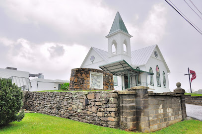
2. Greenville United Methodist Church Cemetery
Greenville, Augusta County, USA
Coordinate: 38.0020700, -79.1573400
3. Pines Chapel Presbyterian Church Cemetery
Greenville, Augusta County, USA
Coordinate: 37.9780800, -79.1352260
4. Bethel Presbyterian Church Cemetery
Middlebrook, Augusta County, USA
Coordinate: 38.0425550, -79.1728310
5. Spring Valley Chapel Cemetery
Stuarts Draft, Augusta County, USA
Coordinate: 38.0025970, -79.1070320
6. Saint Johns Reformed United Church of Christ
Middlebrook, Augusta County, USA
Coordinate: 38.0508070, -79.1776080
7. Oakland Methodist Episcopal Cemetery
Augusta County, USA
Coordinate: 38.0311300, -79.2094600
8. Greenmonte Fellowship Mennonite Church Cemetery
Stuarts Draft, Augusta County, USA
Coordinate: 38.0025880, -79.0920250
9. Pilson Cemetery
Stuarts Draft, Augusta County, USA
Coordinate: 38.0431650, -79.1105740
10. Mount Airy Baptist Church Cemetery
Middlebrook, Augusta County, USA
Coordinate: 38.0448410, -79.2123350
11. Alms House Cemetery
Augusta County, USA
Coordinate: 38.0697220, -79.1647220
12. Dutch Hollow Cemetery
Middlebrook, Augusta County, USA
Coordinate: 38.0032038, -79.2396285
13. Hatton Pond Baptist Church Cemetery
Stuarts Draft, Augusta County, USA
Coordinate: 38.0139980, -79.0693530
14. Zinks Cemetery
Steeles Tavern, Augusta County, USA
Coordinate: 37.9394417, -79.1757278
15. Willson Family Cemetery
Mint Spring, Augusta County, USA
Coordinate: 38.0728264, -79.1209564
16. Old Providence ARP Church Cemetery - New
Spottswood, Augusta County, USA
Coordinate: 37.9604430, -79.2256720
17. Old Providence ARP Church Cemetery
Spottswood, Augusta County, USA
Coordinate: 37.9615097, -79.2271042
18. Mount Joy Presbyterian Church Cemetery
Steeles Tavern, Augusta County, USA
Coordinate: 37.9338360, -79.1594310
19. North Mountain Burying Ground
Middlebrook, Augusta County, USA
Coordinate: 38.0789160, -79.1779770
20. Mount Tabor Lutheran Church Cemetery
Middlebrook, Augusta County, USA
Coordinate: 38.0784620, -79.1911050
21. Calvary United Methodist Church Cemetery
Stuarts Draft, Augusta County, USA
Coordinate: 38.0301730, -79.0572010
22. White Hill Church of the Brethren Cemetery
Stuarts Draft, Augusta County, USA
Coordinate: 38.0392600, -79.0609500
23. Mount Carmel Presbyterian Church Cemetery
Steeles Tavern, Augusta County, USA
Coordinate: 37.9295006, -79.1975021
24. Lambert Family Cemetery
Mint Spring, Augusta County, USA
Coordinate: 38.0554390, -79.0639120