| Memorials | : | 0 |
| Location | : | Stanford, Judith Basin County, USA |
| Coordinate | : | 47.0283830, -110.4878830 |
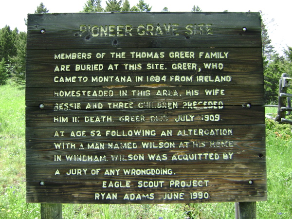
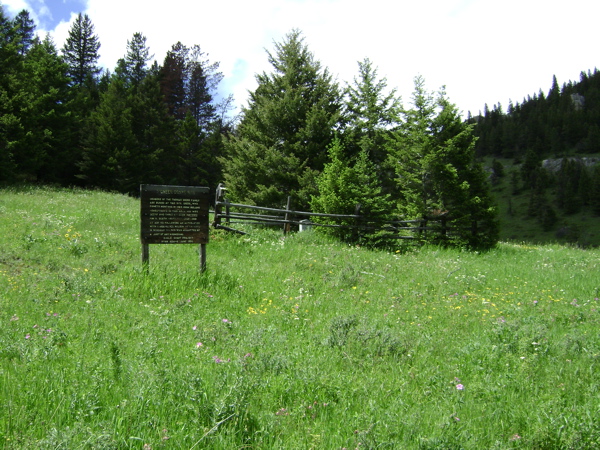
| Description | : | Pioneer Grave Site Members of the Thomas Greer family are buried at this site. Greer, who came to Montana in 1884 from Ireland, homesteaded in this area. His wife Bessie and three children preceded him in death. Greer died July 1909 at age 52 following an altercation with a man named Wilson at his home in Windham. Wilson was acquitted by a jury of any wrongdoing. Eagle Scout Project Ryan Adams June 1990 |
frequently asked questions (FAQ):
-
Where is Greer Cemetery?
Greer Cemetery is located at Stanford, Judith Basin County ,Montana ,USA.
-
Greer Cemetery cemetery's updated grave count on graveviews.com?
0 memorials
-
Where are the coordinates of the Greer Cemetery?
Latitude: 47.0283830
Longitude: -110.4878830
Nearby Cemetories:
1. Barker Cemetery
Cascade County, USA
Coordinate: 47.0522003, -110.6449966
2. Surprise Creek Hutterite Cemetery
Stanford, Judith Basin County, USA
Coordinate: 47.1689358, -110.3323007
3. Surprise Creek Colony Cemetery
Surprise Creek Colony, Judith Basin County, USA
Coordinate: 47.1690000, -110.3323000
4. Neihart Pinehill Cemetery
Neihart, Cascade County, USA
Coordinate: 46.9721985, -110.7581024
5. Lehigh Cemetery
Judith Basin County, USA
Coordinate: 47.0480995, -110.1766968
6. Graveyard Gulch Cemetery
Neihart, Cascade County, USA
Coordinate: 46.9428000, -110.7772000
7. Larson Cemetery
Judith Basin County, USA
Coordinate: 46.9968987, -110.1727982
8. Kibbey Cemetery
Monarch, Cascade County, USA
Coordinate: 47.1742200, -110.7339300
9. Monarch Cemetery
Monarch, Cascade County, USA
Coordinate: 47.1263885, -110.7902832
10. Stanford Cemetery
Stanford, Judith Basin County, USA
Coordinate: 47.1568000, -110.2036670
11. Geyser Cemetery
Geyser, Judith Basin County, USA
Coordinate: 47.2619019, -110.5064011
12. Utica Cemetery
Judith Basin County, USA
Coordinate: 46.9528008, -110.0867004
13. Benchland Cemetery
Judith Basin County, USA
Coordinate: 47.0839005, -110.0500031
14. McLeish Cemetery
Judith Basin County, USA
Coordinate: 47.3596992, -110.5772018
15. Philbrook Cemetery
Hobson, Judith Basin County, USA
Coordinate: 46.9831009, -109.9558029
16. Strouf Pioneer Cemetery
Fergus County, USA
Coordinate: 47.2797012, -110.0481033
17. Moccasin Cemetery
Moccasin, Judith Basin County, USA
Coordinate: 47.0411830, -109.9093000
18. Tiger Butte Cemetery
Belt, Cascade County, USA
Coordinate: 47.2597008, -111.0108032
19. Big Willow Cemetery
Belt, Cascade County, USA
Coordinate: 47.4164009, -110.7444000
20. Coffee Creek Cemetery
Coffee Creek, Fergus County, USA
Coordinate: 47.3588420, -110.0857330
21. Pleasant View Cemetery
Belt, Cascade County, USA
Coordinate: 47.3722000, -110.9088974
22. Hillcrest Cemetery
Denton, Fergus County, USA
Coordinate: 47.3133011, -109.9349976
23. Buffalo Cemetery
Judith Basin County, USA
Coordinate: 46.8526000, -109.8242330
24. Pleasant Valley Colony Cemetery
Pleasant Valley Colony, Cascade County, USA
Coordinate: 47.3409000, -111.0482000


