
| Memorials | : | 0 |
| Location | : | Lawrenceburg, Lawrence County, USA |
| Coordinate | : | 37.2577400, -93.7199800 |
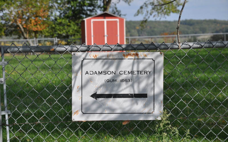
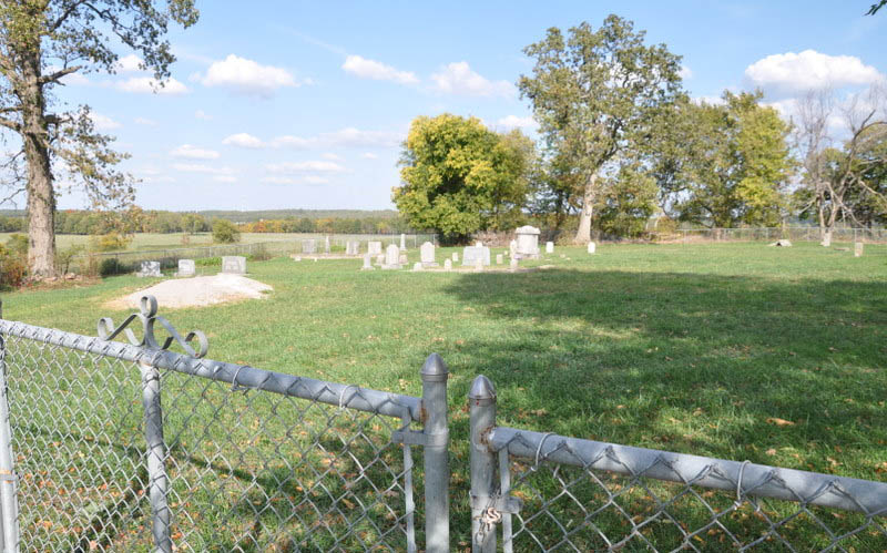
| Description | : | This cemetery is located about 4 miles west-northwest of Lawrenceburg in Section 1, Township 26, Range 26, about 1/8 mile north of Highway DD. It is on private land and was restored by the owner, as recounted in an article in the Springfield News-Leader (August 11, 1996). It was originally called Gum Cemetery but the news article refers to it as Gum Adamson, after the family that purchased the land in 1901 and still owns it. An inventory of burials was made by Fred Miesewinkel in March 1971, and it forms the source for the information posted here. |
frequently asked questions (FAQ):
-
Where is Gum Adamson Cemetery?
Gum Adamson Cemetery is located at Lawrenceburg, Lawrence County ,Missouri ,USA.
-
Gum Adamson Cemetery cemetery's updated grave count on graveviews.com?
0 memorials
-
Where are the coordinates of the Gum Adamson Cemetery?
Latitude: 37.2577400
Longitude: -93.7199800
Nearby Cemetories:
1. Lumbleys Grave
Lawrence County, USA
Coordinate: 37.2506910, -93.7314030
2. Hood Cemetery
Lawrence County, USA
Coordinate: 37.2538986, -93.7442017
3. Morrison Cemetery
Lawrenceburg, Lawrence County, USA
Coordinate: 37.2557120, -93.6881020
4. Richardson Cemetery
Lawrence County, USA
Coordinate: 37.2569008, -93.6872025
5. Dunkle Cemetery
Lawrenceburg, Lawrence County, USA
Coordinate: 37.2475014, -93.6853027
6. Shiloh Cemetery
Dade County, USA
Coordinate: 37.2857094, -93.7637024
7. Ray Springs Cemetery
Everton, Dade County, USA
Coordinate: 37.3049700, -93.7164900
8. Hopewell Cemetery
Lawrenceburg, Lawrence County, USA
Coordinate: 37.2817700, -93.6641700
9. Cedar Haven Amish Mennonite Cemetery
Miller, Lawrence County, USA
Coordinate: 37.2062800, -93.7201100
10. Misemer Cemetery
Miller, Lawrence County, USA
Coordinate: 37.2069016, -93.7014008
11. Hitchcock Family Cemetery
Halltown, Lawrence County, USA
Coordinate: 37.2127100, -93.6712100
12. Sycamore Cemetery
Miller, Lawrence County, USA
Coordinate: 37.2486000, -93.7994003
13. John Gambill Family Cemetery
Dade County, USA
Coordinate: 37.2993642, -93.7879977
14. Wann Cemetery
Halltown, Lawrence County, USA
Coordinate: 37.2182999, -93.6483002
15. Hopper Cemetery
Dade County, USA
Coordinate: 37.3100014, -93.7827988
16. Gambill Cemetery
Dade County, USA
Coordinate: 37.3072014, -93.7900009
17. Brown Family Cemetery
Rock Prairie Township, Dade County, USA
Coordinate: 37.2893672, -93.6348329
18. Sinking Creek Cemetery
Everton, Dade County, USA
Coordinate: 37.3296318, -93.6795197
19. County Poor Farm Cemetery
Ozark Township, Lawrence County, USA
Coordinate: 37.1994410, -93.6517010
20. Merrick Grave Yard
Halltown, Lawrence County, USA
Coordinate: 37.2170677, -93.6282349
21. Davis Cemetery
Lawrence County, USA
Coordinate: 37.2033005, -93.8125000
22. Bishop Cemetery
Dade County, USA
Coordinate: 37.2957993, -93.8302994
23. Antioch Cemetery
Everton, Dade County, USA
Coordinate: 37.3405650, -93.7804720
24. Masters Graves
Lawrence County, USA
Coordinate: 37.2023048, -93.8251266