| Memorials | : | 0 |
| Location | : | New Almaden, Santa Clara County, USA |
| Website | : | californiapioneers.com/visit/hacienda-cemetery/ |
| Coordinate | : | 37.1741940, -121.8230920 |
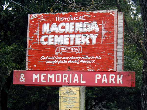
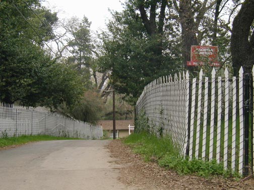
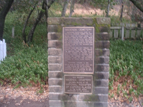
| Description | : | Located in the Santa Teresa Hills. "California Point of Historical Interest Number SCL-052" Dating back to the early 1850's, this cemetery was in use until the 1920's when Musician Ben Black, who wrote the then popular song, "Moonlight and Roses", bought some of the mining company land at the Hacienda and subdivided it. Bertram Road was cut through the cemetery over the tops of an unknown number of graves. After being tax-deeded to historian Gene Vennum, he turned the Hacienda Cemetery over to the California Pioneers of Santa Clara County in 1974. |
frequently asked questions (FAQ):
-
Where is Hacienda Cemetery and Memorial Park?
Hacienda Cemetery and Memorial Park is located at 21480 Bertram Road New Almaden, Santa Clara County ,California , 95120USA.
-
Hacienda Cemetery and Memorial Park cemetery's updated grave count on graveviews.com?
0 memorials
-
Where are the coordinates of the Hacienda Cemetery and Memorial Park?
Latitude: 37.1741940
Longitude: -121.8230920
Nearby Cemetories:
1. Hidalgo Cemetery
San Jose, Santa Clara County, USA
Coordinate: 37.1707800, -121.8358700
2. Guadalupe Cemetery
New Almaden, Santa Clara County, USA
Coordinate: 37.1734690, -121.8402820
3. Los Gatos Memorial Park
San Jose, Santa Clara County, USA
Coordinate: 37.2444000, -121.9405975
4. First Presbyterian Church of Los Gatos Mem Garden
Los Gatos, Santa Clara County, USA
Coordinate: 37.2328910, -121.9593590
5. Holy Cross Cemetery
San Jose, Santa Clara County, USA
Coordinate: 37.2936640, -121.8731080
6. Saint Francis of Asissi Memorial Garden
San Jose, Santa Clara County, USA
Coordinate: 37.2936600, -121.7687000
7. Beth David Memorial Garden
San Jose, Santa Clara County, USA
Coordinate: 37.2989006, -121.8591995
8. Home of Peace Cemetery
San Jose, Santa Clara County, USA
Coordinate: 37.2989006, -121.8591995
9. Islamic Cemetery
San Jose, Santa Clara County, USA
Coordinate: 37.2989006, -121.8591995
10. Oak Hill Memorial Park
San Jose, Santa Clara County, USA
Coordinate: 37.2986200, -121.8623800
11. Historic Chinese American Cemetery
San Jose, Santa Clara County, USA
Coordinate: 37.2989290, -121.8677150
12. Hebbard Cemetery
Los Gatos, Santa Clara County, USA
Coordinate: 37.1727340, -121.9925710
13. Saint Lukes Episcopal Church Columbarium
Los Gatos, Santa Clara County, USA
Coordinate: 37.2227440, -121.9822070
14. Rundell Cemetery
Los Gatos, Santa Clara County, USA
Coordinate: 37.1872545, -121.9954677
15. Willow Glen United Methodist Church Columbarium
San Jose, Santa Clara County, USA
Coordinate: 37.3017010, -121.9008530
16. Mount Hope Cemetery
Morgan Hill, Santa Clara County, USA
Coordinate: 37.1195900, -121.6530000
17. Martin Family Burial Ground
Glenwood, Santa Cruz County, USA
Coordinate: 37.1083870, -121.9868690
18. Santa Clara County Hospital Cemetery
San Jose, Santa Clara County, USA
Coordinate: 37.3129990, -121.9357970
19. Saratoga IOOF Cemetery
Saratoga, Santa Clara County, USA
Coordinate: 37.2511482, -122.0073624
20. Trinity Episcopal Cathedral Columbarium
San Jose, Santa Clara County, USA
Coordinate: 37.3377970, -121.8906590
21. Winchester Mystery House Pet Cemetery
San Jose, Santa Clara County, USA
Coordinate: 37.3178480, -121.9507020
22. Day Valley Cemetery
Aptos, Santa Cruz County, USA
Coordinate: 36.9974050, -121.8503360
23. A.M.O.R.C. Rosicrucian Order
San Jose, Santa Clara County, USA
Coordinate: 37.3343610, -121.9231480
24. Saint Josephs Monastery Cemetery
Aptos, Santa Cruz County, USA
Coordinate: 36.9947200, -121.8361700


