
| Memorials | : | 0 |
| Location | : | Baldwin County, USA |
| Coordinate | : | 32.9769700, -83.1667500 |
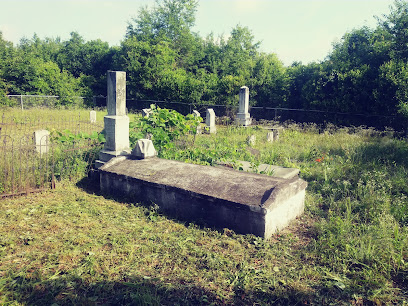
| Description | : | African American Cemetery almost completely destroyed. There are only a few markers that remain. The cemetery is very large, approximately 150 feet by 300 feet. Several unmarked slabs, iron post marks 1 grave, field stone mark several graves and obvious depressions mark more graves. There are too many unmarked graves in this cemetery to count them accurately. Directions: From the Baldwin County Courthouse, go east on Hancock St. one block. Turn right (south) on Wayne St., which becomes Business 441 South. Go 0.9 mile to the Vinson Highway (Hwy 112). Turn left at on the Vinson Highway. Go 6.6 miles to Benson-Adams Rd.... Read More |
frequently asked questions (FAQ):
-
Where is Hall's Cemetery #1?
Hall's Cemetery #1 is located at Baldwin County ,Georgia ,USA.
-
Hall's Cemetery #1 cemetery's updated grave count on graveviews.com?
0 memorials
-
Where are the coordinates of the Hall's Cemetery #1?
Latitude: 32.9769700
Longitude: -83.1667500
Nearby Cemetories:
1. Hall Cemetery #3
Baldwin County, USA
Coordinate: 32.9760300, -83.1704200
2. Bland Cemetery
Milledgeville, Baldwin County, USA
Coordinate: 33.0010986, -83.1932983
3. Emerald Acres Farm Cemetery
Baldwin County, USA
Coordinate: 33.0051120, -83.1935490
4. Georgia Veterans Memorial Cemetery
Milledgeville, Baldwin County, USA
Coordinate: 33.0102463, -83.1962738
5. Lattimore Family Cemetery #2
Milledgeville, Baldwin County, USA
Coordinate: 33.0276800, -83.1583100
6. Baldwin County Poorhouse Cemetery
Hardwick, Baldwin County, USA
Coordinate: 32.9776700, -83.2326700
7. Tollison Family Cemetery
Scottsboro, Baldwin County, USA
Coordinate: 32.9853600, -83.2323100
8. Ennis Family Cemetery
Milledgeville, Baldwin County, USA
Coordinate: 33.0254210, -83.1297950
9. Oak Grove Methodist Church Cemetery
Scottsboro, Baldwin County, USA
Coordinate: 33.0036790, -83.2359020
10. Oak Bethel Church Cemetery
Montpelier, Baldwin County, USA
Coordinate: 33.0141100, -83.1002200
11. Mount Pleasant Baptist Church Cemetery
Mount Pleasant, Baldwin County, USA
Coordinate: 32.9830100, -83.2467200
12. Wimberly Family Cemetery
Scottsboro, Baldwin County, USA
Coordinate: 33.0210670, -83.2301690
13. Hubbard Cemetery
Coopers, Baldwin County, USA
Coordinate: 32.9752500, -83.2491100
14. Samuel Boykin Family Cemetery
Milledgeville, Baldwin County, USA
Coordinate: 32.9915260, -83.0860820
15. Friendship Baptist Church Cemetery
Milledgeville, Baldwin County, USA
Coordinate: 33.0228630, -83.1043780
16. Jasmine Ridge Cemetery
Milledgeville, Baldwin County, USA
Coordinate: 33.0256700, -83.2266400
17. Friendship Baptist Church Cemetery
Baldwin County, USA
Coordinate: 33.0232800, -83.1042220
18. Osborne Family Cemetery
Milledgeville, Baldwin County, USA
Coordinate: 33.0431460, -83.1395800
19. Central State Hospital Cemetery #3
Milledgeville, Baldwin County, USA
Coordinate: 33.0304400, -83.2250000
20. Old duBignon Plantation Cemetery
Milledgeville, Baldwin County, USA
Coordinate: 33.0152500, -83.2435390
21. John Robinson Cemetery
Milledgeville, Baldwin County, USA
Coordinate: 33.0153600, -83.0897500
22. Central State Hospital Cemetery #4
Milledgeville, Baldwin County, USA
Coordinate: 33.0365800, -83.2225300
23. Gum Hill Baptist Church Old Cemetery
Montpelier, Baldwin County, USA
Coordinate: 32.9723730, -83.0754780
24. Whitaker Graveyard
Milledgeville, Baldwin County, USA
Coordinate: 32.9725350, -83.0753150