
| Memorials | : | 2 |
| Location | : | Bennington Township, Licking County, USA |
| Coordinate | : | 40.2695110, -82.5806410 |
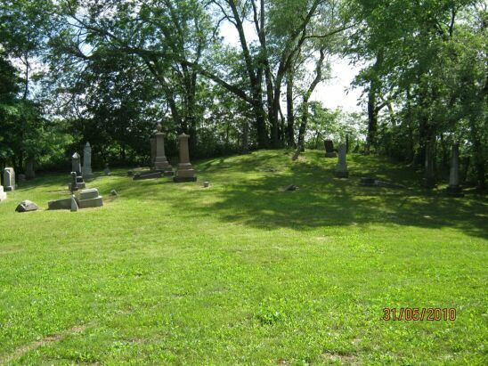
| Description | : | The cemetery is located about 1400 feet east of Hall Road (Township Road 74) / Larimore Road (Township Road 116) about 0.25 miles north of its intersection with Homer Road NW (County Road 19). The cemetery is split into two sections, one south of the county line in Bennington Township in Licking County and one north of the county line in Milford Township in Knox County. The cemetery is located in Bennington Township, Licking County, Ohio, and is # 6611 (Hall Cemetery) in “Ohio Cemeteries 1803-2003”, compiled by the Ohio Genealogical Society. |
frequently asked questions (FAQ):
-
Where is Hall Cemetery?
Hall Cemetery is located at Hall Road (Township Road 74) / Larimore Road (Township Road 116) Bennington Township, Licking County ,Ohio , 43011USA.
-
Hall Cemetery cemetery's updated grave count on graveviews.com?
2 memorials
-
Where are the coordinates of the Hall Cemetery?
Latitude: 40.2695110
Longitude: -82.5806410
Nearby Cemetories:
1. Hall Cemetery
Milfordton, Knox County, USA
Coordinate: 40.2699430, -82.5805820
2. Atherton-Chrisman-Dowell-Jagger Cemetery
Knox County, USA
Coordinate: 40.2783012, -82.6033020
3. Lock Cemetery
Lock, Licking County, USA
Coordinate: 40.2682991, -82.6085968
4. Simmons Cemetery
Licking County, USA
Coordinate: 40.2583000, -82.5370000
5. Bennington Chapel Cemetery
Licking County, USA
Coordinate: 40.2399100, -82.6058600
6. Hall Cemetery
Milford Township, Knox County, USA
Coordinate: 40.2724170, -82.6328200
7. Moreland - Simmons Cemetery
Knox County, USA
Coordinate: 40.2957993, -82.6250000
8. Homer Cemetery
Homer, Licking County, USA
Coordinate: 40.2534000, -82.5243000
9. Five Corners - Disney Cemetery
Knox County, USA
Coordinate: 40.3149986, -82.5950012
10. Patterson Cemetery
Johnstown, Licking County, USA
Coordinate: 40.2187820, -82.5439100
11. Stigers Cemetery
Milfordton, Knox County, USA
Coordinate: 40.3180550, -82.6243880
12. Appleton Cemetery
Licking County, USA
Coordinate: 40.2136002, -82.6057968
13. Robbins Cemetery
Centerburg, Knox County, USA
Coordinate: 40.2821470, -82.6591530
14. Miller Cemetery
Knox County, USA
Coordinate: 40.3266983, -82.5346985
15. Brandon Cemetery
Brandon, Knox County, USA
Coordinate: 40.3123900, -82.5127300
16. Fairview Cemetery
Mount Vernon, Knox County, USA
Coordinate: 40.2678580, -82.4879520
17. Bird Cemetery
Bangs, Knox County, USA
Coordinate: 40.3483009, -82.5789032
18. County Home Cemetery
Bangs, Knox County, USA
Coordinate: 40.3469009, -82.5539017
19. Hartford Cemetery
Croton, Licking County, USA
Coordinate: 40.2391700, -82.6829700
20. Beulah United Methodist Cemetery
Bangs, Knox County, USA
Coordinate: 40.3517780, -82.5554600
21. Atherton Cemetery
Bangs, Knox County, USA
Coordinate: 40.3543020, -82.5847720
22. Conard Cemetery
Utica, Licking County, USA
Coordinate: 40.2253090, -82.4827950
23. Centerburg Cemetery
Centerburg, Knox County, USA
Coordinate: 40.2957993, -82.6908035
24. Mount Liberty Cemetery
Mount Liberty, Knox County, USA
Coordinate: 40.3472400, -82.6358300