
| Memorials | : | 2 |
| Location | : | Murphy, Mayes County, USA |
| Coordinate | : | 36.1511002, -95.2181015 |
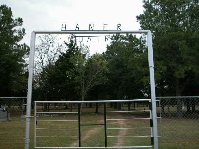
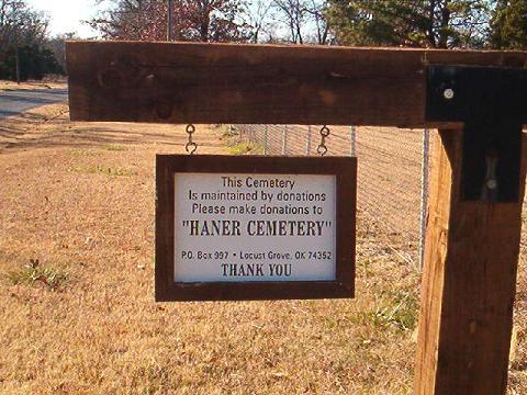
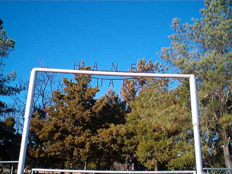
| Description | : | The Haner-Adair Cemetery resulted from the relocation of several rural cemeteries during the construction of Fort Gibson Lake. Construction of the lake began in 1942, but World War II halted the project. The completion of the lake occurred in September 1953. The following cemeteries were relocated during the construction of the lake and now form the Haner-Adair Cemetery which is located in Section 6, Township 19 North, Range 20 East near the community of Murphy, Mayes County, Oklahoma: Adair Cemetery - This cemetery was originally located in Section 10, Township 19 North, Range 19 East, approximately four miles southeast of Chouteau,... Read More |
frequently asked questions (FAQ):
-
Where is Haner Cemetery?
Haner Cemetery is located at Murphy, Mayes County ,Oklahoma ,USA.
-
Haner Cemetery cemetery's updated grave count on graveviews.com?
2 memorials
-
Where are the coordinates of the Haner Cemetery?
Latitude: 36.1511002
Longitude: -95.2181015
Nearby Cemetories:
1. Marcum Cemetery
Murphy, Mayes County, USA
Coordinate: 36.1629510, -95.2225130
2. Ballou Cemetery
Mayes County, USA
Coordinate: 36.1333400, -95.1827900
3. Cavalier-Vann Cemetery
Locust Grove, Mayes County, USA
Coordinate: 36.1585999, -95.1675034
4. Hogan Cemetery South
Locust Grove, Mayes County, USA
Coordinate: 36.1976013, -95.2154999
5. Hogan Cemetery
Locust Grove, Mayes County, USA
Coordinate: 36.1988983, -95.2164001
6. McClain Cemetery
Locust Grove, Mayes County, USA
Coordinate: 36.1567001, -95.1568985
7. Hunter Family Cemetery
Locust Grove, Mayes County, USA
Coordinate: 36.1181955, -95.1718788
8. Batt Family Cemetery
Murphy, Mayes County, USA
Coordinate: 36.1181950, -95.1718780
9. George Mayes Cemetery
Mayes County, USA
Coordinate: 36.2111100, -95.2295100
10. Union Mission Cemetery
Mayes County, USA
Coordinate: 36.1244011, -95.2874985
11. Old Osage Cemetery
Chouteau, Mayes County, USA
Coordinate: 36.2059410, -95.2798470
12. Sixkiller Cemetery
Locust Grove, Mayes County, USA
Coordinate: 36.2144570, -95.1651110
13. Sixkiller Cemetery
Sportsmen Acres, Mayes County, USA
Coordinate: 36.2135600, -95.2804300
14. Gray Cemetery
Cherokee County, USA
Coordinate: 36.0703011, -95.1941986
15. Alberty Cemetery
Sportsmen Acres, Mayes County, USA
Coordinate: 36.2318993, -95.2656021
16. Downing Cemetery
Mayes County, USA
Coordinate: 36.0611000, -95.2022018
17. Bryan-Lindsey Family Cemetery
Boatman, Mayes County, USA
Coordinate: 36.2491600, -95.1869500
18. Brushy Creek Cemetery
Mayes County, USA
Coordinate: 36.1860010, -95.3431750
19. Bryan Chapel Cemetery
Boatman, Mayes County, USA
Coordinate: 36.2586110, -95.1886100
20. Chouteau Cemetery North
Chouteau, Mayes County, USA
Coordinate: 36.1955986, -95.3447037
21. Peggs Cemetery
Peggs, Cherokee County, USA
Coordinate: 36.0886002, -95.0997009
22. Little Rock Cemetery
Locust Grove, Mayes County, USA
Coordinate: 36.2144012, -95.0986023
23. Chouteau Cemetery West
Chouteau, Mayes County, USA
Coordinate: 36.1915860, -95.3558030
24. Our Lady of Clear Creek Abbey Cemetery
Hulbert, Cherokee County, USA
Coordinate: 36.0339950, -95.1959270