
| Memorials | : | 29 |
| Location | : | Rouzerville, Franklin County, USA |
| Coordinate | : | 39.7215700, -77.5330200 |
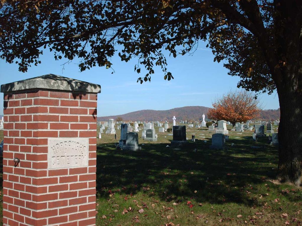
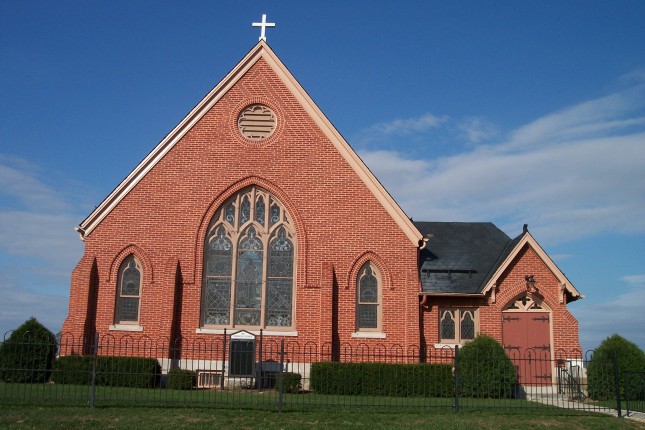
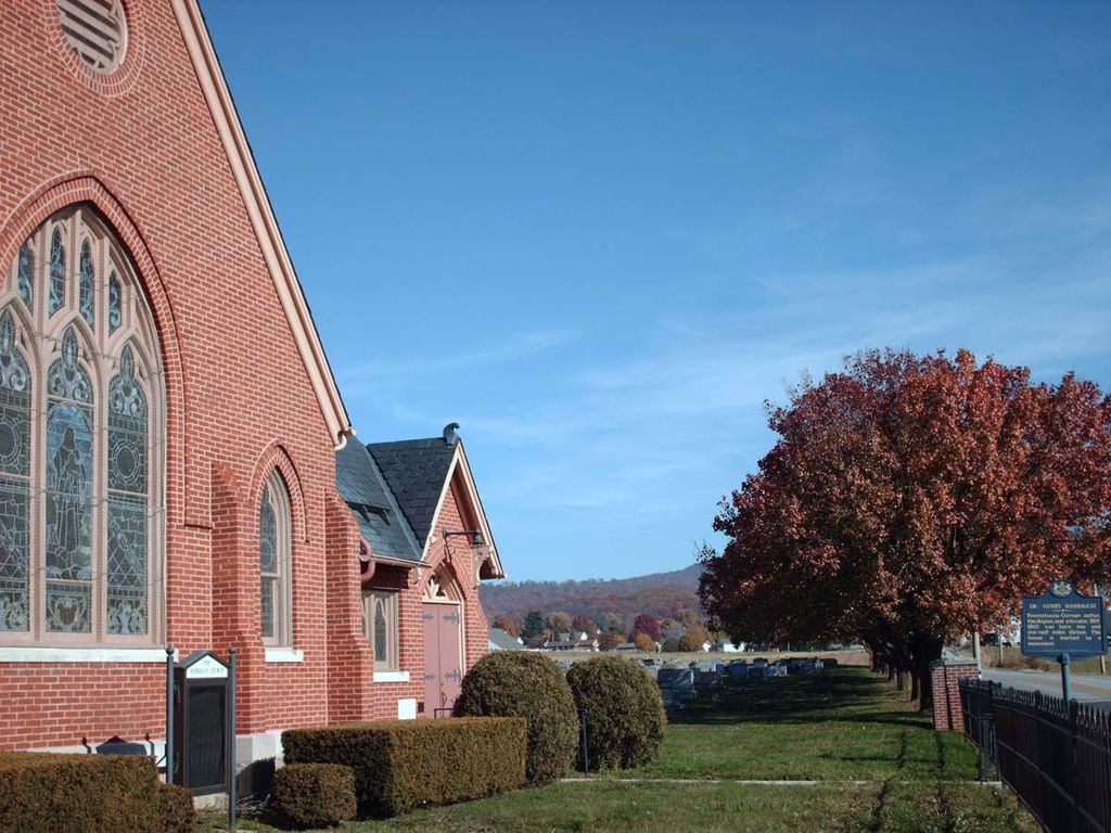
| Description | : | Harbaugh German Reformed Church was erected on this land in 1846. The present building was built in 1892 after the original building was torn down. The Waynesboro Historical Society purchased the building and cemetery in 1983. The church building was placed on the National Register of Historical Places in 2002. Currently the building is used for meetings and gatherings, as well as the occasional wedding or funeral. The cemetery is still an active cemetery. Directions to Harbaugh Church from Waynesboro: Take Rt. 16 east from Waynesboro center square about 2.5 miles to Midvale Road on the right. Follow Midvale... Read More |
frequently asked questions (FAQ):
-
Where is Harbaugh Church Cemetery?
Harbaugh Church Cemetery is located at Rouzerville, Franklin County ,Pennsylvania ,USA.
-
Harbaugh Church Cemetery cemetery's updated grave count on graveviews.com?
26 memorials
-
Where are the coordinates of the Harbaugh Church Cemetery?
Latitude: 39.7215700
Longitude: -77.5330200

Nearby Cemetories:
1. Zentmyer Cemetery
Waterloo, Franklin County, USA
Coordinate: 39.7291139, -77.5309781
2. Amsterdam Church Cemetery
Rouzerville, Franklin County, USA
Coordinate: 39.7359770, -77.5340590
3. John Hoover Ringgold Cemetery
Ringgold, Washington County, USA
Coordinate: 39.7073150, -77.5510810
4. Hess Cemetery
Waynesboro, Franklin County, USA
Coordinate: 39.7425003, -77.5338898
5. Royer Cemetery
Waynesboro, Franklin County, USA
Coordinate: 39.7376300, -77.5525000
6. Ringgold Cemetery
Ringgold, Washington County, USA
Coordinate: 39.7113991, -77.5663986
7. Bonebrake Family Cemetery
Waynesboro, Franklin County, USA
Coordinate: 39.7533000, -77.5386200
8. Burns Family Cemetery
Waynesboro, Franklin County, USA
Coordinate: 39.7443900, -77.5627300
9. Stoner Cemetery
Waynesboro, Franklin County, USA
Coordinate: 39.7385500, -77.5713600
10. Calvary Episcopal Chapel Cemetery
Beartown, Franklin County, USA
Coordinate: 39.7443000, -77.4939000
11. Stouffers Mennonite Church Cemetery
Smithsburg, Washington County, USA
Coordinate: 39.6858800, -77.5570400
12. Germantown Bethel Cemetery
Cascade, Frederick County, USA
Coordinate: 39.6999168, -77.4857712
13. Burns Hill Cemetery
Waynesboro, Franklin County, USA
Coordinate: 39.7540200, -77.5714800
14. Welty Church of the Brethren Cemetery
Smithsburg, Washington County, USA
Coordinate: 39.6857900, -77.5698300
15. Saint Andrew Catholic Cemetery
Waynesboro, Franklin County, USA
Coordinate: 39.7581400, -77.5729100
16. Union Church Cemetery (Defunct)
Waynesboro, Franklin County, USA
Coordinate: 39.7535000, -77.5795000
17. Green Hill Cemetery
Waynesboro, Franklin County, USA
Coordinate: 39.7402992, -77.5905991
18. Snowberger Cemetery
Roadside, Franklin County, USA
Coordinate: 39.7705350, -77.5141400
19. Cochran Family Burial Ground
Waynesboro, Franklin County, USA
Coordinate: 39.7586510, -77.5831120
20. Mount Zion United Methodist Church Cemetery
Smithsburg, Washington County, USA
Coordinate: 39.6719100, -77.4991300
21. Eulid Brown Family Cemetery
Smithsburg, Washington County, USA
Coordinate: 39.6728300, -77.4959800
22. Benchoff Family Cemetery
Charmian, Franklin County, USA
Coordinate: 39.7468800, -77.4639600
23. Old Forge Cemetery
Franklin County, USA
Coordinate: 39.7800100, -77.5094400
24. Fellowship Independence Cemetery
Waynesboro, Franklin County, USA
Coordinate: 39.7831010, -77.5408440