
| Memorials | : | 0 |
| Location | : | Moberly, Randolph County, USA |
| Coordinate | : | 39.4620720, -92.3594210 |
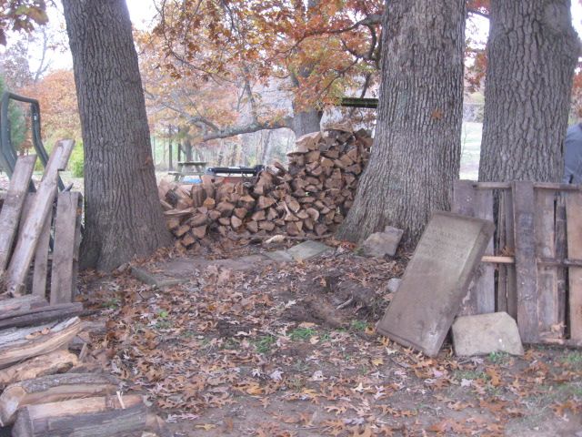
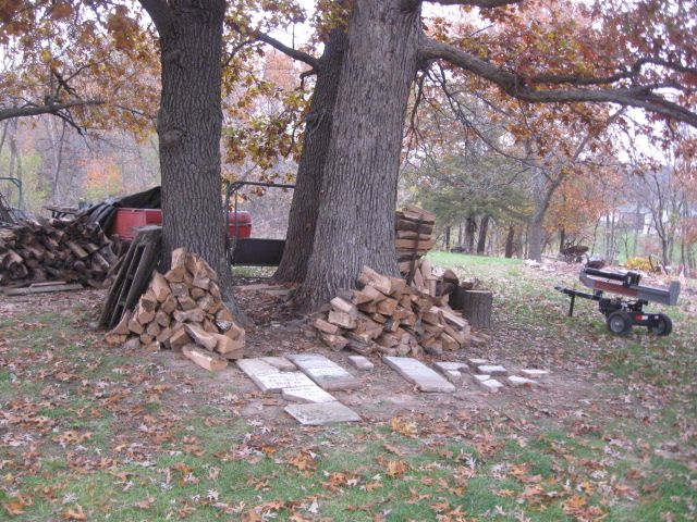
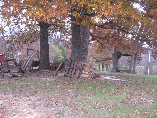
| Description | : | This previously unrecorded cemetery is located in T54 R13 S22 SW 1/4NW 1/4 on the north side of Hwy 24 between the racetrack and Antioch Church Cemetery (in 2018). This land was originally purchased by Lewis Newton in 1833. The cemetery is marked on the 1910 plat on Luther French land. This land was in pasture for decades with many thorny locusts until the late 1990's and early 2000's when it was purchased and cleared by the current landowner who did not know of the cemetery's existence. Broken pieces of stones were found scattered all... Read More |
frequently asked questions (FAQ):
-
Where is Harman-Lampton-Newton Cemetery?
Harman-Lampton-Newton Cemetery is located at Moberly, Randolph County ,Missouri ,USA.
-
Harman-Lampton-Newton Cemetery cemetery's updated grave count on graveviews.com?
0 memorials
-
Where are the coordinates of the Harman-Lampton-Newton Cemetery?
Latitude: 39.4620720
Longitude: -92.3594210
Nearby Cemetories:
1. Antioch Christian Cemetery
Moberly, Randolph County, USA
Coordinate: 39.4635100, -92.3566700
2. McCampbell Cemetery
Randolph County, USA
Coordinate: 39.4645810, -92.3935890
3. Vince Cemetery
Moberly, Randolph County, USA
Coordinate: 39.4533005, -92.3985977
4. Grimes-DeGarmo Cemetery
Randolph County, USA
Coordinate: 39.4223050, -92.3873610
5. Pleasant View Cemetery
Randolph County, USA
Coordinate: 39.5107994, -92.3668976
6. Alexander-Miller Cemetery
Ash, Monroe County, USA
Coordinate: 39.4674200, -92.2951550
7. Caleb Embree Cemetery
Monroe County, USA
Coordinate: 39.4324000, -92.3067000
8. Meals Cemetery
Randolph County, USA
Coordinate: 39.4099998, -92.3632965
9. Jones Cemetery
Randolph County, USA
Coordinate: 39.4198400, -92.4052800
10. Embree Cemetery
Monroe County, USA
Coordinate: 39.4351900, -92.2958600
11. Memorial Park Cemetery
Moberly, Randolph County, USA
Coordinate: 39.4508018, -92.4332962
12. Dunn Family Cemetery
Moberly, Randolph County, USA
Coordinate: 39.4076800, -92.3298700
13. Saint Marys Cemetery
Moberly, Randolph County, USA
Coordinate: 39.4227982, -92.4169006
14. Cottingham Cemetery
Madison, Monroe County, USA
Coordinate: 39.4658012, -92.2806015
15. Deskin Cemetery
Moberly, Randolph County, USA
Coordinate: 39.4155998, -92.4116974
16. Oakland Cemetery
Moberly, Randolph County, USA
Coordinate: 39.4178009, -92.4203033
17. Stevens burial ground
Madison, Monroe County, USA
Coordinate: 39.4631000, -92.2737000
18. Hickory Grove Cemetery
Ash, Monroe County, USA
Coordinate: 39.5149000, -92.2912390
19. Sugar Creek Cemetery
Moberly, Randolph County, USA
Coordinate: 39.4468994, -92.4550018
20. Snell Cemetery
Monroe County, USA
Coordinate: 39.4261000, -92.2712000
21. Brooks-Mobley Cemetery
Randolph County, USA
Coordinate: 39.3838040, -92.3529620
22. Old Pioneer, New Design Cemetery
Monroe County, USA
Coordinate: 39.4209000, -92.2708000
23. Wolff Cemetery
Madison, Monroe County, USA
Coordinate: 39.4361860, -92.2579300
24. Engle Cemetery
Middle Grove, Monroe County, USA
Coordinate: 39.3958940, -92.2951640