| Memorials | : | 0 |
| Location | : | Trenton, Jones County, USA |
| Coordinate | : | 35.0930510, -77.3051740 |
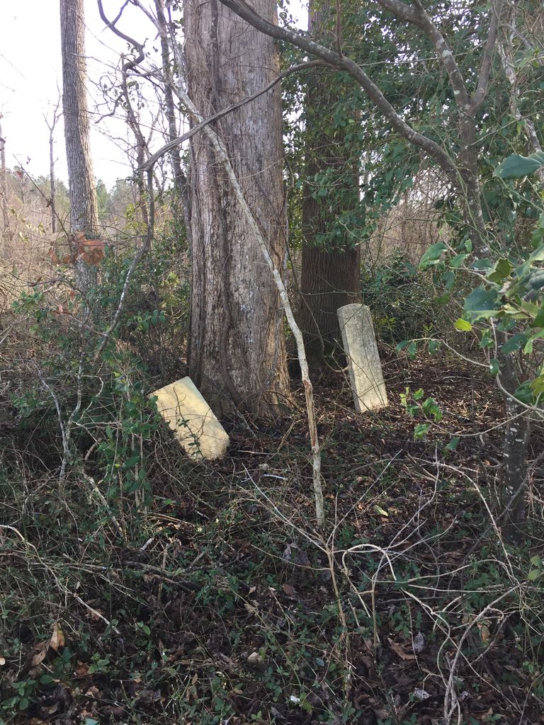
| Description | : | This cemetery is well off the beaten path and in pretty bad shape. From 10 Mile Fork Road, go north on Furney Brock Road until you reach Jumping Creek. At this point you'll need go by foot. Cross Jumping Creek and proceed to the left following the tree line. You'll notice a group of trees protruding into the field. This is where the cemetery is located. If you plug the coordinates "35.093051, -77.305174" into Google Maps you'll find the exact location. There are most likely several unmarked graves as well. |
frequently asked questions (FAQ):
-
Where is Harrison & Andrews Cemetery?
Harrison & Andrews Cemetery is located at Trenton, Jones County ,North Carolina ,USA.
-
Harrison & Andrews Cemetery cemetery's updated grave count on graveviews.com?
0 memorials
-
Where are the coordinates of the Harrison & Andrews Cemetery?
Latitude: 35.0930510
Longitude: -77.3051740
Nearby Cemetories:
1. Barfield Cemetery
Trenton, Jones County, USA
Coordinate: 35.0850000, -77.3063890
2. Andrews Chapel Cemetery
Trenton, Jones County, USA
Coordinate: 35.0868520, -77.3295110
3. Bryant Cemetery
Trenton, Jones County, USA
Coordinate: 35.0919440, -77.3322220
4. Andrews Burying Ground
Trenton, Jones County, USA
Coordinate: 35.0779090, -77.3308240
5. Friendship Church Cemetery
Trenton, Jones County, USA
Coordinate: 35.0974660, -77.3407790
6. Murrell Cemetery
Trenton, Jones County, USA
Coordinate: 35.0636110, -77.2844440
7. Nathan Foscue Cemetery
Trenton, Jones County, USA
Coordinate: 35.0586830, -77.3005250
8. Banks Cemetery
Trenton, Jones County, USA
Coordinate: 35.0669020, -77.2762280
9. Ward Family Cemetery
Trenton, Jones County, USA
Coordinate: 35.0833330, -77.3527780
10. Barber Graveyard
Trenton, Jones County, USA
Coordinate: 35.0636110, -77.3422220
11. Trenton Municipal Cemetery
Trenton, Jones County, USA
Coordinate: 35.0622680, -77.3517380
12. Jones County Courthouse Grounds
Trenton, Jones County, USA
Coordinate: 35.0630460, -77.3537020
13. Haiti Cemetery
Trenton, Jones County, USA
Coordinate: 35.0687430, -77.3586130
14. Brown Cemetery
Trenton, Jones County, USA
Coordinate: 35.0536110, -77.3527780
15. Heath Cemetery
Trenton, Jones County, USA
Coordinate: 35.0376120, -77.3022720
16. Williams Family Cemetery
Pollocksville, Jones County, USA
Coordinate: 35.0513970, -77.2498840
17. Maple Grove Cemetery
Jones County, USA
Coordinate: 35.0313840, -77.3227560
18. Pollock Cemetery on McDaniel Loop Road
Jones County, USA
Coordinate: 35.0296400, -77.3233800
19. Flanner White Cemetery
Pollocksville, Jones County, USA
Coordinate: 35.0359500, -77.2572600
20. Mill Run Free Will Baptist Church Cemetery
Pollocksville, Jones County, USA
Coordinate: 35.0232490, -77.3011780
21. Heath Family Cemetery
Craven County, USA
Coordinate: 35.1607500, -77.3301200
22. Mark Hebrew McCoy Family Cemetery
Cove City, Craven County, USA
Coordinate: 35.1634680, -77.3147650
23. Thomas Green Family Cemetery
Jones County, USA
Coordinate: 35.0613890, -77.3838890
24. Wilson Family Cemetery
Trenton, Jones County, USA
Coordinate: 35.0900520, -77.3935427

