
| Memorials | : | 0 |
| Location | : | Ashville, Pickaway County, USA |
| Coordinate | : | 39.7950920, -82.9890850 |
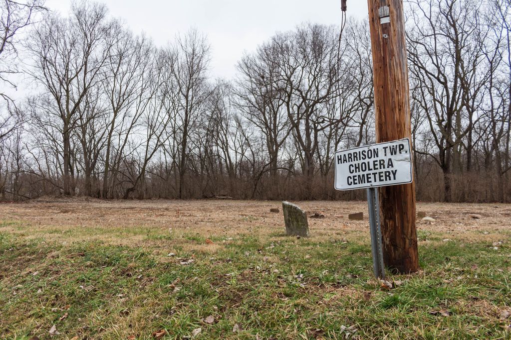
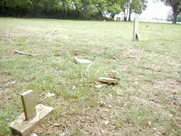
| Description | : | The cemetery is also known as The Paul Peters Farm Cemetery. The listing of names here is from the November 30, 1998 listing done for the Pickaway County Historical Society. The cemetery sits directly on Old Route 23 (T525), immediately south of the Franklin County/Pickaway County line. Few stones remain; however, stones were found for individuals not mentioned in the 1998 reporting of the cemetery. Those are indicated with the listings. The cemetery is located in Harrison Township, Pickaway County, Ohio, and is # 9480 (Cholera Cemetery / Helen, Harold, and Paul Peters Cemetery) in “Ohio... Read More |
frequently asked questions (FAQ):
-
Where is Harrison Township Cholera Cemetery?
Harrison Township Cholera Cemetery is located at Picway Road (Township Road 525) Ashville, Pickaway County ,Ohio , 43137USA.
-
Harrison Township Cholera Cemetery cemetery's updated grave count on graveviews.com?
0 memorials
-
Where are the coordinates of the Harrison Township Cholera Cemetery?
Latitude: 39.7950920
Longitude: -82.9890850


Nearby Cemetories:
1. Williams Family Cemetery
Franklin County, USA
Coordinate: 39.8122400, -82.9963300
2. Decker Cemetery
Lockbourne, Franklin County, USA
Coordinate: 39.8066010, -82.9695860
3. Fernwood Cemetery
Lockbourne, Franklin County, USA
Coordinate: 39.8168983, -82.9860992
4. Lockbourne Cemetery
Lockbourne, Franklin County, USA
Coordinate: 39.8087196, -82.9658585
5. Saint Joseph Cemetery
Lockbourne, Franklin County, USA
Coordinate: 39.8244019, -82.9982986
6. Landes Cemetery
Lockbourne, Franklin County, USA
Coordinate: 39.8219440, -82.9700160
7. Smith Farm Cemetery
Franklin County, USA
Coordinate: 39.8109400, -82.9459560
8. Scioto Cemetery
Franklin County, USA
Coordinate: 39.8100014, -83.0344009
9. Caldwell Farm Cemetery
Commercial Point, Pickaway County, USA
Coordinate: 39.7539518, -83.0168503
10. Haughn-McCord Cemetery
Scioto Township, Pickaway County, USA
Coordinate: 39.7942010, -83.0496930
11. James Borror Farm Cemetery
Pickaway County, USA
Coordinate: 39.7519690, -83.0144500
12. Huddle Cemetery
Groveport, Franklin County, USA
Coordinate: 39.8274510, -82.9349970
13. Beckett Cemetery
Commercial Point, Pickaway County, USA
Coordinate: 39.7766991, -83.0580978
14. Burnley Family Cemetery
Commercial Point, Pickaway County, USA
Coordinate: 39.7692650, -83.0558040
15. Presbyterian Cemetery
Commercial Point, Pickaway County, USA
Coordinate: 39.7609000, -83.0504600
16. Press Peters Farm Cemetery
Commercial Point, Pickaway County, USA
Coordinate: 39.7496470, -83.0378710
17. Walnut Hill Cemetery
Columbus, Franklin County, USA
Coordinate: 39.8610916, -82.9779358
18. Seeds Family Cemetery
Franklin County, USA
Coordinate: 39.8088989, -83.0742035
19. A R Duvall Cemetery
Ashville, Pickaway County, USA
Coordinate: 39.7447850, -82.9235130
20. Hopewell Cemetery
Groveport, Franklin County, USA
Coordinate: 39.8036003, -82.8921967
21. Cox Cemetery
Groveport, Franklin County, USA
Coordinate: 39.8579930, -82.9322530
22. Concord Cemetery
Grove City, Franklin County, USA
Coordinate: 39.8386002, -83.0726624
23. Rarey Cemetery
Groveport, Franklin County, USA
Coordinate: 39.8236008, -82.8942032
24. Watkins Cemetery
Obetz, Franklin County, USA
Coordinate: 39.8744011, -82.9880981