
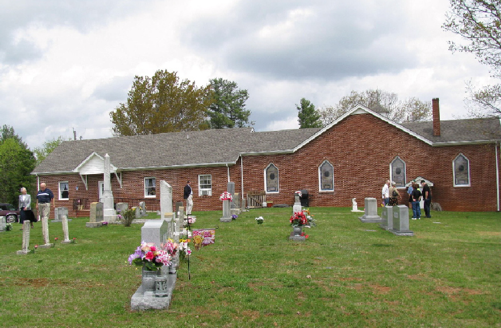
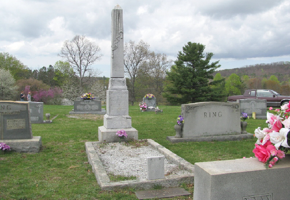
| Memorials | : | 27 |
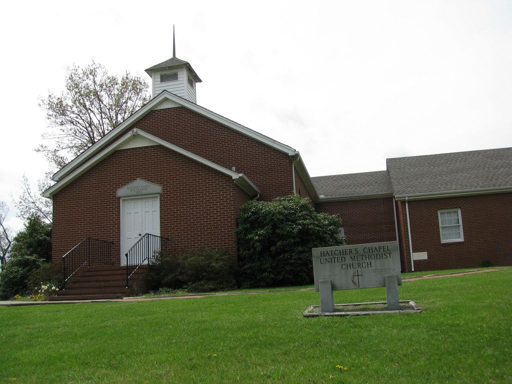
| Location | : | Claudville, Patrick County, USA |
| Coordinate | : | 36.5592080, -80.4639930 |
| Description | : | From the intersection of Hatchers Chapel Road (VA Route 645) and Claudville Highway (VA Highway 103), travel approximately 0.29 miles on Hatchers Chapel Road; the church will be on the right; the cemetery is located behind the church. |
frequently asked questions (FAQ):
-
Where is Hatchers Chapel United Methodist Church Cemetery?
Hatchers Chapel United Methodist Church Cemetery is located at 268 Hatchers Chapel Road Claudville, Patrick County ,Virginia , 24076USA.
-
Hatchers Chapel United Methodist Church Cemetery cemetery's updated grave count on graveviews.com?
27 memorials
-
Where are the coordinates of the Hatchers Chapel United Methodist Church Cemetery?
Latitude: 36.5592080
Longitude: -80.4639930
Nearby Cemetories:
1. Mountain View Pentecostal Holiness Church Cemetery
Claudville, Patrick County, USA
Coordinate: 36.5579510, -80.4603620
2. Love Family Cemetery
Claudville, Patrick County, USA
Coordinate: 36.5546200, -80.4775810
3. God's Family House of Prayer Cemetery
Claudville, Patrick County, USA
Coordinate: 36.5552400, -80.4801500
4. Mount Herman United Methodist Church Cemetery
Mount Herman, Surry County, USA
Coordinate: 36.5342216, -80.4710541
5. Unity Presbyterian Church Cemetery
Ararat, Patrick County, USA
Coordinate: 36.5847015, -80.4766998
6. Hatcher Cemetery
Claudville, Patrick County, USA
Coordinate: 36.5522003, -80.4308014
7. Believers Baptist Church Cemetery
Ararat, Patrick County, USA
Coordinate: 36.5817720, -80.4904290
8. Toney Anderson Family Cemetery
Ararat, Patrick County, USA
Coordinate: 36.5952260, -80.4735910
9. Goins Family Cemetery
Westfield Township, Surry County, USA
Coordinate: 36.5357780, -80.4993890
10. Bethel Presbyterian Church Cemetery
Claudville, Patrick County, USA
Coordinate: 36.5765420, -80.4207910
11. Burkhart Family Cemetery
Slate Mountain, Surry County, USA
Coordinate: 36.5376440, -80.5048940
12. Red Bank Primitive Baptist Church Cemetery
Claudville, Patrick County, USA
Coordinate: 36.5835540, -80.4249720
13. Slate Mountain Baptist Church Cemetery
Slate Mountain, Surry County, USA
Coordinate: 36.5389010, -80.5067890
14. Albion Missionary Baptist Church Cemetery
Albion, Surry County, USA
Coordinate: 36.5199660, -80.4493940
15. Center Church
Ararat, Patrick County, USA
Coordinate: 36.5626780, -80.5153010
16. Calvary Gospel Light Baptist Church Cemetery
Ararat, Patrick County, USA
Coordinate: 36.5627510, -80.5153190
17. Asbury Presbyterian Church Cemetery
Asbury, Stokes County, USA
Coordinate: 36.5316830, -80.4213060
18. Albion Community Church Cemetery
Albion, Surry County, USA
Coordinate: 36.5152400, -80.4496760
19. Ralph Alexander Clement Family Cemetery
Ararat, Patrick County, USA
Coordinate: 36.6029410, -80.4818880
20. Mount Ararat Pentecostal Holiness Church Cemetery
Ararat, Patrick County, USA
Coordinate: 36.5956010, -80.4996170
21. Carters Chapel Church Cemetery
Ararat, Patrick County, USA
Coordinate: 36.6030830, -80.4824980
22. Jason Benjamin Harris Family Cemetery
Ararat, Patrick County, USA
Coordinate: 36.6036200, -80.4819600
23. George Washington Clement Family Cemetery
Carters Mill, Patrick County, USA
Coordinate: 36.6066510, -80.4703270
24. Slate Cemetery
Asbury, Stokes County, USA
Coordinate: 36.5225300, -80.4242400