
| Memorials | : | 62 |
| Location | : | Chester County, USA |
| Coordinate | : | 34.8207520, -81.0942620 |
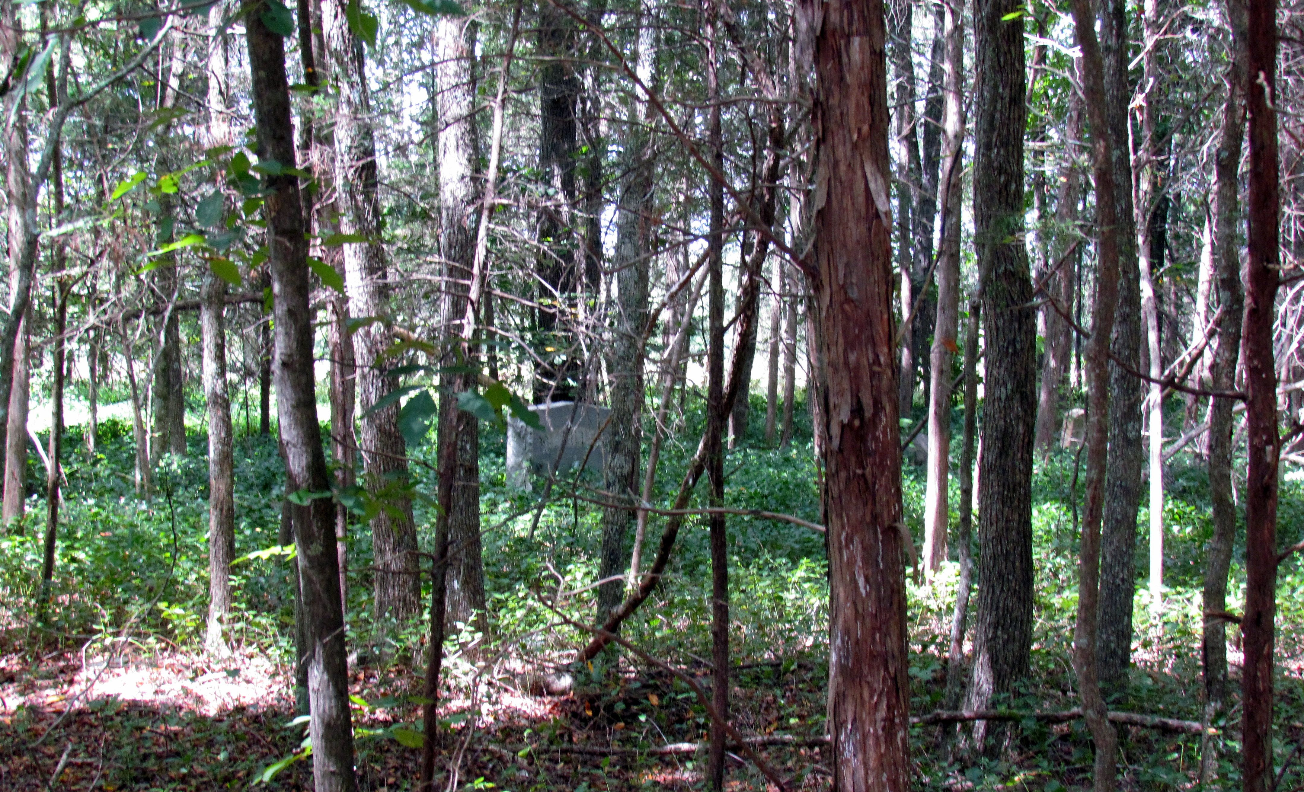
| Description | : | This is an African American Cemetery, dating back to the mid to late 1800's. The stones are in a densely wooded area on private land. The church no longer exists. All headstones were photographed on August 31st, 2021 with the exception of one stone that was very heavy and face down. There were several depressions that gave evidence to the fact that someone was buried there, but did not have a headstone. |
frequently asked questions (FAQ):
-
Where is Hebron United Presbyterian Church Cemetery?
Hebron United Presbyterian Church Cemetery is located at Chester County ,South Carolina ,USA.
-
Hebron United Presbyterian Church Cemetery cemetery's updated grave count on graveviews.com?
62 memorials
-
Where are the coordinates of the Hebron United Presbyterian Church Cemetery?
Latitude: 34.8207520
Longitude: -81.0942620
Nearby Cemetories:
1. Cedar Grove A.M.E. Zion Church Cemetery
Chester County, USA
Coordinate: 34.8208300, -81.1085800
2. Cedar Grove Baptist Church
Chester, Chester County, USA
Coordinate: 34.8069850, -81.1150390
3. Fishing Creek Presbyterian Cemetery
Chester, Chester County, USA
Coordinate: 34.8008700, -81.0668700
4. Fishing Creek Plantation
Chester, Chester County, USA
Coordinate: 34.7874220, -81.0979460
5. New Zion Baptist Church Cemetery
Rock Hill, York County, USA
Coordinate: 34.8588486, -81.1324768
6. Pleasant Ridge Baptist Church Cemetery
Rock Hill, York County, USA
Coordinate: 34.8530235, -81.0420914
7. Chestnut Grove AME Zion Cemetery
Chester County, USA
Coordinate: 34.7714400, -81.1402200
8. Uriel Presbyterian Church Cemetery
Chester, Chester County, USA
Coordinate: 34.7675040, -81.1425140
9. Rowell Family Cemetery
York County, USA
Coordinate: 34.8844670, -81.1180910
10. Mount Hopewell Baptist Church Cemetery
Chester County, USA
Coordinate: 34.7532920, -81.0988980
11. Pleasant Grove United Methodist Church Cemetery
Chester, Chester County, USA
Coordinate: 34.7603370, -81.0523030
12. Red Oak AME Zion Church Cemetery
Edgemoor, Chester County, USA
Coordinate: 34.8019210, -81.0123740
13. Edgemoor ARP Church Cemetery
Edgemoor, Chester County, USA
Coordinate: 34.8055800, -81.0104000
14. Nazareth Baptist Church Cemetery
Rock Hill, York County, USA
Coordinate: 34.8904550, -81.0700740
15. Rehoboth AME Zion Church Cemetery
Richburg, Chester County, USA
Coordinate: 34.7522200, -81.0638700
16. Robertson Family Cemetery
York County, USA
Coordinate: 34.8955910, -81.0790240
17. Mount Holly United Methodist Church Cemetery
Rock Hill, York County, USA
Coordinate: 34.8674278, -81.0165024
18. Big Calvary Baptist Church Cemetery
Edgemoor, Chester County, USA
Coordinate: 34.7882180, -81.0050820
19. Mount Pilgrim Cemetery
York County, USA
Coordinate: 34.8908120, -81.1443920
20. New Vision Freewill Baptist Church Cemetery
Rock Hill, York County, USA
Coordinate: 34.8520660, -81.0023010
21. Rives Family Burying Grounds
Edgemoor, Chester County, USA
Coordinate: 34.7990600, -80.9970000
22. Lando Cemetery
Lando, Chester County, USA
Coordinate: 34.7717300, -81.0102260
23. New Mount Olivet AME Zion Church Cemetery
Rock Hill, York County, USA
Coordinate: 34.8965874, -81.0353928
24. Mount Calvary AME Zion Church Cemetery
Rock Hill, York County, USA
Coordinate: 34.8445778, -80.9860687