| Memorials | : | 0 |
| Location | : | Piggott, Clay County, USA |
| Coordinate | : | 36.3826141, -90.2235641 |
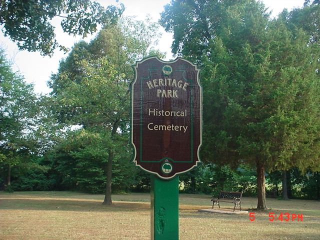
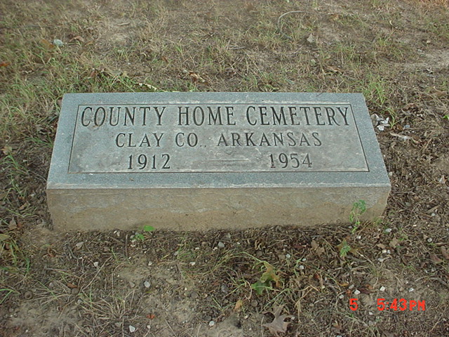
| Description | : | Now the site of Heritage Park, used to be site of the Old County Home (the county's Poor House). Where homeless and widows stayed when they had no place to go. Now is site of cemetery for residents of old county home, mostly mass grave, home was torn down in 1951, has over 60 unmarked graves, has the last Civil War vet of Clay County, Arkansas, buried here. |
frequently asked questions (FAQ):
-
Where is Heritage Park Historical Cemetery?
Heritage Park Historical Cemetery is located at Piggott, Clay County ,Arkansas ,USA.
-
Heritage Park Historical Cemetery cemetery's updated grave count on graveviews.com?
0 memorials
-
Where are the coordinates of the Heritage Park Historical Cemetery?
Latitude: 36.3826141
Longitude: -90.2235641
Nearby Cemetories:
1. Piggott Memorial Gardens
Piggott, Clay County, USA
Coordinate: 36.3736000, -90.2011032
2. Little Flock Cemetery
Pollard, Clay County, USA
Coordinate: 36.3950005, -90.2453003
3. Underwood Cemetery
Clay County, USA
Coordinate: 36.3656006, -90.2639008
4. Williams Cemetery
Greenway, Clay County, USA
Coordinate: 36.3741989, -90.2686005
5. Winston Cemetery
Clay County, USA
Coordinate: 36.3464012, -90.2382965
6. Sarver Cemetery
Clay County, USA
Coordinate: 36.4074287, -90.1787109
7. Mitchell Cemetery
Greenway, Clay County, USA
Coordinate: 36.3352013, -90.2378464
8. Fitzgerald Cemetery
Clay County, USA
Coordinate: 36.3933754, -90.2860718
9. Holcomb Cemetery
Pollard, Clay County, USA
Coordinate: 36.4321594, -90.2577896
10. Cummings Chapel Methodist Church Cemetery
Pollard, Clay County, USA
Coordinate: 36.4019012, -90.2932968
11. New Hope Cemetery
Pollard, Clay County, USA
Coordinate: 36.4272400, -90.2790400
12. Travillian Cemetery
Clay County, USA
Coordinate: 36.3382988, -90.2842026
13. Thomas Cemetery
Clay County, USA
Coordinate: 36.4478607, -90.2491913
14. Rogers Cemetery
Clay County, USA
Coordinate: 36.3939018, -90.3178024
15. Hall Cemetery
Saint Francis, Clay County, USA
Coordinate: 36.4518394, -90.1750488
16. Mars Hill Cemetery
Crockett, Clay County, USA
Coordinate: 36.3624992, -90.3275604
17. Gravel Hill Cemetery
Saint Francis, Clay County, USA
Coordinate: 36.4650002, -90.1905975
18. Blooming Grove Cemetery
Clay County, USA
Coordinate: 36.3147011, -90.2913971
19. Hillsboro Cemetery
Rector, Clay County, USA
Coordinate: 36.2975883, -90.2605820
20. Liberty Hill Cemetery
Boydsville, Clay County, USA
Coordinate: 36.3280983, -90.3182983
21. Hardin Chapel Cemetery
Clay County, USA
Coordinate: 36.3755989, -90.3405991
22. Crocketts Cemetery
Boydsville, Clay County, USA
Coordinate: 36.4185982, -90.3383026
23. Lone Grave
Clay County, USA
Coordinate: 36.3358002, -90.3331070
24. Marys Chapel Cemetery
Rector, Clay County, USA
Coordinate: 36.2921982, -90.2830963


