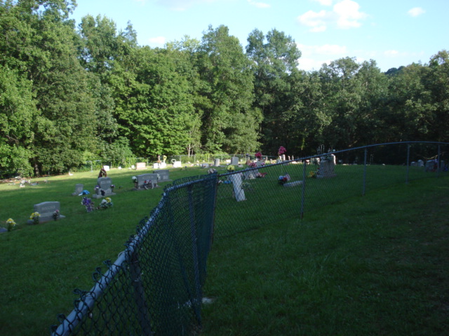
| Memorials | : | 22 |
| Location | : | Parkersburg, Wood County, USA |
| Coordinate | : | 39.2756300, -81.3593100 |
| Description | : | Take Rt. 50 East out of Parkersburg heading toward Clarksburg. Go approximately 15 miles; turn left onto Rt. 31 at the Deerwalk exit. Travel on Rt. 31 for approximately 4 miles until you reach Narrow Gage Road (graveled) - turn left onto it. Follow Narrow Gage Road for about 3/4 mile, always bearing to the right. The cemetery is at the top of the hill at the end of the road. |
frequently asked questions (FAQ):
-
Where is Herndon Chapel Cemetery?
Herndon Chapel Cemetery is located at Parkersburg, Wood County ,West Virginia ,USA.
-
Herndon Chapel Cemetery cemetery's updated grave count on graveviews.com?
21 memorials
-
Where are the coordinates of the Herndon Chapel Cemetery?
Latitude: 39.2756300
Longitude: -81.3593100
Nearby Cemetories:
1. Freshwater Cemetery
Ogden, Wood County, USA
Coordinate: 39.2711680, -81.3865000
2. Pleasant Valley Cemetery
Dallison, Wood County, USA
Coordinate: 39.2477989, -81.3630981
3. Pleasant Hill Cemetery
Deerwalk, Wood County, USA
Coordinate: 39.2526207, -81.3277588
4. Hendershot Cemetery
Tallyho, Wood County, USA
Coordinate: 39.2749990, -81.4098190
5. German-Lutheran Cemetery
Parkersburg, Wood County, USA
Coordinate: 39.2488400, -81.3073100
6. Hubbs Cemetery
Saint Marys, Pleasants County, USA
Coordinate: 39.3050167, -81.3036833
7. Darling Cemetery
Wood County, USA
Coordinate: 39.3209390, -81.3942860
8. Johnson Cemetery
Pleasants County, USA
Coordinate: 39.3232994, -81.3277969
9. Harness Cemetery
Pleasants County, USA
Coordinate: 39.3344002, -81.3591995
10. Riser Cemetery
Deerwalk, Wood County, USA
Coordinate: 39.2187090, -81.3390880
11. McMullen Cemetery
Wood County, USA
Coordinate: 39.2882530, -81.2751318
12. Campbell Cemetery
Horseneck, Pleasants County, USA
Coordinate: 39.3146120, -81.2892360
13. Johnson Cemetery
Wood County, USA
Coordinate: 39.2050018, -81.3602982
14. Grant Cemetery
Murphytown, Wood County, USA
Coordinate: 39.2230000, -81.4203000
15. Farson Cemetery
Murphytown, Wood County, USA
Coordinate: 39.2357400, -81.4375200
16. Malone Cemetery
Horseneck, Pleasants County, USA
Coordinate: 39.3171800, -81.2821100
17. Call-Riggleman Cemetery
Red Hill, Wood County, USA
Coordinate: 39.2755530, -81.4546670
18. Cross Family Cemetery
Red Hill, Wood County, USA
Coordinate: 39.2664900, -81.4566780
19. Goodman Cemetery
Lower Newport, Washington County, USA
Coordinate: 39.3502000, -81.3406000
20. Farrow Cemetery
Murphytown, Wood County, USA
Coordinate: 39.2243000, -81.4347000
21. Nash Springs Cemetery
Pleasants County, USA
Coordinate: 39.3340490, -81.2908120
22. Kelley Cemetery
Horseneck, Pleasants County, USA
Coordinate: 39.3240400, -81.2748300
23. Barker Cemetery
Lower Newport, Washington County, USA
Coordinate: 39.3563843, -81.3430099
24. Wenmoth Cemetery
Parkersburg, Wood County, USA
Coordinate: 39.2943330, -81.4624530

