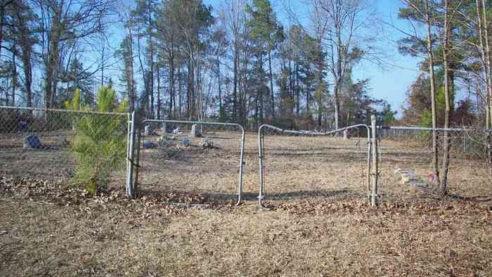
| Memorials | : | 0 |
| Location | : | Jefferson County, USA |
| Coordinate | : | 34.2397003, -92.2108002 |
frequently asked questions (FAQ):
-
Where is Heutt Cemetery?
Heutt Cemetery is located at Jefferson County ,Arkansas ,USA.
-
Heutt Cemetery cemetery's updated grave count on graveviews.com?
0 memorials
-
Where are the coordinates of the Heutt Cemetery?
Latitude: 34.2397003
Longitude: -92.2108002
Nearby Cemetories:
1. Cedar Branch Cemetery
Ain, Grant County, USA
Coordinate: 34.2283750, -92.2418610
2. Providence Cemetery
Jefferson County, USA
Coordinate: 34.2042380, -92.2081750
3. Phillips Cemetery
Jefferson County, USA
Coordinate: 34.2057991, -92.1960983
4. Branch Cemetery
Jefferson County, USA
Coordinate: 34.1897011, -92.1903000
5. Saint Paul AME Church Cemetery
Grapevine, Grant County, USA
Coordinate: 34.2311200, -92.2748700
6. Saint Luke AME Cemetery
Pine Bluff, Jefferson County, USA
Coordinate: 34.2356240, -92.1416200
7. New Shiloh Cemetery
Midway, Jefferson County, USA
Coordinate: 34.3043640, -92.2064340
8. Saint Patrick Cemetery
Sulphur Springs, Jefferson County, USA
Coordinate: 34.1872090, -92.1591960
9. Chandler Cemetery
Jefferson County, USA
Coordinate: 34.3046989, -92.1838989
10. Old Shiloh Cemetery
Jefferson County, USA
Coordinate: 34.3031006, -92.1750031
11. Mount Zion Cemetery
Grant County, USA
Coordinate: 34.2285995, -92.2981033
12. White Cemetery
Grant County, USA
Coordinate: 34.1917000, -92.2853012
13. Center Campground Cemetery
Prague, Grant County, USA
Coordinate: 34.3069000, -92.2641983
14. Mount Olive Cemetery
Pine Bluff, Jefferson County, USA
Coordinate: 34.2322006, -92.1108017
15. Mount Zion Cemetery
Sulphur Springs, Jefferson County, USA
Coordinate: 34.1727778, -92.1433333
16. Lee Cemetery
Sulphur Springs, Jefferson County, USA
Coordinate: 34.1506004, -92.2228012
17. Camp White Sulphur Springs Confederate Cemetery
Sulphur Springs, Jefferson County, USA
Coordinate: 34.1833000, -92.1200000
18. Lena Norena Hunt Gravesite
Sulphur Springs, Jefferson County, USA
Coordinate: 34.1769200, -92.1253400
19. Center Grove Cemetery
Sheridan, Grant County, USA
Coordinate: 34.3157280, -92.2808920
20. Fitzhugh Cemetery
Jefferson County, USA
Coordinate: 34.1624985, -92.1296997
21. Ramick Cemetery
Grant County, USA
Coordinate: 34.1436005, -92.2549973
22. Plain View Cemetery
Spring Township, Jefferson County, USA
Coordinate: 34.1365500, -92.1981350
23. Saint John Cemetery
Grapevine, Grant County, USA
Coordinate: 34.2221985, -92.3367004
24. Pine Ridge Cemetery
Ain, Grant County, USA
Coordinate: 34.1797800, -92.3170800

