
| Memorials | : | 85 |
| Location | : | Douglass, District of Columbia, USA |
| Coordinate | : | 38.8520654, -76.9825828 |
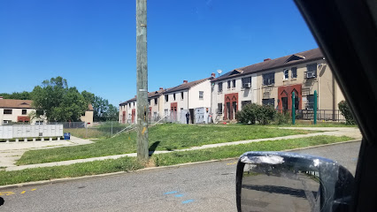
| Description | : | This cemetery, which covered lots 849 and 935 in Square 5876 in the Douglass neighborhood of Southeast Washington, was located on the north side of Bruce Place, S.E., between Jasper Place and 12th Place. It was bounded by today's Bruce Gardens apartment complex on the west, today's Jasper Place apartment complex on the east, and Stanton Road on the north. John Hayden Johnson Middle School is directly Bruce Place from the former cemetery grounds today. This part of Southeast Washington was also referred to, interchangeably, as Hillsdale, Barry Farm, and Stantontown. The Hillsdale Cemetery Association was incorporated in 1877, and... Read More |
frequently asked questions (FAQ):
-
Where is Hillsdale Cemetery (Defunct)?
Hillsdale Cemetery (Defunct) is located at Douglass, District of Columbia ,District of Columbia , 20020USA.
-
Hillsdale Cemetery (Defunct) cemetery's updated grave count on graveviews.com?
0 memorials
-
Where are the coordinates of the Hillsdale Cemetery (Defunct)?
Latitude: 38.8520654
Longitude: -76.9825828
Nearby Cemetories:
1. Rosemont Cemetery (Defunct)
Garfield Heights, District of Columbia, USA
Coordinate: 38.8527985, -76.9788971
2. Rosewood Cemetery (Defunct)
Anacostia, District of Columbia, USA
Coordinate: 38.8525009, -76.9783020
3. Elesavetgrad Cemetery
Anacostia, District of Columbia, USA
Coordinate: 38.8483500, -76.9828200
4. Saint Elizabeths Hospital East Cemetery
Anacostia, District of Columbia, USA
Coordinate: 38.8493996, -76.9869003
5. Adas Israel Cemetery
Washington, District of Columbia, USA
Coordinate: 38.8457990, -76.9844730
6. Washington Hebrew Congregation Cemetery
Washington, District of Columbia, USA
Coordinate: 38.8454480, -76.9858040
7. Ohev Sholom Congregation Cemetery
Congress Heights, District of Columbia, USA
Coordinate: 38.8453640, -76.9866000
8. Saint Elizabeths Hospital West Cemetery
Anacostia, District of Columbia, USA
Coordinate: 38.8547710, -77.0034340
9. Lincoln Memorial Cemetery
Suitland, Prince George's County, USA
Coordinate: 38.8563995, -76.9477997
10. Kingdom of Animals at Congressional Cemetery
District of Columbia, USA
Coordinate: 38.8802810, -76.9772440
11. Congressional Cemetery
Washington, District of Columbia, USA
Coordinate: 38.8810997, -76.9792023
12. Washington National Cemetery
Suitland, Prince George's County, USA
Coordinate: 38.8544006, -76.9428024
13. Eastern Methodist Cemetery (Defunct)
Washington, District of Columbia, USA
Coordinate: 38.8835030, -76.9799230
14. Beckett's Cemetery (Defunct)
Anacostia, District of Columbia, USA
Coordinate: 38.8849380, -76.9814450
15. Cedar Hill Cemetery
Suitland, Prince George's County, USA
Coordinate: 38.8594017, -76.9400024
16. Saint Barnabas Church Cemetery
Temple Hills, Prince George's County, USA
Coordinate: 38.8189011, -76.9602966
17. Bnai Israel Cemetery
Oxon Hill, Prince George's County, USA
Coordinate: 38.8149986, -76.9642029
18. Folger Shakespeare Library
Washington, District of Columbia, USA
Coordinate: 38.8894160, -77.0030730
19. National Museum of the American Indian
Washington, District of Columbia, USA
Coordinate: 38.8882840, -77.0166090
20. National Air and Space Museum
Washington, District of Columbia, USA
Coordinate: 38.8884100, -77.0198600
21. Washington Asylum Potters Field
Anacostia, District of Columbia, USA
Coordinate: 38.8128240, -77.0161050
22. Woodlawn Cemetery
Benning, District of Columbia, USA
Coordinate: 38.8852997, -76.9389038
23. Saint Ignatius Cemetery
Oxon Hill, Prince George's County, USA
Coordinate: 38.8041992, -76.9672012
24. Graceland Cemetery (Defunct)
Washington, District of Columbia, USA
Coordinate: 38.9015010, -76.9810860