
| Memorials | : | 1 |
| Location | : | Millville, Grant County, USA |
| Coordinate | : | 43.0272390, -90.9247180 |
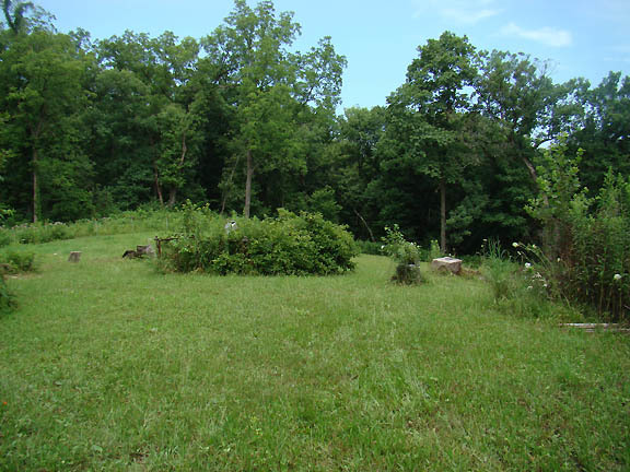
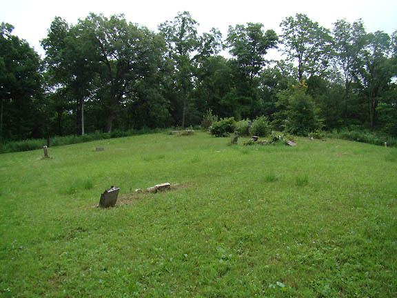
| Description | : | Hilltop Cemetery is located on the top of a bluff between Millville Hollow Road to the West and Kussmaul Road to the East. Access to the cemetery is across private land at 14349 Kussmaul Rd. in Mt. Hope. The caretaker (Terry Key) is very co-operative, if you ask he may offer to give you a ride to the cemetery on his ATV. The uphill walk to the cemetery is about a third of a mile of rugged, overgrown pathway. The cemetery is no longer active. The last interment I saw was in 1927. A survey done about 1976... Read More |
frequently asked questions (FAQ):
-
Where is Hilltop Cemetery?
Hilltop Cemetery is located at Millville, Grant County ,Wisconsin , 53816USA.
-
Hilltop Cemetery cemetery's updated grave count on graveviews.com?
1 memorials
-
Where are the coordinates of the Hilltop Cemetery?
Latitude: 43.0272390
Longitude: -90.9247180
Nearby Cemetories:
1. Warner Cemetery
Millville, Grant County, USA
Coordinate: 43.0464900, -90.9431500
2. Bethlehem Cemetery
Mount Hope, Grant County, USA
Coordinate: 43.0106010, -90.8683014
3. Stuckeyville Cemetery
Wauzeka, Crawford County, USA
Coordinate: 43.0789100, -90.9300500
4. Herold Family Cemetery
Wauzeka, Crawford County, USA
Coordinate: 43.0815200, -90.9070500
5. Gran Grae Cemetery
Bridgeport, Crawford County, USA
Coordinate: 43.0544300, -90.9995700
6. Hermitage Cemetery
Mount Hope, Grant County, USA
Coordinate: 42.9721985, -90.8803024
7. Wauzeka Cemetery
Wauzeka, Crawford County, USA
Coordinate: 43.0880870, -90.8934550
8. Sacred Heart Cemetery
Wauzeka, Crawford County, USA
Coordinate: 43.0869000, -90.8770000
9. Union Cemetery
Patch Grove, Grant County, USA
Coordinate: 42.9533005, -90.9531021
10. Saint Lawrence O'Toole Catholic Church Cemetery
Mount Ida, Grant County, USA
Coordinate: 43.0066500, -90.8162400
11. Saint Johns Cemetery
Patch Grove, Grant County, USA
Coordinate: 42.9425011, -90.9421997
12. Casler Cemetery
Mount Hope, Grant County, USA
Coordinate: 42.9706001, -90.8336029
13. Patch Grove Cemetery
Patch Grove, Grant County, USA
Coordinate: 42.9380989, -90.9768982
14. Dutch Ridge Cemetery
Wauzeka, Crawford County, USA
Coordinate: 43.1024800, -91.0098500
15. Rosendale Catholic Cemetery
Woodman, Grant County, USA
Coordinate: 43.0755000, -90.8005000
16. Woodman Cemetery
Woodman, Grant County, USA
Coordinate: 43.0881300, -90.8102700
17. Bridgeport Cemetery
Prairie du Chien, Crawford County, USA
Coordinate: 43.0102600, -91.0701300
18. Brodtville Cemetery
Wyalusing, Grant County, USA
Coordinate: 42.9532000, -91.0423000
19. Boydtown Cemetery
Boydtown, Crawford County, USA
Coordinate: 43.1119490, -90.7958220
20. Mount Ida Cemetery
Mount Ida, Grant County, USA
Coordinate: 42.9744640, -90.7656100
21. Flint Cemetery
Bagley, Grant County, USA
Coordinate: 42.9528008, -91.0781021
22. Hazen Corners Cemetery
Eastman, Crawford County, USA
Coordinate: 43.1231200, -91.0559300
23. Borah Cemetery
Mount Ida, Grant County, USA
Coordinate: 42.9606018, -90.7596970
24. Crown Hill Cemetery
Fennimore, Grant County, USA
Coordinate: 43.0393982, -90.7352982